
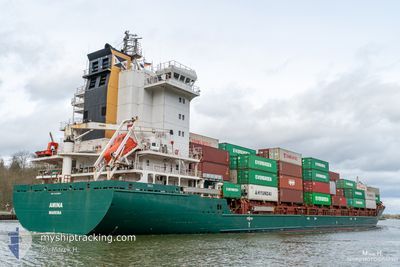
AMINA
Container Ship
Current Trip
| Time Travelled | 13 h, 4 mins |
|---|---|
| Remaining Time | 3 mins |
| Distance Travelled | 131.11 nm |
| Remaining Distance | 1.53 nm |
| AVG Speed | 12.3 Knots |
| MAX Speed | 15.8 Knots |
| AVG Wind | 13.3 knots |
| MAX Wind | 20 knots |
| MIN Temp | 10.6°C / 51.08°F |
| MAX Temp | 13.8°C / 56.84°F |
| Draught | 6.8 m |
| Position Received | 1 m ago |
Current Position
| Longitude | 8.48705° |
|---|---|
| Latitude | 53.61261° |
| Status | Under way using engine |
| Speed | 7.9 Knots |
| Course | 135.9° |
| Area | North Sea |
| Station | T-AIS |
| Position Received | 1 m ago |
Info
Information
The current position of AMINA is in North Sea with coordinates 53.61261° / 8.48705° as reported on 2024-06-05 16:58 by AIS to our vessel tracker app. The vessel's current speed is 7.9 Knots and is heading at the port of BREMERHAVEN. The estimated time of arrival as calculated by vessel tracking app is 2024-06-05 17:02 LT
The vessel AMINA (IMO: 9448683, MMSI: 255806464) is a Container Ship that was built in 2011 ( 13 years old ). It's sailing under the flag of [PT] Portugal.
In this page you can find informations about the vessels current position, last detected port calls, and current voyage information. If the vessels is not in coverage by AIS you will find the latest position.
The current position of AMINA is detected by our AIS receivers and we are not responsible for the reliability of the data. The last position was recorded while the vessel was in Coverage by the Ais receivers of our vessel tracking app.
The current draught of AMINA as reported by AIS is 6.8 meters
Weather
| Temperature | 13.1°C / 55.58°F |
|---|---|
| Wind Speed | 13 knots |
| Direction | 291° WNW |
| Pressure | 1012 hPa |
| Humidity | 73.6 % |
| Cloud Coverage | 92 % |
Featured Company
Last Port Calls
| Port | Arrival | Departure | Time In Port |
|---|---|---|---|
| 2024-06-03 21:53 | 2024-06-05 03:55 | 1 d | |
| 2024-06-02 10:25 | 2024-06-03 00:35 | 14 h | |
| 2024-05-24 11:50 | 2024-06-01 13:58 | 8 d | |
| 2024-05-23 18:24 | 2024-05-24 00:46 | 6 h | |
| 2024-05-20 20:35 | 2024-05-22 06:11 | 1 d | |
| 2024-05-19 15:44 | 2024-05-20 10:58 | 19 h | |
| 2024-05-17 23:46 | 2024-05-18 10:32 | 10 h | |
| 2024-05-16 08:46 | 2024-05-17 15:02 | 1 d | |
| 2024-05-08 12:12 | 2024-05-09 00:39 | 12 h | |
| 2024-05-07 21:39 | 2024-05-08 09:38 | 11 h |
Most Visited Ports (Last year)
| Port | Arrivals | |
|---|---|---|
| 30 | ||
| 23 | ||
| 20 | ||
| 18 | ||
| 13 | ||
| 11 |
Last Trips
| Origin | Departure | Destination | Arrival | Distance | |
|---|---|---|---|---|---|
| 2024-06-03 02:35 | 2024-06-03 23:53 | 300.63 nm | |||
| 2024-06-01 15:58 | 2024-06-02 12:25 | 313.30 nm | |||
| 2024-05-24 02:46 | 2024-05-24 13:50 | 108.67 nm | |||
| 2024-05-22 08:11 | 2024-05-23 20:24 | 375.82 nm | |||
| 2024-05-20 12:58 | 2024-05-20 22:35 | 111.47 nm | |||
| 2024-05-18 12:32 | 2024-05-19 17:44 | 283.70 nm | |||
| 2024-05-17 17:02 | 2024-05-18 01:46 | 109.81 nm | |||
| 2024-05-09 02:39 | 2024-05-16 10:46 | 1316.75 nm | |||
| 2024-05-08 11:38 | 2024-05-08 14:12 | 20.15 nm | |||
| 2024-05-06 21:59 | 2024-05-07 23:39 | 354.18 nm |
Events
| Time | Event | Details | Position / Dest | Info |
|---|---|---|---|---|
| 2024-06-05 15:04 | Status Changed | Under way using engine Default |
53.85354 / 7.97785
DEBRV
|
Speed: 11.9 kn Course: 100° |
| 2024-06-05 14:54 | Status Changed | Default Under way using engine |
53.86024 / 7.91861
DEBRV
|
Speed: 14.9 kn Course: 104.3° |
| 2024-06-05 14:50 | Status Changed | Under way using engine Default |
53.86373 / 7.89451
DEBRV
|
Speed: 11.5 kn Course: 102° |
| 2024-06-05 14:30 | Status Changed | Default Under way using engine |
53.87401 / 7.79436
DEBRV
|
Speed: 10.2 kn Course: 105.6° |
| 2024-06-05 14:28 | Status Changed | Under way using engine Default |
53.87573 / 7.78353
DEBRV
|
Speed: 8 kn Course: 108° |
| 2024-06-05 14:19 | IN Coverage |
53.87520 / 7.78673
North Sea
DEBRV
|
Speed: 10.1 kn Course: 105.8° |
|
| 2024-06-05 11:45 | Status Changed | Default Under way using engine |
54.02842 / 7.86991
DEBRV
|
Speed: 9.1 kn Course: 274.8° |
| 2024-06-05 11:34 | OUT of Coverage |
54.02616 / 7.91780
North Sea
DEBRV
|
Speed: 9.1 kn Course: 274.8° |
|
| 2024-06-05 10:48 | Status Changed | Under way using engine Default |
54.01742 / 8.15975
DEBRV
|
Speed: 8.6 kn Course: 274° |
| 2024-06-05 09:31 | OUT of Coverage |
53.98620 / 8.40005
North Sea
DEBRV
|
Speed: 6.8 kn Course: 279.8° |