
AMIS CHAMPION
Cargo
Current Trip
| Time Travelled | 18 days |
|---|---|
| Remaining Time | 1 day |
| Distance Travelled | 3889.91 nm |
| Remaining Distance | 463.40 nm |
| AVG Speed | 9.7 Knots |
| MAX Speed | 13 Knots |
| AVG Wind | 10.5 knots |
| MAX Wind | 25.4 knots |
| MIN Temp | 21.1°C / 69.98°F |
| MAX Temp | 32.1°C / 89.78°F |
| Draught | 12.9 m |
| Position Received | 2 d ago |
Current Position
| Longitude | 118.17498° |
|---|---|
| Latitude | 23.58489° |
| Status | Under way using engine |
| Speed | 11 Knots |
| Course | 58.1° |
| Area | South China Sea |
| Station | T-AIS |
| Position Received | 2 d ago |
Info
Information
The current position of AMIS CHAMPION is in South China Sea with coordinates 23.58489° / 118.17498° as reported on 2024-06-06 09:41 by AIS to our vessel tracker app. The vessel's current speed is 11 Knots and is heading at the port of BAYUQUAN. The estimated time of arrival as calculated by vessel tracking app is 2024-06-11 01:15 LT
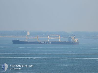
The vessel AMIS CHAMPION (IMO: 9636369, MMSI: 357887000) is a Cargo It's sailing under the flag of [PA] Panama.
In this page you can find informations about the vessels current position, last detected port calls, and current voyage information. If the vessels is not in coverage by AIS you will find the latest position.
The current position of AMIS CHAMPION is detected by our AIS receivers and we are not responsible for the reliability of the data. The last position was recorded while the vessel was in Coverage by the Ais receivers of our vessel tracking app.
The current draught of AMIS CHAMPION as reported by AIS is 12.9 meters
Weather
| Temperature | 22°C / 71.6°F |
|---|---|
| Wind Speed | 4 knots |
| Direction | 226° SW |
| Pressure | 1009 hPa |
| Humidity | 69.7 % |
| Cloud Coverage | 58 % |
Featured Company
Events
| Time | Event | Details | Position / Dest | Info |
|---|---|---|---|---|
| 2024-06-06 09:47 | Status Changed | Default Under way using engine |
23.59627 / 118.19450
CN BAY
|
Speed: 11 kn Course: 58.1° |
| 2024-06-06 09:41 | OUT of Coverage |
23.58489 / 118.17498
South China Sea
CN BAY
|
Speed: 11 kn Course: 58.1° |
|
| 2024-06-06 07:17 | Change Sea Area | Chinese part of the South China Sea Malaysian part of the Singapore Strait |
23.34389 / 117.81619
South China Sea
CN BAY
|
Speed: 9.2 kn Course: 46° |
| 2024-06-06 07:14 | Status Changed | Under way using engine Default |
23.33961 / 117.81160
CN BAY
|
Speed: 9 kn Course: 41° |
| 2024-06-06 07:07 | IN Coverage |
23.34389 / 117.81619
South China Sea
CN BAY
|
Speed: 9.2 kn Course: 46° |
|
| 2024-05-31 17:50 | Status Changed | Default Under way using engine |
1.29787 / 104.34480
CN BAY
|
Speed: 10.5 kn Course: 50.2° |
| 2024-05-31 17:47 | OUT of Coverage |
1.29189 / 104.33762
Singapore Strait
CN BAY
|
Speed: 10.5 kn Course: 50.2° |
|
| 2024-05-31 17:43 | Status Changed | Under way using engine Default |
1.28523 / 104.32931
CN BAY
|
Speed: 10.8 kn Course: 87° |
| 2024-05-31 17:26 | Status Changed | Default Under way using engine |
1.27961 / 104.27859
CN BAY
|
Speed: 10.7 kn Course: 86° |
| 2024-05-31 16:43 | Change Sea Area | Malaysian part of the Singapore Strait Indonesian part of the Singapore Strait |
1.25885 / 104.14881
Singapore Strait
CN BAY
|
Speed: 11 kn Course: 81.1° |