
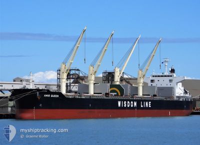
AMIS QUEEN
Cargo
Current Trip
| Time Travelled | 10 days |
|---|---|
| Remaining Time | 3 days |
| Distance Travelled | 3640.78 nm |
| Remaining Distance | 1265.58 nm |
| AVG Speed | 13.7 Knots |
| MAX Speed | 19.7 Knots |
| AVG Wind | 9.7 knots |
| MAX Wind | 28.6 knots |
| MIN Temp | 2.6°C / 36.68°F |
| MAX Temp | 21.4°C / 70.52°F |
| Draught | 7 m |
| Position Received | 6 d ago |
Current Position
| Longitude | 141.79138° |
|---|---|
| Latitude | 41.69341° |
| Status | Under way using engine |
| Speed | 13.5 Knots |
| Course | 84.4° |
| Area | North Pacific Ocean |
| Station | T-AIS |
| Position Received | 6 d ago |
Info
Information
The current position of AMIS QUEEN is in North Pacific Ocean with coordinates 41.69341° / 141.79138° as reported on 2024-05-13 13:46 by AIS to our vessel tracker app. The vessel's current speed is 13.5 Knots and is heading at the port of PRINCE RUPERT. The estimated time of arrival as calculated by vessel tracking app is 2024-05-24 02:08 LT
The vessel AMIS QUEEN (IMO: 9852676, MMSI: 354827000) is a Cargo It's sailing under the flag of [PA] Panama.
In this page you can find informations about the vessels current position, last detected port calls, and current voyage information. If the vessels is not in coverage by AIS you will find the latest position.
The current position of AMIS QUEEN is detected by our AIS receivers and we are not responsible for the reliability of the data. The last position was recorded while the vessel was in Coverage by the Ais receivers of our vessel tracking app.
The current draught of AMIS QUEEN as reported by AIS is 7 meters
Weather
| Temperature | 3.6°C / 38.48°F |
|---|---|
| Wind Speed | 14 knots |
| Direction | 141° SE |
| Pressure | 1012.2 hPa |
| Humidity | 92.9 % |
| Cloud Coverage | 100 % |
Featured Company
Events
| Time | Event | Details | Position / Dest | Info |
|---|---|---|---|---|
| 2024-05-13 13:52 | Status Changed | Default Under way using engine |
41.69548 / 141.82025
PRINCE RUPERT
|
Speed: 13.5 kn Course: 84.4° |
| 2024-05-13 13:46 | OUT of Coverage |
41.69341 / 141.79138
North Pacific Ocean
PRINCE RUPERT
|
Speed: 13.5 kn Course: 84.4° |
|
| 2024-05-13 13:45 | Status Changed | Under way using engine Default |
41.69306 / 141.78639
PRINCE RUPERT
|
Speed: 13 kn Course: 83° |
| 2024-05-13 13:38 | Status Changed | Default Under way using engine |
41.69067 / 141.74846
PRINCE RUPERT
|
Speed: 13.5 kn Course: 87.7° |
| 2024-05-13 12:07 | Change Sea Area | Japanese part of the North Pacific Ocean Japanese part of the Japan Sea |
41.66607 / 141.28297
North Pacific Ocean
PRINCE RUPERT
|
Speed: 13 kn Course: 87.3° |
| 2024-05-13 11:30 | Status Changed | Under way using engine Default |
41.66057 / 141.10785
PRINCE RUPERT
|
Speed: 14.8 kn Course: 89° |
| 2024-05-13 11:24 | Status Changed | Default Under way using engine |
41.66016 / 141.07169
PRINCE RUPERT
|
Speed: 16.8 kn Course: 90.7° |
| 2024-05-13 11:03 | Status Changed | Under way using engine Default |
41.63949 / 140.94849
PRINCE RUPERT
|
Speed: 16.6 kn Course: 63° |
| 2024-05-13 11:01 | Status Changed | Default Under way using engine |
41.63414 / 140.93486
PRINCE RUPERT
|
Speed: 17.1 kn Course: 62.8° |
| 2024-05-13 10:37 | Status Changed | Under way using engine Default |
41.57781 / 140.80867
PRINCE RUPERT
|
Speed: 16 kn Course: 56° |