
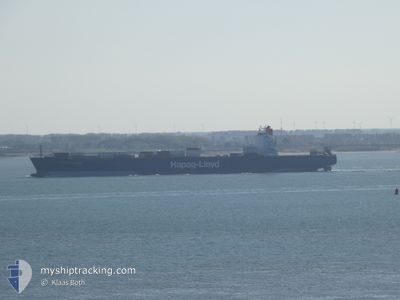
AMSTERDAM EXPRESS
Container Ship
Current Trip
CLSAI
| Time Travelled | 10 days |
|---|---|
| Remaining Time | --- |
| Distance Travelled | 2722.64 nm |
| Remaining Distance | --- |
| AVG Speed | 12.1 Knots |
| MAX Speed | 22.4 Knots |
| AVG Wind | 16.4 knots |
| MAX Wind | 34 knots |
| MIN Temp | -0.3°C / 31.46°F |
| MAX Temp | 23.4°C / 74.12°F |
| Draught | 13.2 m |
| Position Received | 4 d ago |
Current Position
| Longitude | -52.09973° |
|---|---|
| Latitude | -32.12729° |
| Status | Under way using engine |
| Speed | 8.2 Knots |
| Course | 181.3° |
| Area | South Atlantic Ocean |
| Station | T-AIS |
| Position Received | 4 d ago |
Info
Information
The current position of AMSTERDAM EXPRESS is in South Atlantic Ocean with coordinates -32.12729° / -52.09973° as reported on 2024-05-27 13:08 by AIS to our vessel tracker app. The vessel's current speed is 8.2 Knots
The vessel AMSTERDAM EXPRESS (IMO: 9193317, MMSI: 636093132) is a Container Ship that was built in 2000 ( 24 years old ). It's sailing under the flag of [LR] Liberia.
In this page you can find informations about the vessels current position, last detected port calls, and current voyage information. If the vessels is not in coverage by AIS you will find the latest position.
The current position of AMSTERDAM EXPRESS is detected by our AIS receivers and we are not responsible for the reliability of the data. The last position was recorded while the vessel was in Coverage by the Ais receivers of our vessel tracking app.
The current draught of AMSTERDAM EXPRESS as reported by AIS is 13.2 meters
Weather
| Temperature | 6.9°C / 44.42°F |
|---|---|
| Wind Speed | 5 knots |
| Direction | 98° E |
| Pressure | 1012.1 hPa |
| Humidity | 71.4 % |
| Cloud Coverage | 85 % |
Featured Company
Last Port Calls
| Port | Arrival | Departure | Time In Port |
|---|---|---|---|
| 2024-05-20 21:47 | 2024-05-21 21:59 | 1 d | |
| 2024-05-17 21:55 | 2024-05-17 22:02 | 6 m | |
| 2024-05-15 17:37 | 2024-05-16 09:08 | 15 h | |
| 2024-05-05 18:54 | 2024-05-06 10:35 | 15 h | |
| 2024-05-03 01:28 | 2024-05-05 00:53 | 1 d | |
| 2024-04-29 11:21 | 2024-04-30 03:40 | 16 h | |
| 2024-04-23 22:14 | 2024-04-26 04:30 | 2 d | |
| 2024-04-21 11:09 | 2024-04-22 04:53 | 17 h | |
| 2024-04-16 21:51 | 2024-04-17 20:37 | 22 h | |
| 2024-04-02 23:17 | 2024-04-03 16:26 | 17 h |
Most Visited Ports (Last year)
| Port | Arrivals | |
|---|---|---|
| 9 | ||
| 3 | ||
| 3 | ||
| 3 | ||
| 1 | ||
| 1 |
Last Trips
| Origin | Departure | Destination | Arrival | Distance | |
|---|---|---|---|---|---|
| 2024-05-17 19:02 | 2024-05-20 18:47 | 250.29 nm | |||
| 2024-05-16 06:08 | 2024-05-17 18:55 | 377.29 nm | |||
| 2024-05-06 06:35 | 2024-05-15 14:37 | 3182.89 nm | |||
| 2024-05-04 20:53 | 2024-05-05 14:54 | 228.20 nm | |||
| 2024-04-29 23:40 | 2024-05-02 21:28 | 924.81 nm | |||
| 2024-04-25 23:30 | 2024-04-29 07:21 | 1285.29 nm | |||
| 2024-04-21 23:53 | 2024-04-23 17:14 | 710.80 nm | |||
| 2024-04-17 16:37 | 2024-04-21 06:09 | 1357.96 nm | |||
| 2024-04-03 13:26 | 2024-04-16 17:51 | 3603.17 nm | |||
| 2024-04-02 05:46 | 2024-04-02 20:17 | 38.89 nm |
Events
| Time | Event | Details | Position / Dest | Info |
|---|---|---|---|---|
| 2024-05-27 13:14 | Status Changed | Default Under way using engine |
-32.14251 / -52.09857
CLSAI
|
Speed: 8.2 kn Course: 181.3° |
| 2024-05-27 13:08 | OUT of Coverage |
-32.12729 / -52.09973
South Atlantic Ocean
|
Speed: 8.2 kn Course: 181.3° |
|
| 2024-05-27 13:05 | Draught Changed | 13.2 12.8 |
-32.12114 / -52.09951
CLSAI
|
Speed: 5.4 kn Course: 165.2° |
| 2024-05-27 13:05 | Destination Changed | CLSAI BRRIG |
-32.12114 / -52.09951
CLSAI
|
Speed: 5.4 kn Course: 165.2° |
| 2024-05-27 13:05 | ETA Changed | 2025/03/06 12:00 2025/03/05 11:00 |
-32.12114 / -52.09951
CLSAI
|
Speed: 5.4 kn Course: 165.2° |
| 2024-05-27 13:02 | START Moving | 5.44 nm, South of RIO GRANDE |
-32.11812 / -52.10041
BRRIG
|
Speed: 3.1 kn Course: 104° |
| 2024-05-27 11:23 | Status Changed | Under way using engine Default |
-32.12534 / -52.10232
BRRIG
|
Speed: Course: 3° |
| 2024-05-27 11:22 | IN Coverage |
-32.12535 / -52.10231
South Atlantic Ocean
|
Speed: Course: 4° |
|
| 2024-05-26 20:55 | Status Changed | Default Moored |
-32.12534 / -52.10226
BRRIG
|
Speed: Course: 3° |
| 2024-05-26 20:52 | OUT of Coverage |
-32.12540 / -52.10241
South Atlantic Ocean
|
Speed: Course: 3° |