
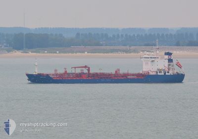
AMUR STAR
Oil/Chemical Tanker
Current Trip
| Time Travelled | 17 days |
|---|---|
| Remaining Time | 1 day |
| Distance Travelled | 2995.19 nm |
| Remaining Distance | 443.48 nm |
| AVG Speed | 10.3 Knots |
| MAX Speed | 14.2 Knots |
| AVG Wind | 8.8 knots |
| MAX Wind | 14 knots |
| MIN Temp | 19.6°C / 67.28°F |
| MAX Temp | 30°C / 86°F |
| Draught | 6.2 m |
| Position Received | 2 d ago |
Current Position
| Longitude | -80.34089° |
|---|---|
| Latitude | 24.30620° |
| Status | Under way using engine |
| Speed | 9 Knots |
| Course | 235° |
| Area | North Atlantic Ocean |
| Station | T-AIS |
| Position Received | 2 d ago |
Info
Information
The current position of AMUR STAR is in North Atlantic Ocean with coordinates 24.30620° / -80.34089° as reported on 2024-05-26 14:30 by AIS to our vessel tracker app. The vessel's current speed is 9 Knots and is heading at the port of CORPUS CHRISTI. The estimated time of arrival as calculated by vessel tracking app is 2024-05-30 10:22 LT
The vessel AMUR STAR (IMO: 9480368, MMSI: 248043000) is a Oil/Chemical Tanker that was built in 2010 ( 14 years old ). It's sailing under the flag of [MT] Malta.
In this page you can find informations about the vessels current position, last detected port calls, and current voyage information. If the vessels is not in coverage by AIS you will find the latest position.
The current position of AMUR STAR is detected by our AIS receivers and we are not responsible for the reliability of the data. The last position was recorded while the vessel was in Coverage by the Ais receivers of our vessel tracking app.
The current draught of AMUR STAR as reported by AIS is 6.2 meters
Weather
| Temperature | 27.6°C / 81.68°F |
|---|---|
| Wind Speed | 13 knots |
| Direction | 129° SE |
| Pressure | 1015.4 hPa |
| Humidity | 91.3 % |
| Cloud Coverage | 1 % |
Featured Company
Last Port Calls
| Port | Arrival | Departure | Time In Port |
|---|---|---|---|
| 2024-05-10 00:53 | 2024-05-11 17:50 | 1 d | |
| 2024-04-29 21:02 | 2024-04-29 23:00 | 1 h | |
| 2024-04-22 02:12 | 2024-04-22 04:19 | 2 h | |
| 2024-04-14 16:30 | 2024-04-15 13:08 | 20 h | |
| 2024-04-08 05:33 | 2024-04-08 07:28 | 1 h | |
| 2024-03-30 18:29 | 2024-03-30 19:09 | 40 m | |
| 2024-03-16 12:21 | 2024-03-17 10:54 | 22 h | |
| 2024-03-11 22:35 | 2024-03-13 23:00 | 2 d | |
| 2024-03-05 01:10 | 2024-03-05 14:50 | 13 h | |
| 2024-03-03 08:51 | 2024-03-03 23:07 | 14 h |
Last Trips
| Origin | Departure | Destination | Arrival | Distance | |
|---|---|---|---|---|---|
| 2024-04-29 19:00 | 2024-05-09 20:53 | 2496.01 nm | |||
| 2024-04-22 00:19 | 2024-04-29 17:02 | 708.76 nm | |||
| 2024-04-15 09:08 | 2024-04-21 22:12 | 1598.24 nm | |||
| 2024-04-08 03:28 | 2024-04-14 12:30 | 1552.48 nm | |||
| 2024-03-30 15:09 | 2024-04-08 01:33 | 719.93 nm | |||
| 2024-03-17 11:54 | 2024-03-30 14:29 | 3303.17 nm | |||
| 2024-03-14 00:00 | 2024-03-16 13:21 | 307.23 nm | |||
| 2024-03-05 15:50 | 2024-03-11 23:35 | 893.58 nm | |||
| 2024-03-04 00:07 | 2024-03-05 02:10 | 240.84 nm | |||
| 2024-03-01 04:25 | 2024-03-03 09:51 | 523.00 nm |
Events
| Time | Event | Details | Position / Dest | Info |
|---|---|---|---|---|
| 2024-05-26 14:33 | Status Changed | Default Under way using engine |
24.30147 / -80.34852
CORPUS CHRISTI
|
Speed: 9 kn Course: 235° |
| 2024-05-26 14:30 | Status Changed | Under way using engine Default |
24.30620 / -80.34089
CORPUS CHRISTI
|
Speed: 9 kn Course: 235° |
| 2024-05-26 14:30 | OUT of Coverage |
24.30620 / -80.34089
North Atlantic Ocean
CORPUS CHRISTI
|
Speed: 9 kn Course: 235° |
|
| 2024-05-26 13:54 | Status Changed | Default Under way using engine |
24.35833 / -80.25500
CORPUS CHRISTI
|
Speed: 9.3 kn Course: 236.4° |
| 2024-05-26 13:50 | Status Changed | Under way using engine Default |
24.36483 / -80.24514
CORPUS CHRISTI
|
Speed: 9 kn Course: 236° |
| 2024-05-26 13:33 | IN Coverage |
24.36483 / -80.24514
North Atlantic Ocean
CORPUS CHRISTI
|
Speed: 9.3 kn Course: 236.4° |
|
| 2024-05-26 05:02 | Status Changed | Default Under way using engine |
25.43633 / -79.57446
CORPUS CHRISTI
|
Speed: 9.1 kn Course: 196.5° |
| 2024-05-26 04:58 | OUT of Coverage |
25.44614 / -79.57110
North Atlantic Ocean
CORPUS CHRISTI
|
Speed: 9.1 kn Course: 196.5° |
|
| 2024-05-25 23:41 | Destination Changed | CORPUS CHRISTI NEW YORK (US NYC) |
26.20188 / -79.43485
CORPUS CHRISTI
|
Speed: 8.6 kn Course: 187.5° |
| 2024-05-25 23:41 | ETA Changed | 2024/05/30 12:00 2024/05/22 23:00 |
26.20188 / -79.43485
CORPUS CHRISTI
|
Speed: 8.6 kn Course: 187.5° |