
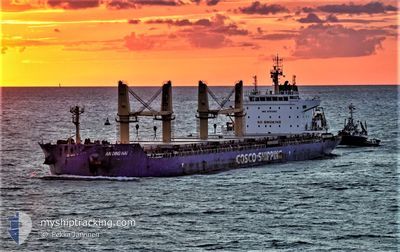
AN DING HAI
Cargo
Current Trip
| Time Travelled | 5 days |
|---|---|
| Remaining Time | --- |
| Distance Travelled | 587.01 nm |
| Remaining Distance | --- |
| AVG Speed | 11.4 Knots |
| MAX Speed | 13.6 Knots |
| AVG Wind | 12 knots |
| MAX Wind | 19.8 knots |
| MIN Temp | 22.6°C / 72.68°F |
| MAX Temp | 29°C / 84.2°F |
| Draught | 7 m |
| Position Received | 2 d ago |
Current Position
| Longitude | -96.88672° |
|---|---|
| Latitude | 27.78815° |
| Status | At anchor |
| Speed | |
| Course | 70° |
| Area | Gulf of Mexico |
| Station | T-AIS |
| Position Received | 2 d ago |
Info
Information
The current position of AN DING HAI is in Gulf of Mexico with coordinates 27.78815° / -96.88672° as reported on 2024-05-15 18:53 by AIS to our vessel tracker app. The vessel's current speed is 0 Knots
The vessel AN DING HAI (IMO: 9751303, MMSI: 477850300) is a Cargo It's sailing under the flag of [HK] Hong Kong.
In this page you can find informations about the vessels current position, last detected port calls, and current voyage information. If the vessels is not in coverage by AIS you will find the latest position.
The current position of AN DING HAI is detected by our AIS receivers and we are not responsible for the reliability of the data. The last position was recorded while the vessel was in Coverage by the Ais receivers of our vessel tracking app.
The current draught of AN DING HAI as reported by AIS is 7 meters
Weather
| Temperature | 24.8°C / 76.64°F |
|---|---|
| Wind Speed | 15 knots |
| Direction | 77° ENE |
| Pressure | 1007.5 hPa |
| Humidity | 83.1 % |
| Cloud Coverage | 2 % |
Featured Company
Most Visited Ports (Last year)
| Port | Arrivals | |
|---|---|---|
| 2 | ||
| 2 | ||
| 2 | ||
| 1 | ||
| 1 | ||
| 1 |
Events
| Time | Event | Details | Position / Dest | Info |
|---|---|---|---|---|
| 2024-05-15 18:56 | Status Changed | Default At anchor |
27.78815 / -96.88676
US CRP
|
Speed: Course: 70° |
| 2024-05-15 18:53 | Status Changed | At anchor Default |
27.78815 / -96.88672
US CRP
|
Speed: Course: 69° |
| 2024-05-15 18:53 | OUT of Coverage |
27.78815 / -96.88672
Gulf of Mexico
|
Speed: Course: 313.2° |
|
| 2024-05-15 18:36 | IN Coverage |
27.78815 / -96.88672
Gulf of Mexico
|
Speed: Course: 313.2° |
|
| 2024-05-15 14:20 | Status Changed | Default At anchor |
27.78788 / -96.88661
US CRP
|
Speed: Course: 61° |
| 2024-05-15 14:17 | Status Changed | At anchor Default |
27.78789 / -96.88662
US CRP
|
Speed: Course: 65° |
| 2024-05-15 14:17 | OUT of Coverage |
27.78789 / -96.88662
Gulf of Mexico
|
Speed: Course: 338.1° |
|
| 2024-05-15 14:06 | Status Changed | Default At anchor |
27.78667 / -96.88666
US CRP
|
Speed: Course: 55° |
| 2024-05-15 13:59 | Status Changed | At anchor Default |
27.78780 / -96.88659
US CRP
|
Speed: Course: 57° |
| 2024-05-15 13:59 | IN Coverage |
27.78780 / -96.88659
Gulf of Mexico
|
Speed: Course: 326.1° |