
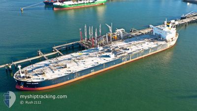
ANAFI WARRIOR
Crude Oil Tanker
Current Trip
RABICH SAUDI ARABIA
| Time Travelled | 4 days |
|---|---|
| Remaining Time | --- |
| Distance Travelled | 516.03 nm |
| Remaining Distance | --- |
| AVG Speed | 8.5 Knots |
| MAX Speed | 13.9 Knots |
| AVG Wind | 6.7 knots |
| MAX Wind | 16.9 knots |
| MIN Temp | 29.5°C / 85.1°F |
| MAX Temp | 37.1°C / 98.78°F |
| Draught | 14.4 m |
| Position Received | 1 m ago |
Current Position
| Longitude | 56.79040° |
|---|---|
| Latitude | 25.10060° |
| Status | Under way using engine |
| Speed | 11.7 Knots |
| Course | 122.4° |
| Area | Gulf of Oman |
| Station | T-AIS |
| Position Received | 1 m ago |
Info
Information
The current position of ANAFI WARRIOR is in Gulf of Oman with coordinates 25.10060° / 56.79040° as reported on 2024-06-02 15:40 by AIS to our vessel tracker app. The vessel's current speed is 11.7 Knots
The vessel ANAFI WARRIOR (IMO: 9370848, MMSI: 241408000) is a Crude Oil Tanker that was built in 2009 ( 15 years old ). It's sailing under the flag of [GR] Greece.
In this page you can find informations about the vessels current position, last detected port calls, and current voyage information. If the vessels is not in coverage by AIS you will find the latest position.
The current position of ANAFI WARRIOR is detected by our AIS receivers and we are not responsible for the reliability of the data. The last position was recorded while the vessel was in Coverage by the Ais receivers of our vessel tracking app.
The current draught of ANAFI WARRIOR as reported by AIS is 14.4 meters
Weather
| Temperature | 33.1°C / 91.58°F |
|---|---|
| Wind Speed | 5 knots |
| Direction | 181° S |
| Pressure | 1000.5 hPa |
| Humidity | 69.8 % |
| Cloud Coverage | --- |
Featured Company
Events
| Time | Event | Details | Position / Dest | Info |
|---|---|---|---|---|
| 2024-06-02 15:21 | Status Changed | Under way using engine At anchor |
25.13368 / 56.73313
RABICH SAUDI ARABIA
|
Speed: 11.1 kn Course: 124.1° |
| 2024-06-02 13:14 | START Moving | 6.46 nm, North East of FUJAIRAH |
25.21474 / 56.45856
RABICH SAUDI ARABIA
|
Speed: 3.1 kn Course: 90° |
| 2024-06-02 07:17 | Status Changed | At anchor Default |
25.21518 / 56.45260
RABICH SAUDI ARABIA
|
Speed: 0.1 kn Course: 90° |
| 2024-06-02 07:14 | Status Changed | Default At anchor |
25.21526 / 56.45259
RABICH SAUDI ARABIA
|
Speed: 0.1 kn Course: 92° |
| 2024-06-02 06:59 | Status Changed | At anchor Default |
25.21573 / 56.45256
RABICH SAUDI ARABIA
|
Speed: 0.1 kn Course: 116° |
| 2024-06-02 06:53 | Status Changed | Default At anchor |
25.21604 / 56.45261
RABICH SAUDI ARABIA
|
Speed: 0.2 kn Course: 122° |
| 2024-06-02 06:05 | Status Changed | At anchor Default |
25.21682 / 56.45428
RABICH SAUDI ARABIA
|
Speed: Course: 161° |
| 2024-06-02 06:02 | Status Changed | Default At anchor |
25.21678 / 56.45430
RABICH SAUDI ARABIA
|
Speed: Course: 162° |
| 2024-06-01 19:08 | Status Changed | At anchor Under way using engine |
25.21616 / 56.45343
RABICH SAUDI ARABIA
|
Speed: 0.2 kn Course: 132° |
| 2024-06-01 18:55 | STOP Moving | 6.24 nm, North East of FUJAIRAH |
25.21524 / 56.45297
RABICH SAUDI ARABIA
|
Speed: 0.3 kn Course: 112° |