
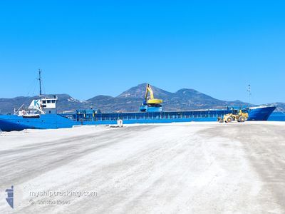
ANASTASIA
General Cargo
Current Trip
| Time Travelled | 1 day |
|---|---|
| Remaining Time | --- |
| Distance Travelled | 173.23 nm |
| Remaining Distance | --- |
| AVG Speed | 8.3 Knots |
| MAX Speed | 9.3 Knots |
| AVG Wind | 5.6 knots |
| MAX Wind | 11.1 knots |
| MIN Temp | 20.7°C / 69.26°F |
| MAX Temp | 23.9°C / 75.02°F |
| Draught | 4 m |
| Position Received | 2 m ago |
Current Position
| Longitude | 25.13640° |
|---|---|
| Latitude | 37.54270° |
| Status | Under way using engine |
| Speed | |
| Course | 277° |
| Area | Aegean Sea |
| Station | T-AIS |
| Position Received | 2 m ago |
Info
Information
The current position of ANASTASIA is in Aegean Sea with coordinates 37.54270° / 25.13640° as reported on 2024-06-02 00:33 by AIS to our vessel tracker app. The vessel's current speed is 0 Knots
The vessel ANASTASIA (IMO: 8417546, MMSI: 241783000) is a General Cargo that was built in 1984 ( 40 years old ). It's sailing under the flag of [GR] Greece.
In this page you can find informations about the vessels current position, last detected port calls, and current voyage information. If the vessels is not in coverage by AIS you will find the latest position.
The current position of ANASTASIA is detected by our AIS receivers and we are not responsible for the reliability of the data. The last position was recorded while the vessel was in Coverage by the Ais receivers of our vessel tracking app.
The current draught of ANASTASIA as reported by AIS is 4 meters
Weather
| Temperature | 22.2°C / 71.96°F |
|---|---|
| Wind Speed | 7 knots |
| Direction | 252° WSW |
| Pressure | 1017.2 hPa |
| Humidity | 68 % |
| Cloud Coverage | 7 % |
Featured Company
Last Port Calls
| Port | Arrival | Departure | Time In Port |
|---|---|---|---|
| 2024-05-30 19:56 | 2024-05-31 05:42 | 9 h | |
| 2024-05-26 13:10 | 2024-05-27 01:18 | 12 h | |
| 2024-05-24 03:35 | 2024-05-24 17:25 | 13 h | |
| 2024-05-22 16:51 | 2024-05-23 02:55 | 10 h | |
| 2024-05-22 16:20 | 2024-05-22 16:26 | 6 m | |
| 2024-05-18 12:33 | 2024-05-18 22:18 | 9 h | |
| 2024-05-15 20:25 | 2024-05-16 13:39 | 17 h | |
| 2024-05-14 07:34 | 2024-05-15 05:59 | 22 h | |
| 2024-05-12 15:30 | 2024-05-13 14:00 | 22 h | |
| 2024-05-09 16:52 | 2024-05-11 15:20 | 1 d |
Last Trips
| Origin | Departure | Destination | Arrival | Distance | |
|---|---|---|---|---|---|
| 2024-05-27 04:18 | 2024-05-30 22:56 | 195.74 nm | |||
| 2024-05-24 20:25 | 2024-05-26 16:10 | 171.23 nm | |||
| 2024-05-23 05:55 | 2024-05-24 06:35 | 166.45 nm | |||
| 2024-05-22 19:26 | 2024-05-22 19:51 | 0.70 nm | |||
| 2024-05-19 01:18 | 2024-05-22 19:20 | 185.32 nm | |||
| 2024-05-16 16:39 | 2024-05-18 15:33 | 170.70 nm | |||
| 2024-05-15 08:59 | 2024-05-15 23:25 | 131.79 nm | |||
| 2024-05-13 17:00 | 2024-05-14 10:34 | 134.20 nm | |||
| 2024-05-11 18:20 | 2024-05-12 18:30 | 199.74 nm | |||
| 2024-05-08 21:16 | 2024-05-09 19:52 | 195.18 nm |
Events
| Time | Event | Details | Position / Dest | Info |
|---|---|---|---|---|
| 2024-06-01 20:57 | STOP Moving | 1.12 nm, West of TINOS |
37.54163 / 25.13538
THNOS
|
Speed: 0.3 kn Course: 6° |
| 2024-06-01 19:26 | Status Changed | Under way using engine Default |
37.50921 / 25.33526
THNOS
|
Speed: 7 kn Course: 271° |
| 2024-06-01 19:15 | Status Changed | Default Under way using engine |
37.50834 / 25.36667
THNOS
|
Speed: 7.9 kn Course: 271.7° |
| 2024-06-01 19:07 | Status Changed | Under way using engine Default |
37.50780 / 25.38986
THNOS
|
Speed: 8.3 kn Course: 280° |
| 2024-06-01 18:41 | Status Changed | Default Under way using engine |
37.49775 / 25.46334
THNOS
|
Speed: 8.3 kn Course: 283.2° |
| 2024-06-01 17:57 | Status Changed | Under way using engine Default |
37.47233 / 25.58674
THNOS
|
Speed: 8.3 kn Course: 290° |
| 2024-06-01 17:49 | Status Changed | Default Under way using engine |
37.46624 / 25.61023
THNOS
|
Speed: 8.4 kn Course: 289.7° |
| 2024-06-01 17:44 | Status Changed | Under way using engine Default |
37.46275 / 25.62255
THNOS
|
Speed: 8 kn Course: 289° |
| 2024-06-01 17:44 | IN Coverage |
37.46275 / 25.62255
Aegean Sea
THNOS
|
Speed: 8.3 kn Course: 289.6° |
|
| 2024-06-01 16:34 | OUT of Coverage |
37.41260 / 25.81739
Aegean Sea
THNOS
|
Speed: 8.6 kn Course: 269° |