
ANCHORAGE
Dredging or underwater ops
Current Trip
| Time Travelled | 4 days |
|---|---|
| Remaining Time | --- |
| Distance Travelled | 510.56 nm |
| Remaining Distance | --- |
| AVG Speed | 8.8 Knots |
| MAX Speed | 12.9 Knots |
| AVG Wind | 4.1 knots |
| MAX Wind | 11 knots |
| MIN Temp | 8.1°C / 46.58°F |
| MAX Temp | 17°C / 62.6°F |
| Draught | 4.5 m |
| Position Received | 1 m ago |
Current Position
| Longitude | -0.66146° |
|---|---|
| Latitude | 50.55356° |
| Status | Under way using engine |
| Speed | 8.6 Knots |
| Course | 96.1° |
| Area | English Channel |
| Station | T-AIS |
| Position Received | 1 m ago |
Info
Information
The current position of ANCHORAGE is in English Channel with coordinates 50.55356° / -0.66146° as reported on 2024-05-19 17:59 by AIS to our vessel tracker app. The vessel's current speed is 8.6 Knots and is heading at the port of GRAVESEND. The estimated time of arrival as calculated by vessel tracking app is 2024-05-20 20:00 LT
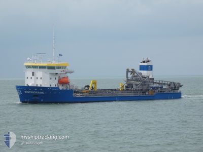
The vessel ANCHORAGE (IMO: 9823792, MMSI: 246400000) is a Dredging or underwater ops It's sailing under the flag of [NL] Netherlands.
In this page you can find informations about the vessels current position, last detected port calls, and current voyage information. If the vessels is not in coverage by AIS you will find the latest position.
The current position of ANCHORAGE is detected by our AIS receivers and we are not responsible for the reliability of the data. The last position was recorded while the vessel was in Coverage by the Ais receivers of our vessel tracking app.
The current draught of ANCHORAGE as reported by AIS is 4.5 meters
Weather
| Temperature | 14.8°C / 58.64°F |
|---|---|
| Wind Speed | 1 knots |
| Direction | 240° WSW |
| Pressure | 1013.1 hPa |
| Humidity | 74.4 % |
| Cloud Coverage | 34 % |
Featured Company
Last Port Calls
| Port | Arrival | Departure | Time In Port |
|---|---|---|---|
| 2024-05-14 11:46 | 2024-05-15 11:21 | 23 h | |
| 2024-05-12 15:23 | 2024-05-12 20:36 | 5 h | |
| 2024-05-11 02:21 | 2024-05-11 09:23 | 7 h | |
| 2024-05-09 13:59 | 2024-05-09 19:39 | 5 h | |
| 2024-05-08 04:16 | 2024-05-08 23:07 | 18 h | |
| 2024-05-05 06:29 | 2024-05-05 22:20 | 15 h | |
| 2024-05-04 10:17 | 2024-05-04 23:03 | 12 h | |
| 2024-05-01 10:09 | 2024-05-01 22:41 | 12 h | |
| 2024-04-30 08:12 | 2024-05-01 09:56 | 1 d | |
| 2024-04-29 04:55 | 2024-04-29 10:47 | 5 h |
Most Visited Ports (Last year)
| Port | Arrivals | |
|---|---|---|
| 82 | ||
| 23 | ||
| 18 | ||
| 17 | ||
| 9 | ||
| 9 |
Last Trips
| Origin | Departure | Destination | Arrival | Distance | |
|---|---|---|---|---|---|
| 2024-05-12 22:36 | 2024-05-14 13:46 | 319.61 nm | |||
| 2024-05-11 10:23 | 2024-05-12 17:23 | 301.69 nm | |||
| 2024-05-09 20:39 | 2024-05-11 03:21 | 357.67 nm | |||
| 2024-05-09 01:07 | 2024-05-09 14:59 | 133.33 nm | |||
| 2024-05-06 00:20 | 2024-05-08 06:16 | 379.61 nm | |||
| 2024-05-05 01:03 | 2024-05-05 08:29 | 57.12 nm | |||
| 2024-05-02 00:41 | 2024-05-04 12:17 | 205.62 nm | |||
| 2024-05-01 11:56 | 2024-05-01 12:09 | 2.99 nm | |||
| 2024-04-29 12:47 | 2024-04-30 10:12 | 124.72 nm | |||
| 2024-04-28 22:23 | 2024-04-29 06:55 | 70.51 nm |
Events
| Time | Event | Details | Position / Dest | Info |
|---|---|---|---|---|
| 2024-05-19 16:39 | START Moving | 9.08 nm, South East of SANDOWN |
50.59071 / -.93528
GBGVS
|
Speed: 3.1 kn Course: 214° |
| 2024-05-19 16:30 | Status Changed | Under way using engine Restricted manoeuverability |
50.59341 / -.92767
GBGVS
|
Speed: 2.6 kn Course: 237° |
| 2024-05-19 16:20 | ETA Changed | 2024/05/20 20:00 2024/05/19 15:00 |
50.59677 / -.92319
GBGVS
|
Speed: 1.2 kn Course: 234° |
| 2024-05-19 16:13 | Destination Changed | GBGVS DREDGE AREA 451 |
50.59818 / -.92114
GBGVS
|
Speed: 1 kn Course: 236° |
| 2024-05-19 16:13 | Status Changed | Restricted manoeuverability Under way using engine |
50.59822 / -.92109
DREDGE AREA 451
|
Speed: 1 kn Course: 236° |
| 2024-05-19 16:07 | STOP Moving | 9.35 nm, South East of ST HELENS |
50.59925 / -.91999
DREDGE AREA 451
|
Speed: 0.2 kn Course: 307° |
| 2024-05-19 15:57 | START Moving | 9.27 nm, East of SANDOWN |
50.59311 / -.92803
DREDGE AREA 451
|
Speed: 3.1 kn Course: 12° |
| 2024-05-19 14:29 | STOP Moving | 9.34 nm, South East of ST HELENS |
50.60066 / -.91843
DREDGE AREA 451
|
Speed: 0.3 kn Course: 243° |
| 2024-05-19 12:26 | Status Changed | Under way using engine Default |
50.26958 / -.71036
DREDGE AREA 451
|
Speed: 11.3 kn Course: 337° |
| 2024-05-19 12:23 | Status Changed | Default Under way using engine |
50.26041 / -.70418
DREDGE AREA 451
|
Speed: 11.2 kn Course: 336° |