
ANDAMAN SKIES
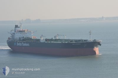
Crude Oil Tanker
Current Trip
| Time Travelled | 13 days |
|---|---|
| Remaining Time | 3 days |
| Distance Travelled | 3705.23 nm |
| Remaining Distance | 1053.45 nm |
| AVG Speed | 10.8 Knots |
| MAX Speed | 14.7 Knots |
| AVG Wind | 16.7 knots |
| MAX Wind | 33 knots |
| MIN Temp | 9.4°C / 48.92°F |
| MAX Temp | 25.1°C / 77.18°F |
| Draught | 14.4 m |
| Position Received | Now |
Current Position
| Longitude | 12.55320° |
|---|---|
| Latitude | 36.99348° |
| Status | Under way using engine |
| Speed | 12.4 Knots |
| Course | 105° |
| Area | Mediterranean Sea - Eastern Basin |
| Station | T-AIS |
| Position Received | Now |
Info
Information
The current position of ANDAMAN SKIES is in Mediterranean Sea - Eastern Basin with coordinates 36.99348° / 12.55320° as reported on 2024-06-18 13:28 by AIS to our vessel tracker app. The vessel's current speed is 12.4 Knots and is heading at the port of PORT SAID. The estimated time of arrival as calculated by vessel tracking app is 2024-06-22 02:10 LT
The vessel ANDAMAN SKIES (IMO: 9288693, MMSI: 518998632) is a Crude Oil Tanker that was built in 2004 ( 20 years old ). It's sailing under the flag of [CK] Cook Is.
In this page you can find informations about the vessels current position, last detected port calls, and current voyage information. If the vessels is not in coverage by AIS you will find the latest position.
The current position of ANDAMAN SKIES is detected by our AIS receivers and we are not responsible for the reliability of the data. The last position was recorded while the vessel was in Coverage by the Ais receivers of our vessel tracking app.
The current draught of ANDAMAN SKIES as reported by AIS is 14.4 meters
Weather
| Temperature | 24.1°C / 75.38°F |
|---|---|
| Wind Speed | 10 knots |
| Direction | 168° SSE |
| Pressure | 1017.8 hPa |
| Humidity | 73.5 % |
| Cloud Coverage | --- |
Featured Company
Last Port Calls
| Port | Arrival | Departure | Time In Port |
|---|---|---|---|
| 2024-06-04 05:19 | 2024-06-05 07:50 | 1 d | |
| 2024-05-09 04:08 | 2024-05-09 13:22 | 9 h | |
| 2024-04-13 04:34 | 2024-04-13 13:55 | 9 h | |
| 2024-04-03 14:09 | 2024-04-04 15:57 | 1 d |
Most Visited Ports (Last year)
| Port | Arrivals | |
|---|---|---|
| 6 | ||
| 4 | ||
| 3 | ||
| 1 | ||
| 1 | ||
| 1 |
Last Trips
| Origin | Departure | Destination | Arrival | Distance | |
|---|---|---|---|---|---|
| 2024-04-04 18:57 | 2024-06-04 08:19 | 6787.50 nm | |||
| 2024-04-04 18:57 | 2024-05-09 06:08 | 7888.87 nm | |||
| 2024-04-04 18:57 | 2024-04-13 06:34 | 1308.06 nm | |||
| 2024-03-27 16:53 | 2024-04-03 17:09 | 870.10 nm |
Events
| Time | Event | Details | Position / Dest | Info |
|---|---|---|---|---|
| 2024-06-18 13:12 | Status Changed | Under way using engine Default |
37.00780 / 12.48883
PORT SAID
|
Speed: 12 kn Course: 105° |
| 2024-06-18 13:01 | Status Changed | Default Under way using engine |
37.01775 / 12.44512
PORT SAID
|
Speed: 12.1 kn Course: 105° |
| 2024-06-18 11:24 | Status Changed | Under way using engine Default |
37.12215 / 12.04892
PORT SAID
|
Speed: 12.7 kn Course: 106° |
| 2024-06-18 11:17 | Status Changed | Default Under way using engine |
37.12843 / 12.02198
PORT SAID
|
Speed: 13 kn Course: 108° |
| 2024-06-18 11:13 | Status Changed | Under way using engine Default |
37.13378 / 12.00138
PORT SAID
|
Speed: 13 kn Course: 108° |
| 2024-06-18 11:01 | Status Changed | Default Under way using engine |
37.14688 / 11.95353
PORT SAID
|
Speed: 12.7 kn Course: 108° |
| 2024-06-18 10:54 | Change Sea Area | Italian part of the Mediterranean Sea - Eastern Basin Tunisian part of the Mediterranean Sea - Eastern Basin |
37.15515 / 11.92328
Mediterranean Sea - Eastern Basin
PORT SAID
|
Speed: 12.7 kn Course: 108° |
| 2024-06-18 09:01 | Change Sea Area | Tunisian part of the Mediterranean Sea - Eastern Basin Tunisian part of the Mediterranean Sea - Western Basin |
37.27673 / 11.45265
Mediterranean Sea - Eastern Basin
PORT SAID
|
Speed: 12.5 kn Course: 108° |
| 2024-06-18 09:01 | Status Changed | Under way using engine Default |
37.27673 / 11.45265
PORT SAID
|
Speed: 12.4 kn Course: 110° |
| 2024-06-18 08:37 | Status Changed | Default Under way using engine |
37.30388 / 11.35957
PORT SAID
|
Speed: 12.1 kn Course: 110° |