
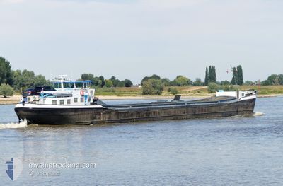
ANDANTE
Cargo
Current Trip
| Time Travelled | 9 days |
|---|---|
| Remaining Time | 39 mins |
| Distance Travelled | 507.64 nm |
| Remaining Distance | 8.21 nm |
| AVG Speed | 6.9 Knots |
| MAX Speed | 10.4 Knots |
| AVG Wind | 7.2 knots |
| MAX Wind | 15.9 knots |
| MIN Temp | 8.5°C / 47.3°F |
| MAX Temp | 25.4°C / 77.72°F |
| Draught | 1 m |
| Position Received | 4 m ago |
Current Position
| Longitude | 5.42910° |
|---|---|
| Latitude | 51.87428° |
| Status | Under way using engine |
| Speed | 10 Knots |
| Course | 212.5° |
| Area | North Sea |
| Station | T-AIS |
| Position Received | 4 m ago |
Info
Information
The current position of ANDANTE is in North Sea with coordinates 51.87428° / 5.42910° as reported on 2024-05-15 17:59 by AIS to our vessel tracker app. The vessel's current speed is 10 Knots and is heading at the port of DEEST. The estimated time of arrival as calculated by vessel tracking app is 2024-05-15 18:42 LT
The vessel ANDANTE (MMSI: 244710274) is a Cargo It's sailing under the flag of [NL] Netherlands.
In this page you can find informations about the vessels current position, last detected port calls, and current voyage information. If the vessels is not in coverage by AIS you will find the latest position.
The current position of ANDANTE is detected by our AIS receivers and we are not responsible for the reliability of the data. The last position was recorded while the vessel was in Coverage by the Ais receivers of our vessel tracking app.
The current draught of ANDANTE as reported by AIS is 1 meters
Weather
| Temperature | 15°C / 59°F |
|---|---|
| Wind Speed | 4 knots |
| Direction | 316° NW |
| Pressure | 1005.8 hPa |
| Humidity | 93.6 % |
| Cloud Coverage | 100 % |
Featured Company
Last Port Calls
| Port | Arrival | Departure | Time In Port |
|---|---|---|---|
| 2024-05-06 04:37 | |||
| 2024-05-01 16:32 | 2024-05-01 17:34 | 1 h | |
| 2024-05-01 11:58 | 2024-05-01 12:18 | 20 m | |
| 2024-04-30 14:51 | 2024-04-30 15:24 | 33 m | |
| 2024-04-30 10:37 | 2024-04-30 12:12 | 1 h | |
| 2024-04-29 18:19 | 2024-04-29 19:26 | 1 h | |
| 2024-04-29 16:01 | 2024-04-29 16:20 | 18 m | |
| 2024-04-29 10:17 | 2024-04-29 10:38 | 20 m | |
| 2024-04-29 08:41 | 2024-04-29 09:12 | 31 m | |
| 2024-04-29 05:19 | 2024-04-29 06:39 | 1 h |
Last Trips
| Origin | Departure | Destination | Arrival | Distance | |
|---|---|---|---|---|---|
| 2024-05-01 14:18 | 2024-05-01 18:32 | 8.35 nm | |||
| 2024-04-30 17:24 | 2024-05-01 13:58 | 36.02 nm | |||
| 2024-04-30 14:12 | 2024-04-30 16:51 | 7.12 nm | |||
| 2024-04-29 21:26 | 2024-04-30 12:37 | 58.68 nm | |||
| 2024-04-29 18:20 | 2024-04-29 20:19 | 7.17 nm | |||
| 2024-04-29 12:38 | 2024-04-29 18:01 | 13.19 nm | |||
| 2024-04-29 11:12 | 2024-04-29 12:17 | 5.25 nm | |||
| 2024-04-29 08:39 | 2024-04-29 10:41 | 13.51 nm | |||
| 2024-04-29 04:44 | 2024-04-29 07:19 | 16.23 nm | |||
| 2024-04-26 14:59 | 2024-04-26 16:07 | 6.29 nm |
Events
| Time | Event | Details | Position / Dest | Info |
|---|---|---|---|---|
| 2024-05-15 16:56 | START Moving | 0.45 nm, East of DEEST |
51.89254 / 5.68440
DEEST
|
Speed: 4.4 kn Course: 308° |
| 2024-05-15 16:54 | Status Changed | Under way using engine Moored |
51.89227 / 5.68532
DEEST
|
Speed: 0.2 kn Course: 511° |
| 2024-05-15 14:21 | Status Changed | Moored Under way using engine |
51.89243 / 5.68442
DEEST
|
Speed: 0.8 kn Course: 511° |
| 2024-05-15 14:16 | Status Changed | Under way using engine Moored |
51.89244 / 5.68660
DEEST
|
Speed: 1 kn Course: 511° |
| 2024-05-15 11:02 | Status Changed | Moored Under way using engine |
51.89231 / 5.68737
DEEST
|
Speed: Course: 511° |
| 2024-05-15 11:00 | STOP Moving | 0.57 nm, East of DEEST |
51.89231 / 5.68739
DEEST
|
Speed: 0.2 kn Course: 511° |
| 2024-05-15 09:59 | Draught Changed | 1 2.7 |
51.89510 / 5.53558
DEEST
|
Speed: 6.7 kn Course: 63.1° |
| 2024-05-15 09:59 | Destination Changed | DEEST NLNGN0226BBRDG100017 |
51.89510 / 5.53558
DEEST
|
Speed: 6.7 kn Course: 63.1° |
| 2024-05-15 09:59 | ETA Changed | 2024/05/15 14:00 2024/05/14 23:53 |
51.89510 / 5.53558
DEEST
|
Speed: 6.7 kn Course: 63.1° |
| 2024-05-15 09:28 | START Moving | 0.87 nm, North East of TIEL |
51.89896 / 5.45618
NLNGN0226BBRDG100017
|
Speed: 7.4 kn Course: 159.4° |