
ANDES
Pleasure Craft
Current Trip
Unknown
| Time Travelled | 8 days |
|---|---|
| Remaining Time | --- |
| Distance Travelled | 448.51 nm |
| Remaining Distance | --- |
| AVG Speed | 6.6 Knots |
| MAX Speed | 11.6 Knots |
| AVG Wind | 9.1 knots |
| MAX Wind | 20 knots |
| MIN Temp | 19°C / 66.2°F |
| MAX Temp | 24.6°C / 76.28°F |
| Draught | 0 m |
| Position Received | 1 m ago |
Current Position
| Longitude | 7.11385° |
|---|---|
| Latitude | 43.56208° |
| Status | Default |
| Speed | |
| Course | --- |
| Area | Mediterranean Sea - Western Basin |
| Station | T-AIS |
| Position Received | 1 m ago |
Info
Information
The current position of ANDES is in Mediterranean Sea - Western Basin with coordinates 43.56208° / 7.11385° as reported on 2024-06-14 09:40 by AIS to our vessel tracker app. The vessel's current speed is 0 Knots
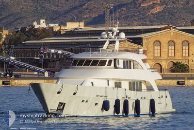
The vessel ANDES (MMSI: 378112106) is a Pleasure Craft It's sailing under the flag of [VG] British Virgin Is.
In this page you can find informations about the vessels current position, last detected port calls, and current voyage information. If the vessels is not in coverage by AIS you will find the latest position.
The current position of ANDES is detected by our AIS receivers and we are not responsible for the reliability of the data. The last position was recorded while the vessel was in Coverage by the Ais receivers of our vessel tracking app.
Weather
| Temperature | 20.6°C / 69.08°F |
|---|---|
| Wind Speed | 7 knots |
| Direction | 212° SSW |
| Pressure | 1016.7 hPa |
| Humidity | 56.6 % |
| Cloud Coverage | 100 % |
Featured Company
Most Visited Ports (Last year)
| Port | Arrivals | |
|---|---|---|
| 2 | ||
| 1 | ||
| 1 | ||
| 1 | ||
| 1 |
Last Trips
| Origin | Departure | Destination | Arrival | Distance |
|---|
Events
| Time | Event | Details | Position / Dest | Info |
|---|---|---|---|---|
| 2024-06-10 07:39 | STOP Moving | 1.57 nm, South of ANTIBES |
43.56239 / 7.11420
|
Speed: 0.3 kn Course: 511° |
| 2024-06-10 07:33 | START Moving | 1.31 nm, East of GOLFE JUAN |
43.56061 / 7.10802
|
Speed: 6.1 kn Course: 45.3° |
| 2024-06-08 02:39 | STOP Moving | 1.22 nm, East of GOLFE JUAN |
43.55787 / 7.10494
|
Speed: 0.1 kn Course: 511° |
| 2024-06-07 19:12 | IN Coverage |
42.93321 / 6.54032
Mediterranean Sea - Western Basin
|
Speed: 6.2 kn Course: 42.9° |
|
| 2024-06-07 17:40 | OUT of Coverage |
42.81612 / 6.39543
Mediterranean Sea - Western Basin
|
Speed: 6.1 kn Course: 47.1° |
|
| 2024-06-07 17:40 | IN Coverage |
42.81612 / 6.39543
Mediterranean Sea - Western Basin
|
Speed: 6.1 kn Course: 47.1° |
|
| 2024-06-07 14:37 | OUT of Coverage |
42.57585 / 6.07780
Mediterranean Sea - Western Basin
|
Speed: 7.2 kn Course: 40.8° |
|
| 2024-06-07 13:15 | Detected in Sea | French part of the Mediterranean Sea - Western Basin |
42.43147 / 5.88808
Mediterranean Sea - Western Basin
|
Speed: 11.1 kn Course: 42.9° |
| 2024-06-07 13:15 | IN Coverage |
42.43147 / 5.88808
Mediterranean Sea - Western Basin
|
Speed: 11.1 kn Course: 42.9° |
|
| 2024-06-06 16:41 | OUT of Coverage |
39.79391 / 2.62960
Balearic Sea
|
Speed: 10.9 kn Course: 82° |