
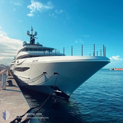
ANDREA
Pleasure Craft
Current Trip
| Trip Time | 17 days |
|---|---|
| Trip Distance | 260.96 nm |
| AVG Speed | 8.6 Knots |
| MAX Speed | 13.9 Knots |
| Draught | 4 m |
| AVG Wind | 8 knots |
| MAX Wind | 22 knots |
| MIN Temp | 13.4°C / 56.12°F |
| MAX Temp | 30.3°C / 86.54°F |
| Position Received | 20 h, 7 m ago |
Current Position
| Longitude | 7.13033° |
|---|---|
| Latitude | 43.58659° |
| Status | Moored |
| Speed | |
| Course | --- |
| Area | Mediterranean Sea - Western Basin |
| Station | T-AIS |
| Position Received | 20 h, 7 m ago |
Info
Information
The current position of ANDREA is in Mediterranean Sea - Western Basin with coordinates 43.58659° / 7.13033° as reported on 2024-06-20 09:30 by AIS to our vessel tracker app. The vessel's current speed is 0 Knots and is currently inside the port of ANTIBES.
The vessel ANDREA (IMO: 1012218, MMSI: 538071396) is a Pleasure Craft It's sailing under the flag of [MH] Marshall Is.
In this page you can find informations about the vessels current position, last detected port calls, and current voyage information. If the vessels is not in coverage by AIS you will find the latest position.
The current position of ANDREA is detected by our AIS receivers and we are not responsible for the reliability of the data. The last position was recorded while the vessel was in Coverage by the Ais receivers of our vessel tracking app.
The current draught of ANDREA as reported by AIS is 4 meters
Weather
| Temperature | 22.3°C / 72.14°F |
|---|---|
| Wind Speed | 6 knots |
| Direction | 70° ENE |
| Pressure | 1016 hPa |
| Humidity | 79.3 % |
| Cloud Coverage | 100 % |
Featured Company
Last Port Calls
| Port | Arrival | Departure | Time In Port |
|---|---|---|---|
| 2024-06-18 07:48 | |||
| 2024-05-28 08:28 | 2024-06-01 07:04 | 3 d | |
| 2024-05-25 04:48 | 2024-05-25 13:30 | 8 h | |
| 2024-04-15 19:25 | 2024-05-07 16:03 | 21 d | |
| 2024-04-06 11:14 | 2024-04-07 05:06 | 17 h |
Last Trips
| Origin | Departure | Destination | Arrival | Distance | |
|---|---|---|---|---|---|
| 2024-06-01 09:04 | 2024-06-18 09:48 | 260.96 nm | |||
| 2024-05-25 15:30 | 2024-05-28 10:28 | 775.29 nm | |||
| 2024-05-07 12:03 | 2024-05-25 06:48 | 3900.33 nm | |||
| 2024-04-07 01:06 | 2024-04-15 15:25 | 3.06 nm | |||
| 2024-01-09 22:52 | 2024-04-06 07:14 | 427.24 nm |
Events
| Time | Event | Details | Position / Dest | Info |
|---|---|---|---|---|
| 2024-06-20 09:30 | OUT of Coverage |
43.58659 / 7.13033
Mediterranean Sea - Western Basin
[FR] ANTIBES
|
Speed: Course: 511° |
|
| 2024-06-19 18:06 | ETA Changed | 2024/06/18 07:30 |
43.58661 / 7.13011
[FR] ANTIBES
|
Speed: 0.1 kn Course: 303° |
| 2024-06-19 17:54 | ETA Changed | 2024/06/18 07:30 |
43.58662 / 7.13013
[FR] ANTIBES
|
Speed: 0.1 kn Course: 303° |
| 2024-06-19 17:42 | ETA Changed | 2024/06/18 07:30 |
43.58659 / 7.13013
[FR] ANTIBES
|
Speed: 0.1 kn Course: 303° |
| 2024-06-19 17:06 | ETA Changed | 2024/06/18 07:30 |
43.58661 / 7.13011
[FR] ANTIBES
|
Speed: Course: 303° |
| 2024-06-19 16:54 | ETA Changed | 2024/06/18 07:30 |
43.58664 / 7.13011
[FR] ANTIBES
|
Speed: Course: 303° |
| 2024-06-19 16:30 | ETA Changed | 2024/06/18 07:30 |
43.58662 / 7.13011
[FR] ANTIBES
|
Speed: Course: 303° |
| 2024-06-18 21:10 | ETA Changed | 2024/06/18 07:30 |
43.58661 / 7.13009
[FR] ANTIBES
|
Speed: 0.1 kn Course: 300° |
| 2024-06-18 17:40 | ETA Changed | 2024/06/18 07:30 |
43.58662 / 7.13010
[FR] ANTIBES
|
Speed: Course: 301° |
| 2024-06-18 09:29 | Status Changed | Moored Under way using engine |
43.58661 / 7.13010
[FR] ANTIBES
|
Speed: 0.1 kn Course: 301° |