
ANDREAS KALVOS
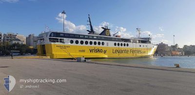
Ro-Ro/Passenger Ship
Current Trip
| Trip Time | 26 mins |
|---|---|
| Trip Distance | 5.51 nm |
| AVG Speed | 12.3 Knots |
| MAX Speed | 15.9 Knots |
| Draught | 4.4 m |
| AVG Wind | 5 knots |
| MAX Wind | 5 knots |
| MIN Temp | 19.7°C / 67.46°F |
| MAX Temp | 19.9°C / 67.82°F |
| Position Received | 21 m ago |
Current Position
| Longitude | 20.64784° |
|---|---|
| Latitude | 38.25516° |
| Status | Moored |
| Speed | |
| Course | 353° |
| Area | Ionian Sea |
| Station | T-AIS |
| Position Received | 21 m ago |
Info
Information
The current position of ANDREAS KALVOS is in Ionian Sea with coordinates 38.25516° / 20.64784° as reported on 2024-05-11 16:21 by AIS to our vessel tracker app. The vessel's current speed is 0 Knots and is currently inside the port of SAMI.
The vessel ANDREAS KALVOS (IMO: 8500484, MMSI: 237416000) is a Ro-Ro/Passenger Ship that was built in 1985 ( 39 years old ). It's sailing under the flag of [GR] Greece.
In this page you can find informations about the vessels current position, last detected port calls, and current voyage information. If the vessels is not in coverage by AIS you will find the latest position.
The current position of ANDREAS KALVOS is detected by our AIS receivers and we are not responsible for the reliability of the data. The last position was recorded while the vessel was in Coverage by the Ais receivers of our vessel tracking app.
The current draught of ANDREAS KALVOS as reported by AIS is 4.4 meters
Weather
| Temperature | 19°C / 66.2°F |
|---|---|
| Wind Speed | 8 knots |
| Direction | 343° NNW |
| Pressure | 1014.9 hPa |
| Humidity | 68.5 % |
| Cloud Coverage | 37 % |
Featured Company
Last Port Calls
| Port | Arrival | Departure | Time In Port |
|---|---|---|---|
| 2024-05-11 14:48 | |||
| 2024-05-11 14:13 | 2024-05-11 14:22 | 8 m | |
| 2024-05-11 13:27 | 2024-05-11 13:51 | 23 m | |
| 2024-05-11 09:08 | 2024-05-11 10:08 | 59 m | |
| 2024-05-11 05:13 | 2024-05-11 05:39 | 26 m | |
| 2024-05-11 04:34 | 2024-05-11 04:49 | 15 m | |
| 2024-05-10 15:05 | 2024-05-11 04:09 | 13 h | |
| 2024-05-10 14:10 | 2024-05-10 14:20 | 10 m | |
| 2024-05-10 09:06 | 2024-05-10 10:15 | 1 h | |
| 2024-05-10 05:14 | 2024-05-10 05:38 | 23 m |
Last Trips
| Origin | Departure | Destination | Arrival | Distance | |
|---|---|---|---|---|---|
| 2024-05-11 17:22 | 2024-05-11 17:48 | 5.51 nm | |||
| 2024-05-11 16:51 | 2024-05-11 17:13 | 4.56 nm | |||
| 2024-05-11 13:08 | 2024-05-11 16:27 | 52.54 nm | |||
| 2024-05-11 08:39 | 2024-05-11 12:08 | 52.54 nm | |||
| 2024-05-11 07:49 | 2024-05-11 08:13 | 5.84 nm | |||
| 2024-05-11 07:09 | 2024-05-11 07:34 | 5.67 nm | |||
| 2024-05-10 17:20 | 2024-05-10 18:05 | 5.91 nm | |||
| 2024-05-10 13:15 | 2024-05-10 17:10 | 57.96 nm | |||
| 2024-05-10 08:38 | 2024-05-10 12:06 | 52.42 nm | |||
| 2024-05-10 07:50 | 2024-05-10 08:14 | 5.67 nm |
Events
| Time | Event | Details | Position / Dest | Info |
|---|---|---|---|---|
| 2024-05-11 14:49 | STOP Moving |
38.25518 / 20.64783
[GR] SAMI
|
Speed: 0.3 kn Course: 353° |
|
| 2024-05-11 14:48 | PORT ARRIVAL |
|
38.25518 / 20.64783
[GR] SAMI
|
Speed: 2.3 kn Course: 350° |
| 2024-05-11 14:47 | Status Changed | Moored Under way using engine |
38.25558 / 20.64772
GRSAI
|
Speed: 11.6 kn Course: 160.9° |
| 2024-05-11 14:22 | START Moving | 0.49 nm, South West of AETOS |
38.34059 / 20.67939
GRSAI
|
Speed: 13.2 kn Course: 203° |
| 2024-05-11 14:22 | PORT DEPARTURE |
|
38.34059 / 20.67939
GRSAI
|
Speed: 0.1 kn Course: 253° |
| 2024-05-11 14:15 | STOP Moving |
38.34717 / 20.68432
[GR] AETOS
|
Speed: 0.1 kn Course: 248° |
|
| 2024-05-11 14:13 | PORT ARRIVAL |
|
38.34718 / 20.68431
[GR] AETOS
|
Speed: 11.3 kn Course: 20.9° |
| 2024-05-11 13:51 | START Moving | 1.36 nm, North of SAMI |
38.27498 / 20.65433
GRSAI
|
Speed: 16.1 kn Course: 14° |
| 2024-05-11 13:51 | PORT DEPARTURE |
|
38.27498 / 20.65433
GRSAI
|
Speed: 0.5 kn Course: 352° |
| 2024-05-11 13:32 | STOP Moving |
38.25519 / 20.64781
[GR] SAMI
|
Speed: 0.1 kn Course: 353° |