
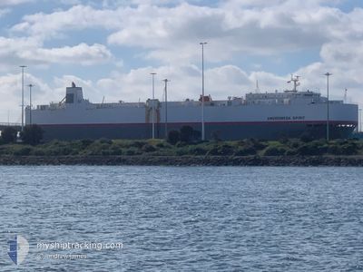
ANDROMEDA SPIRIT
Vehicles Carrier
Current Trip
| Time Travelled | 3 days |
|---|---|
| Remaining Time | --- |
| Distance Travelled | 1358.33 nm |
| Remaining Distance | --- |
| AVG Speed | 15.8 Knots |
| MAX Speed | 19.3 Knots |
| AVG Wind | 14 knots |
| MAX Wind | 22.8 knots |
| MIN Temp | 12.1°C / 53.78°F |
| MAX Temp | 20.6°C / 69.08°F |
| Draught | 7.5 m |
| Position Received | 1 d ago |
Current Position
| Longitude | -129.83826° |
|---|---|
| Latitude | 34.49544° |
| Status | Under way using engine |
| Speed | 18.1 Knots |
| Course | 266.1° |
| Area | North Pacific Ocean |
| Station | T-AIS |
| Position Received | 1 d ago |
Info
Information
The current position of ANDROMEDA SPIRIT is in North Pacific Ocean with coordinates 34.49544° / -129.83826° as reported on 2024-06-22 19:57 by AIS to our vessel tracker app. The vessel's current speed is 18.1 Knots and is heading at the port of YOKOHAMA. The estimated time of arrival as calculated by vessel tracking app is 2024-07-03 19:00 LT
The vessel ANDROMEDA SPIRIT (IMO: 9372327, MMSI: 372945000) is a Vehicles Carrier that was built in 2007 ( 17 years old ). It's sailing under the flag of [PA] Panama.
In this page you can find informations about the vessels current position, last detected port calls, and current voyage information. If the vessels is not in coverage by AIS you will find the latest position.
The current position of ANDROMEDA SPIRIT is detected by our AIS receivers and we are not responsible for the reliability of the data. The last position was recorded while the vessel was in Coverage by the Ais receivers of our vessel tracking app.
The current draught of ANDROMEDA SPIRIT as reported by AIS is 7.5 meters
Weather
| Temperature | 19.1°C / 66.38°F |
|---|---|
| Wind Speed | 2 knots |
| Direction | 54° NE |
| Pressure | 1024 hPa |
| Humidity | 73.1 % |
| Cloud Coverage | --- |
Featured Company
Last Port Calls
| Port | Arrival | Departure | Time In Port |
|---|---|---|---|
| 2024-06-20 06:52 | 2024-06-21 00:49 | 17 h | |
| 2024-06-12 19:55 | 2024-06-13 09:59 | 14 h | |
| 2024-06-10 15:49 | 2024-06-11 05:34 | 13 h | |
| 2024-05-26 21:53 | 2024-05-28 08:41 | 1 d | |
| 2024-05-24 21:46 | 2024-05-25 07:20 | 9 h | |
| 2024-05-05 20:32 | 2024-05-06 11:14 | 14 h | |
| 2024-05-03 21:34 | 2024-05-04 12:40 | 15 h | |
| 2024-04-28 20:07 | 2024-04-30 08:02 | 1 d | |
| 2024-04-14 22:21 | 2024-04-15 07:18 | 8 h | |
| 2024-04-12 21:57 | 2024-04-13 07:26 | 9 h |
Most Visited Ports (Last year)
| Port | Arrivals | |
|---|---|---|
| 4 | ||
| 4 | ||
| 3 | ||
| 3 | ||
| 2 | ||
| 2 |
Last Trips
| Origin | Departure | Destination | Arrival | Distance | |
|---|---|---|---|---|---|
| 2024-06-13 02:59 | 2024-06-19 23:52 | 1222.79 nm | |||
| 2024-06-10 22:34 | 2024-06-12 12:55 | 186.47 nm | |||
| 2024-05-28 17:41 | 2024-06-10 08:49 | 4810.73 nm | |||
| 2024-05-25 16:20 | 2024-05-27 06:53 | 391.77 nm | |||
| 2024-05-06 21:14 | 2024-05-25 06:46 | 5373.39 nm | |||
| 2024-05-04 22:10 | 2024-05-06 06:32 | 517.30 nm | |||
| 2024-04-30 16:02 | 2024-05-04 07:04 | 1388.44 nm | |||
| 2024-04-15 16:18 | 2024-04-29 04:07 | 4524.94 nm | |||
| 2024-04-13 16:26 | 2024-04-15 07:21 | 533.12 nm | |||
| 2024-04-12 23:18 | 2024-04-13 06:57 | 97.33 nm |
Events
| Time | Event | Details | Position / Dest | Info |
|---|---|---|---|---|
| 2024-06-22 20:03 | Status Changed | Default Under way using engine |
34.49507 / -129.87234
JPYOK
|
Speed: 18.1 kn Course: 266.1° |
| 2024-06-22 19:57 | OUT of Coverage |
34.49544 / -129.83826
North Pacific Ocean
JPYOK
|
Speed: 18.1 kn Course: 266.1° |
|
| 2024-06-22 19:40 | Status Changed | Under way using engine Default |
34.49773 / -129.73221
JPYOK
|
Speed: 18.3 kn Course: 267° |
| 2024-06-22 19:31 | IN Coverage |
34.49770 / -129.73334
North Pacific Ocean
JPYOK
|
Speed: 18.2 kn Course: 269.4° |
|
| 2024-06-22 18:01 | Status Changed | Default Under way using engine |
34.49901 / -129.13055
JPYOK
|
Speed: 18.4 kn Course: 273.7° |
| 2024-06-22 17:58 | OUT of Coverage |
34.49860 / -129.11347
North Pacific Ocean
JPYOK
|
Speed: 18.4 kn Course: 273.7° |
|
| 2024-06-22 17:51 | Status Changed | Under way using engine Default |
34.49766 / -129.06739
JPYOK
|
Speed: 18.2 kn Course: 271° |
| 2024-06-22 17:19 | Status Changed | Default Under way using engine |
34.49571 / -128.87373
JPYOK
|
Speed: 17.9 kn Course: 269.6° |
| 2024-06-22 16:16 | IN Coverage |
34.49587 / -128.49673
North Pacific Ocean
JPYOK
|
Speed: 18.2 kn Course: 268.5° |
|
| 2024-06-22 16:13 | Status Changed | Under way using engine Default |
34.49647 / -128.47588
JPYOK
|
Speed: 18.3 kn Course: 267° |