
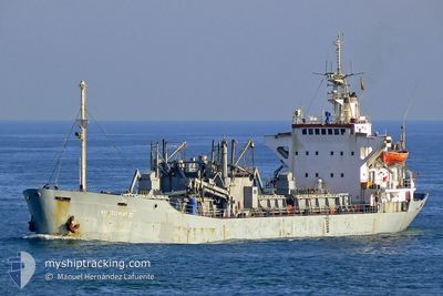
ANGELOS K
Cement Carrier
Current Trip
ELARISH EGYPT
| Time Travelled | 16 h, 51 mins |
|---|---|
| Remaining Time | --- |
| Distance Travelled | 0.28 nm |
| Remaining Distance | --- |
| AVG Speed | 4.9 Knots |
| MAX Speed | 6.2 Knots |
| AVG Wind | 6.7 knots |
| MAX Wind | 9.5 knots |
| MIN Temp | 22.4°C / 72.32°F |
| MAX Temp | 23.4°C / 74.12°F |
| Draught | 4.1 m |
| Position Received | 3 m ago |
Current Position
| Longitude | 35.49085° |
|---|---|
| Latitude | 33.81824° |
| Status | At anchor |
| Speed | 0.2 Knots |
| Course | --- |
| Area | Mediterranean Sea - Eastern Basin |
| Station | T-AIS |
| Position Received | 3 m ago |
Info
Information
The current position of ANGELOS K is in Mediterranean Sea - Eastern Basin with coordinates 33.81824° / 35.49085° as reported on 2024-06-01 13:03 by AIS to our vessel tracker app. The vessel's current speed is 0.2 Knots
The vessel ANGELOS K (IMO: 7106188, MMSI: 377263000) is a Cement Carrier that was built in 1971 ( 53 years old ). It's sailing under the flag of [VC] St Vincent Grenadines.
In this page you can find informations about the vessels current position, last detected port calls, and current voyage information. If the vessels is not in coverage by AIS you will find the latest position.
The current position of ANGELOS K is detected by our AIS receivers and we are not responsible for the reliability of the data. The last position was recorded while the vessel was in Coverage by the Ais receivers of our vessel tracking app.
The current draught of ANGELOS K as reported by AIS is 4.1 meters
Weather
| Temperature | 25°C / 77°F |
|---|---|
| Wind Speed | 8 knots |
| Direction | 348° NNW |
| Pressure | 1017.6 hPa |
| Humidity | 48.9 % |
| Cloud Coverage | --- |
Featured Company
Last Port Calls
| Port | Arrival | Departure | Time In Port |
|---|---|---|---|
| 2024-05-31 20:07 | 2024-05-31 20:16 | 9 m | |
| 2024-05-21 20:41 | 2024-05-28 14:17 | 6 d | |
| 2024-05-20 14:25 | |||
| 2024-05-08 12:08 | 2024-05-16 02:28 | 7 d | |
| 2024-04-27 06:17 | 2024-04-29 06:19 | 2 d | |
| 2024-04-17 15:02 | 2024-04-25 10:37 | 7 d | |
| 2024-04-06 08:29 | 2024-04-07 10:33 | 1 d | |
| 2024-04-04 10:59 |
Last Trips
| Origin | Departure | Destination | Arrival | Distance | |
|---|---|---|---|---|---|
| 2024-05-28 17:17 | 2024-05-31 22:07 | 91.14 nm | |||
| 2024-05-20 16:25 | 2024-05-21 23:41 | 99.11 nm | |||
| 2024-04-29 08:19 | 2024-05-08 15:08 | 732.67 nm | |||
| 2024-04-25 13:37 | 2024-04-27 08:17 | 101.55 nm | |||
| 2024-04-07 13:33 | 2024-04-17 18:02 | 900.90 nm |
Events
| Time | Event | Details | Position / Dest | Info |
|---|---|---|---|---|
| 2024-06-01 13:03 | IN Coverage |
33.81824 / 35.49085
Mediterranean Sea - Eastern Basin
|
Speed: 0.2 kn Course: 149.5° |
|
| 2024-06-01 08:34 | OUT of Coverage |
31.18539 / 33.82281
Mediterranean Sea - Eastern Basin
|
Speed: 0.3 kn Course: 135.9° |
|
| 2024-06-01 07:36 | Status Changed | At anchor Default |
31.18546 / 33.82270
ELARISH EGYPT
|
Speed: Course: -1° |
| 2024-06-01 07:33 | Status Changed | Default At anchor |
31.18549 / 33.82267
ELARISH EGYPT
|
Speed: Course: 511° |
| 2024-06-01 07:21 | Status Changed | At anchor Default |
31.18549 / 33.82264
ELARISH EGYPT
|
Speed: Course: -1° |
| 2024-06-01 07:12 | Status Changed | Default At anchor |
31.18552 / 33.82260
ELARISH EGYPT
|
Speed: Course: 511° |
| 2024-06-01 06:34 | Status Changed | At anchor Default |
31.18579 / 33.82244
ELARISH EGYPT
|
Speed: Course: -1° |
| 2024-06-01 06:28 | Status Changed | Default At anchor |
31.18582 / 33.82240
ELARISH EGYPT
|
Speed: 0.1 kn Course: 511° |
| 2024-06-01 06:09 | Status Changed | At anchor Default |
31.18597 / 33.82244
ELARISH EGYPT
|
Speed: Course: -1° |
| 2024-06-01 06:06 | Status Changed | Default At anchor |
31.18592 / 33.82236
ELARISH EGYPT
|
Speed: 0.1 kn Course: 511° |