
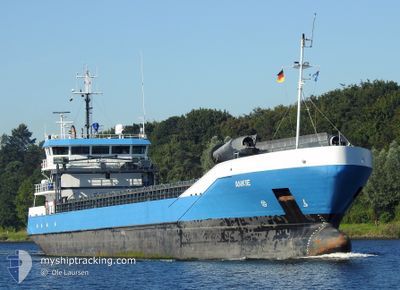
ANKIE
General Cargo
Current Trip
| Time Travelled | 9 h, 7 mins |
|---|---|
| Remaining Time | 4 days |
| Distance Travelled | 93.28 nm |
| Remaining Distance | 1200.40 nm |
| AVG Speed | 10.6 Knots |
| MAX Speed | 12.6 Knots |
| AVG Wind | 19.2 knots |
| MAX Wind | 23.8 knots |
| MIN Temp | 12.8°C / 55.04°F |
| MAX Temp | 16.1°C / 60.98°F |
| Draught | 5.4 m |
| Position Received | 2 h, 59 m ago |
Current Position
| Longitude | 3.13130° |
|---|---|
| Latitude | 52.13542° |
| Status | Under way using engine |
| Speed | 12.5 Knots |
| Course | 42.8° |
| Area | North Sea |
| Station | T-AIS |
| Position Received | 2 h, 59 m ago |
Info
Information
The current position of ANKIE is in North Sea with coordinates 52.13542° / 3.13130° as reported on 2024-05-28 16:28 by AIS to our vessel tracker app. The vessel's current speed is 12.5 Knots and is heading at the port of KOTKA. The estimated time of arrival as calculated by vessel tracking app is 2024-06-02 00:53 LT
The vessel ANKIE (IMO: 9331359, MMSI: 244554000) is a General Cargo that was built in 2007 ( 17 years old ). It's sailing under the flag of [NL] Netherlands.
In this page you can find informations about the vessels current position, last detected port calls, and current voyage information. If the vessels is not in coverage by AIS you will find the latest position.
The current position of ANKIE is detected by our AIS receivers and we are not responsible for the reliability of the data. The last position was recorded while the vessel was in Coverage by the Ais receivers of our vessel tracking app.
The current draught of ANKIE as reported by AIS is 5.4 meters
Weather
| Temperature | 13.8°C / 56.84°F |
|---|---|
| Wind Speed | 23 knots |
| Direction | 219° SW |
| Pressure | 1009.7 hPa |
| Humidity | 95.4 % |
| Cloud Coverage | 100 % |
Featured Company
Last Port Calls
| Port | Arrival | Departure | Time In Port |
|---|---|---|---|
| 2024-05-25 17:30 | 2024-05-28 10:21 | 2 d | |
| 2024-05-24 04:42 | 2024-05-24 07:25 | 2 h | |
| 2024-05-11 20:34 | 2024-05-13 18:20 | 1 d | |
| 2024-05-05 17:49 | 2024-05-05 19:40 | 1 h | |
| 2024-04-27 21:56 | 2024-04-30 16:12 | 2 d | |
| 2024-04-25 05:41 | 2024-04-26 08:16 | 1 d | |
| 2024-04-21 18:54 | 2024-04-23 16:06 | 1 d | |
| 2024-04-12 06:56 | 2024-04-16 17:11 | 4 d | |
| 2024-04-06 21:31 | 2024-04-08 08:22 | 1 d | |
| 2024-04-05 10:13 | 2024-04-05 14:59 | 4 h |
Last Trips
| Origin | Departure | Destination | Arrival | Distance | |
|---|---|---|---|---|---|
| 2024-05-24 09:25 | 2024-05-25 19:30 | 339.63 nm | |||
| 2024-05-13 20:20 | 2024-05-24 06:42 | 1821.46 nm | |||
| 2024-05-05 21:40 | 2024-05-11 22:34 | 948.63 nm | |||
| 2024-04-30 19:12 | 2024-05-05 19:49 | 896.68 nm | |||
| 2024-04-26 10:16 | 2024-04-28 00:56 | 223.50 nm | |||
| 2024-04-23 19:06 | 2024-04-25 07:41 | 366.23 nm | |||
| 2024-04-16 19:11 | 2024-04-21 21:54 | 1119.44 nm | |||
| 2024-04-08 10:22 | 2024-04-12 08:56 | 743.71 nm | |||
| 2024-04-05 16:59 | 2024-04-06 23:31 | 14.28 nm | |||
| 2024-03-26 23:33 | 2024-04-05 12:13 | 826.12 nm |
Events
| Time | Event | Details | Position / Dest | Info |
|---|---|---|---|---|
| 2024-05-28 16:34 | Status Changed | Default Under way using engine |
52.15106 / 3.15541
KOTKA
|
Speed: 12.5 kn Course: 42.8° |
| 2024-05-28 16:28 | OUT of Coverage |
52.13542 / 3.13130
North Sea
KOTKA
|
Speed: 12.5 kn Course: 42.8° |
|
| 2024-05-28 16:22 | Status Changed | Under way using engine Default |
52.12046 / 3.10864
KOTKA
|
Speed: 12 kn Course: 38° |
| 2024-05-28 16:16 | Status Changed | Default Under way using engine |
52.10333 / 3.08333
KOTKA
|
Speed: 12.5 kn Course: 39° |
| 2024-05-28 14:14 | Change Sea Area | Dutch part of the North Sea Belgian part of the North Sea |
51.77291 / 2.71250
North Sea
KOTKA
|
Speed: 11 kn Course: 24.4° |
| 2024-05-28 10:21 | PORT DEPARTURE |
|
51.36500 / 3.18503
KOTKA
|
Speed: 10.4 kn Course: 296° |
| 2024-05-28 10:11 | START Moving |
51.34479 / 3.18188
[BE] ZEEBRUGGE
|
Speed: 5.6 kn Course: 44° |
|
| 2024-05-28 09:47 | Status Changed | Under way using engine Moored |
51.34331 / 3.17964
[BE] ZEEBRUGGE
|
Speed: Course: 51° |
| 2024-05-28 06:00 | Status Changed | Moored Default |
51.34334 / 3.17960
[BE] ZEEBRUGGE
|
Speed: Course: 52° |
| 2024-05-28 05:57 | Status Changed | Default Moored |
51.34336 / 3.17962
[BE] ZEEBRUGGE
|
Speed: Course: 52° |