
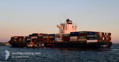
ANL WANGARATTA
Container Ship
Current Trip
| Time Travelled | 5 days |
|---|---|
| Remaining Time | 8 days |
| Distance Travelled | 2304.11 nm |
| Remaining Distance | 3913.79 nm |
| AVG Speed | 19.1 Knots |
| MAX Speed | 21 Knots |
| AVG Wind | 12.3 knots |
| MAX Wind | 20.3 knots |
| MIN Temp | 17.1°C / 62.78°F |
| MAX Temp | 31°C / 87.8°F |
| Draught | 9.7 m |
| Position Received | 2 d ago |
Current Position
| Longitude | -123.41827° |
|---|---|
| Latitude | 29.29417° |
| Status | Under way using engine |
| Speed | 18.9 Knots |
| Course | 307.4° |
| Area | North Pacific Ocean |
| Station | T-AIS |
| Position Received | 2 d ago |
Info
Information
The current position of ANL WANGARATTA is in North Pacific Ocean with coordinates 29.29417° / -123.41827° as reported on 2024-06-19 19:38 by AIS to our vessel tracker app. The vessel's current speed is 18.9 Knots and is heading at the port of YOKOHAMA. The estimated time of arrival as calculated by vessel tracking app is 2024-06-30 09:38 LT
The vessel ANL WANGARATTA (IMO: 9334167, MMSI: 215167000) is a Container Ship that was built in 2008 ( 16 years old ). It's sailing under the flag of [MT] Malta.
In this page you can find informations about the vessels current position, last detected port calls, and current voyage information. If the vessels is not in coverage by AIS you will find the latest position.
The current position of ANL WANGARATTA is detected by our AIS receivers and we are not responsible for the reliability of the data. The last position was recorded while the vessel was in Coverage by the Ais receivers of our vessel tracking app.
The current draught of ANL WANGARATTA as reported by AIS is 9.7 meters
Weather
| Temperature | 17.9°C / 64.22°F |
|---|---|
| Wind Speed | 10 knots |
| Direction | 334° NNW |
| Pressure | 1026.8 hPa |
| Humidity | 88.8 % |
| Cloud Coverage | 100 % |
Featured Company
Last Port Calls
| Port | Arrival | Departure | Time In Port |
|---|---|---|---|
| 2024-06-14 22:51 | 2024-06-16 19:43 | 1 d | |
| 2024-06-08 07:43 | 2024-06-09 19:29 | 1 d | |
| 2024-05-13 06:20 | 2024-05-13 22:40 | 16 h | |
| 2024-05-09 00:20 | 2024-05-10 00:24 | 1 d | |
| 2024-05-01 16:22 | 2024-05-03 04:19 | 1 d | |
| 2024-04-28 10:08 | 2024-04-28 23:20 | 13 h | |
| 2024-04-16 10:10 | 2024-04-21 06:42 | 4 d | |
| 2024-04-09 14:02 | 2024-04-11 04:57 | 1 d | |
| 2024-04-04 15:01 | 2024-04-05 18:05 | 1 d |
Most Visited Ports (Last year)
| Port | Arrivals | |
|---|---|---|
| 10 | ||
| 8 | ||
| 6 | ||
| 6 | ||
| 4 | ||
| 4 |
Last Trips
| Origin | Departure | Destination | Arrival | Distance | |
|---|---|---|---|---|---|
| 2024-06-09 14:29 | 2024-06-14 17:51 | 368.97 nm | |||
| 2024-05-14 07:40 | 2024-06-08 02:43 | 6534.90 nm | |||
| 2024-05-10 08:24 | 2024-05-13 15:20 | 549.94 nm | |||
| 2024-05-03 12:19 | 2024-05-09 08:20 | 2166.68 nm | |||
| 2024-04-29 07:20 | 2024-05-02 00:22 | 212.06 nm | |||
| 2024-04-21 14:42 | 2024-04-28 18:08 | 2554.15 nm | |||
| 2024-04-11 12:57 | 2024-04-16 18:10 | 2344.85 nm | |||
| 2024-04-06 02:05 | 2024-04-09 22:02 | 224.15 nm | |||
| 2024-03-31 18:43 | 2024-04-04 23:01 | 212.17 nm |
Events
| Time | Event | Details | Position / Dest | Info |
|---|---|---|---|---|
| 2024-06-19 19:41 | Status Changed | Default Under way using engine |
29.30452 / -123.43348
JPYOK
|
Speed: 18.9 kn Course: 307.4° |
| 2024-06-19 19:38 | OUT of Coverage |
29.29417 / -123.41827
North Pacific Ocean
JPYOK
|
Speed: 18.9 kn Course: 307.4° |
|
| 2024-06-19 19:29 | Status Changed | Under way using engine Default |
29.26629 / -123.37741
JPYOK
|
Speed: 18.9 kn Course: 308° |
| 2024-06-19 19:22 | Status Changed | Default Under way using engine |
29.24289 / -123.34338
JPYOK
|
Speed: 18.8 kn Course: 307.4° |
| 2024-06-19 16:03 | Status Changed | Under way using engine Default |
28.62240 / -122.37440
JPYOK
|
Speed: 19 kn Course: 307° |
| 2024-06-19 15:50 | Status Changed | Default Under way using engine |
28.58279 / -122.31316
JPYOK
|
Speed: 19.2 kn Course: 305.8° |
| 2024-06-19 15:36 | Status Changed | Under way using engine Default |
28.53893 / -122.24620
JPYOK
|
Speed: 19.1 kn Course: 307° |
| 2024-06-19 15:27 | Status Changed | Default Under way using engine |
28.50737 / -122.19820
JPYOK
|
Speed: 19.2 kn Course: 307.1° |
| 2024-06-19 15:07 | Change Sea Area | High seas of the North Pacific Ocean Mexican part of the North Pacific Ocean |
28.44617 / -122.10543
North Pacific Ocean
JPYOK
|
Speed: 19.3 kn Course: 305.4° |
| 2024-06-19 14:35 | Draught Changed | 9.7 12.6 |
28.34065 / -121.94716
JPYOK
|
Speed: 19 kn Course: 307.1° |