
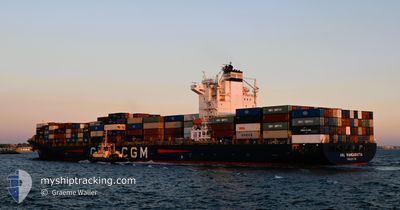
ANL WANGARATTA
Container Ship
Current Trip
| Time Travelled | 9 days |
|---|---|
| Remaining Time | --- |
| Distance Travelled | 2987.17 nm |
| Remaining Distance | 3493.75 nm |
| AVG Speed | 12.8 Knots |
| MAX Speed | 18 Knots |
| AVG Wind | 15 knots |
| MAX Wind | 32.9 knots |
| MIN Temp | 4.1°C / 39.38°F |
| MAX Temp | 18.4°C / 65.12°F |
| Draught | 12.6 m |
| Position Received | 7 d ago |
Current Position
| Longitude | 141.68411° |
|---|---|
| Latitude | 41.64100° |
| Status | Under way using engine |
| Speed | 12.6 Knots |
| Course | 88.4° |
| Area | North Pacific Ocean |
| Station | T-AIS |
| Position Received | 7 d ago |
Info
Information
The current position of ANL WANGARATTA is in North Pacific Ocean with coordinates 41.64100° / 141.68411° as reported on 2024-05-16 08:39 by AIS to our vessel tracker app. The vessel's current speed is 12.6 Knots and is heading at the port of MANZANILLO. The estimated time of arrival as calculated by vessel tracking app is 2024-06-07 12:00 LT
The vessel ANL WANGARATTA (IMO: 9334167, MMSI: 215167000) is a Container Ship that was built in 2008 ( 16 years old ). It's sailing under the flag of [MT] Malta.
In this page you can find informations about the vessels current position, last detected port calls, and current voyage information. If the vessels is not in coverage by AIS you will find the latest position.
The current position of ANL WANGARATTA is detected by our AIS receivers and we are not responsible for the reliability of the data. The last position was recorded while the vessel was in Coverage by the Ais receivers of our vessel tracking app.
The current draught of ANL WANGARATTA as reported by AIS is 12.6 meters
Weather
| Temperature | 7.8°C / 46.04°F |
|---|---|
| Wind Speed | 12 knots |
| Direction | 186° S |
| Pressure | 1027.5 hPa |
| Humidity | 88.4 % |
| Cloud Coverage | 100 % |
Featured Company
Last Port Calls
| Port | Arrival | Departure | Time In Port |
|---|---|---|---|
| 2024-05-13 06:20 | 2024-05-13 22:40 | 16 h | |
| 2024-05-09 00:20 | 2024-05-10 00:24 | 1 d | |
| 2024-05-01 16:22 | 2024-05-03 04:19 | 1 d | |
| 2024-04-28 10:08 | 2024-04-28 23:20 | 13 h | |
| 2024-04-16 10:10 | 2024-04-21 06:42 | 4 d | |
| 2024-04-09 14:02 | 2024-04-11 04:57 | 1 d | |
| 2024-04-04 15:01 | 2024-04-05 18:05 | 1 d | |
| 2024-03-30 07:03 | 2024-03-31 10:43 | 1 d | |
| 2024-03-28 19:26 | 2024-03-29 05:46 | 10 h | |
| 2024-03-27 17:49 | 2024-03-28 05:21 | 11 h |
Most Visited Ports (Last year)
| Port | Arrivals | |
|---|---|---|
| 10 | ||
| 8 | ||
| 6 | ||
| 6 | ||
| 4 | ||
| 4 |
Last Trips
| Origin | Departure | Destination | Arrival | Distance | |
|---|---|---|---|---|---|
| 2024-05-10 08:24 | 2024-05-13 15:20 | 549.94 nm | |||
| 2024-05-03 12:19 | 2024-05-09 08:20 | 2166.68 nm | |||
| 2024-04-29 07:20 | 2024-05-02 00:22 | 212.06 nm | |||
| 2024-04-21 14:42 | 2024-04-28 18:08 | 2554.15 nm | |||
| 2024-04-11 12:57 | 2024-04-16 18:10 | 2344.85 nm | |||
| 2024-04-06 02:05 | 2024-04-09 22:02 | 224.15 nm | |||
| 2024-03-31 18:43 | 2024-04-04 23:01 | 212.17 nm | |||
| 2024-03-29 13:46 | 2024-03-30 15:03 | 35.98 nm | |||
| 2024-03-28 13:21 | 2024-03-29 03:26 | 36.34 nm | |||
| 2024-03-14 03:51 | 2024-03-28 01:49 | 4305.06 nm |
Events
| Time | Event | Details | Position / Dest | Info |
|---|---|---|---|---|
| 2024-05-16 08:41 | Status Changed | Default Under way using engine |
41.64124 / 141.69192
MXZLO
|
Speed: 12.6 kn Course: 88.4° |
| 2024-05-16 08:39 | OUT of Coverage |
41.64100 / 141.68411
North Pacific Ocean
MXZLO
|
Speed: 12.6 kn Course: 88.4° |
|
| 2024-05-16 08:35 | Status Changed | Under way using engine Default |
41.64066 / 141.66518
MXZLO
|
Speed: 14 kn Course: 93° |
| 2024-05-16 08:35 | IN Coverage |
41.64071 / 141.66842
North Pacific Ocean
MXZLO
|
Speed: 12.7 kn Course: 88.3° |
|
| 2024-05-16 07:26 | Status Changed | Default Under way using engine |
41.63091 / 141.31322
MXZLO
|
Speed: 12.6 kn Course: 82.8° |
| 2024-05-16 07:23 | Status Changed | Under way using engine Default |
41.62983 / 141.30148
MXZLO
|
Speed: 12 kn Course: 83° |
| 2024-05-16 07:23 | OUT of Coverage |
41.62983 / 141.30148
North Pacific Ocean
MXZLO
|
Speed: 12.6 kn Course: 82.8° |
|
| 2024-05-16 07:23 | Change Sea Area | Japanese part of the North Pacific Ocean Japanese part of the Japan Sea |
41.62983 / 141.30148
North Pacific Ocean
MXZLO
|
Speed: 12.6 kn Course: 82.8° |
| 2024-05-16 07:17 | Status Changed | Default Under way using engine |
41.62833 / 141.27333
MXZLO
|
Speed: 12.2 kn Course: 84.1° |
| 2024-05-16 06:47 | Status Changed | Under way using engine Default |
41.62076 / 141.13471
MXZLO
|
Speed: 13.6 kn Course: 89° |