
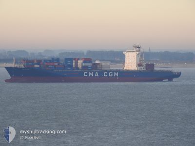
ANL WYONG
Container Ship
Current Trip
BC#.!LMAS
| Time Travelled | 4 days |
|---|---|
| Remaining Time | --- |
| Distance Travelled | 1137.39 nm |
| Remaining Distance | --- |
| AVG Speed | 12.8 Knots |
| MAX Speed | 19.2 Knots |
| AVG Wind | 9 knots |
| MAX Wind | 13.8 knots |
| MIN Temp | 22.8°C / 73.04°F |
| MAX Temp | 29°C / 84.2°F |
| Draught | 0.8 m |
| Position Received | 8 d ago |
Current Position
| Longitude | -14.18931° |
|---|---|
| Latitude | 27.48256° |
| Status | Under way using engine |
| Speed | 12.9 Knots |
| Course | 217.3° |
| Area | North Atlantic Ocean |
| Station | T-AIS |
| Position Received | 8 d ago |
Info
Information
The current position of ANL WYONG is in North Atlantic Ocean with coordinates 27.48256° / -14.18931° as reported on 2024-05-08 14:01 by AIS to our vessel tracker app. The vessel's current speed is 12.9 Knots
The vessel ANL WYONG (IMO: 9334155, MMSI: 215206000) is a Container Ship that was built in 2008 ( 16 years old ). It's sailing under the flag of [MT] Malta.
In this page you can find informations about the vessels current position, last detected port calls, and current voyage information. If the vessels is not in coverage by AIS you will find the latest position.
The current position of ANL WYONG is detected by our AIS receivers and we are not responsible for the reliability of the data. The last position was recorded while the vessel was in Coverage by the Ais receivers of our vessel tracking app.
The current draught of ANL WYONG as reported by AIS is 0.8 meters
Weather
| Temperature | 27.8°C / 82.04°F |
|---|---|
| Wind Speed | 11 knots |
| Direction | 205° SSW |
| Pressure | 1012 hPa |
| Humidity | 78.3 % |
| Cloud Coverage | 100 % |
Featured Company
Last Port Calls
| Port | Arrival | Departure | Time In Port |
|---|---|---|---|
| 2024-05-11 12:42 | 2024-05-12 22:42 | 1 d | |
| 2024-05-06 04:49 | 2024-05-06 09:48 | 4 h | |
| 2024-05-04 06:05 | 2024-05-05 05:04 | 22 h | |
| 2024-04-28 12:09 | 2024-04-29 13:37 | 1 d | |
| 2024-04-25 22:21 | 2024-04-26 18:43 | 20 h | |
| 2024-04-24 11:13 | 2024-04-25 08:22 | 21 h | |
| 2024-04-23 11:02 | 2024-04-24 04:43 | 17 h | |
| 2024-04-21 23:05 | 2024-04-22 14:26 | 15 h | |
| 2024-04-12 19:20 | 2024-04-13 19:36 | 1 d | |
| 2024-04-06 05:11 | 2024-04-08 08:59 | 2 d |
Last Trips
| Origin | Departure | Destination | Arrival | Distance | |
|---|---|---|---|---|---|
| 2024-05-06 11:48 | 2024-05-11 12:42 | 1559.86 nm | |||
| 2024-05-05 06:04 | 2024-05-06 06:49 | 21.18 nm | |||
| 2024-04-29 15:37 | 2024-05-04 07:05 | 1249.40 nm | |||
| 2024-04-26 20:43 | 2024-04-28 14:09 | 285.14 nm | |||
| 2024-04-25 10:22 | 2024-04-26 00:21 | 101.35 nm | |||
| 2024-04-24 06:43 | 2024-04-24 13:13 | 79.01 nm | |||
| 2024-04-22 15:26 | 2024-04-23 13:02 | 135.06 nm | |||
| 2024-04-13 19:36 | 2024-04-22 00:05 | 2602.84 nm | |||
| 2024-04-08 08:59 | 2024-04-12 19:20 | 1254.92 nm | |||
| 2024-04-01 13:07 | 2024-04-06 05:11 | 1333.28 nm |
Events
| Time | Event | Details | Position / Dest | Info |
|---|---|---|---|---|
| 2024-05-12 22:42 | PORT DEPARTURE |
|
14.67783 / -17.41253
BC#.!LMAS
|
Speed: 4.9 kn Course: 88° |
| 2024-05-12 22:22 | START Moving |
14.68185 / -17.42587
[SN] DAKAR
|
Speed: 3.2 kn Course: 331° |
|
| 2024-05-11 12:59 | STOP Moving |
14.68425 / -17.42666
[SN] DAKAR
|
Speed: 0.3 kn Course: 340° |
|
| 2024-05-11 12:42 | PORT ARRIVAL |
|
14.67792 / -17.42148
[SN] DAKAR
|
Speed: 6.7 kn Course: 261° |
| 2024-05-11 12:14 | START Moving | 1.36 nm, East of GOREE |
14.66676 / -17.37473
BC#.!LMAS
|
Speed: 4.8 kn Course: 17° |
| 2024-05-11 11:50 | STOP Moving | 1.27 nm, East of GOREE |
14.66369 / -17.37698
BC#.!LMAS
|
Speed: 0.2 kn Course: 40° |
| 2024-05-11 10:34 | START Moving | 8.35 nm, South of GOREE |
14.53519 / -17.35944
BC#.!LMAS
|
Speed: 3.7 kn Course: 39° |
| 2024-05-11 08:58 | STOP Moving | 8.66 nm, South of GOREE |
14.52656 / -17.37466
BC#.!LMAS
|
Speed: 0.2 kn Course: 96° |
| 2024-05-08 14:06 | Status Changed | Default Under way using engine |
27.46858 / -14.20114
BC#.!LMAS
|
Speed: 12.9 kn Course: 217.3° |
| 2024-05-08 14:01 | OUT of Coverage |
27.48256 / -14.18931
North Atlantic Ocean
|
Speed: 12.9 kn Course: 217.3° |