
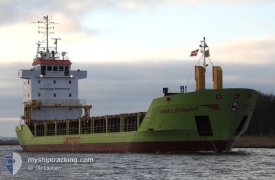
ANNA LEHMANN
General Cargo
Current Trip
| Trip Time | 23 h, 32 mins |
|---|---|
| Trip Distance | 233.48 nm |
| AVG Speed | 10.7 Knots |
| MAX Speed | 11.9 Knots |
| Draught | 4.7 m |
| AVG Wind | 8 knots |
| MAX Wind | 14 knots |
| MIN Temp | 10.6°C / 51.08°F |
| MAX Temp | 26.4°C / 79.52°F |
| Position Received | 20 h, 35 m ago |
Current Position
| Longitude | 23.49032° |
|---|---|
| Latitude | 60.03720° |
| Status | Under way using engine |
| Speed | 11.3 Knots |
| Course | 22.9° |
| Area | Gulf of Finland |
| Station | T-AIS |
| Position Received | 20 h, 35 m ago |
Info
Information
The current position of ANNA LEHMANN is in Gulf of Finland with coordinates 60.03720° / 23.49032° as reported on 2024-06-02 07:49 by AIS to our vessel tracker app. The vessel's current speed is 11.3 Knots and is currently inside the port of POHJANKURU.
The vessel ANNA LEHMANN (IMO: 9225562, MMSI: 304145000) is a General Cargo that was built in 2000 ( 24 years old ). It's sailing under the flag of [AG] Antigua Barbuda.
In this page you can find informations about the vessels current position, last detected port calls, and current voyage information. If the vessels is not in coverage by AIS you will find the latest position.
The current position of ANNA LEHMANN is detected by our AIS receivers and we are not responsible for the reliability of the data. The last position was recorded while the vessel was in Coverage by the Ais receivers of our vessel tracking app.
The current draught of ANNA LEHMANN as reported by AIS is 4.7 meters
Weather
| Temperature | 13.2°C / 55.76°F |
|---|---|
| Wind Speed | 3 knots |
| Direction | 252° WSW |
| Pressure | 1005.4 hPa |
| Humidity | 93.7 % |
| Cloud Coverage | 40 % |
Featured Company
Last Port Calls
| Port | Arrival | Departure | Time In Port |
|---|---|---|---|
| 2024-06-02 09:22 | |||
| 2024-06-01 08:55 | 2024-06-01 09:50 | 55 m | |
| 2024-05-30 17:42 | 2024-06-01 04:05 | 1 d | |
| 2024-05-30 01:41 | 2024-05-30 15:18 | 13 h | |
| 2024-05-29 18:28 | 2024-05-29 18:47 | 19 m | |
| 2024-05-19 14:56 | 2024-05-23 19:50 | 4 d | |
| 2024-05-13 07:32 | 2024-05-13 23:12 | 15 h | |
| 2024-05-11 04:43 | 2024-05-11 20:03 | 15 h | |
| 2024-05-07 12:23 | 2024-05-08 13:53 | 1 d | |
| 2024-04-30 10:59 | 2024-05-03 22:39 | 3 d |
Most Visited Ports (Last year)
| Port | Arrivals | |
|---|---|---|
| 11 | ||
| 10 | ||
| 9 | ||
| 6 | ||
| 4 | ||
| 3 |
Last Trips
| Origin | Departure | Destination | Arrival | Distance | |
|---|---|---|---|---|---|
| 2024-06-01 11:50 | 2024-06-02 12:22 | 233.48 nm | |||
| 2024-06-01 06:05 | 2024-06-01 10:55 | 48.66 nm | |||
| 2024-05-30 17:18 | 2024-05-30 19:42 | 23.80 nm | |||
| 2024-05-29 20:47 | 2024-05-30 03:41 | 66.18 nm | |||
| 2024-05-23 21:50 | 2024-05-29 20:28 | 1303.47 nm | |||
| 2024-05-14 02:12 | 2024-05-19 16:56 | 1490.73 nm | |||
| 2024-05-11 23:03 | 2024-05-13 10:32 | 285.49 nm | |||
| 2024-05-08 15:53 | 2024-05-11 07:43 | 648.98 nm | |||
| 2024-05-04 00:39 | 2024-05-07 14:23 | 873.63 nm | |||
| 2024-04-24 00:20 | 2024-04-30 12:59 | 1306.45 nm |
Events
| Time | Event | Details | Position / Dest | Info |
|---|---|---|---|---|
| 2024-06-02 09:22 | PORT ARRIVAL |
|
60.09500 / 23.55333
[FI] POHJANKURU
|
Speed: 1 kn Course: -1° |
| 2024-06-02 07:54 | Status Changed | Default Under way using engine |
60.05098 / 23.50297
SKURU
|
Speed: 11.3 kn Course: 22.9° |
| 2024-06-02 07:49 | Status Changed | Under way using engine Default |
60.03720 / 23.49032
SKURU
|
Speed: 11.3 kn Course: 23° |
| 2024-06-02 07:49 | OUT of Coverage |
60.03720 / 23.49032
Gulf of Finland
SKURU
|
Speed: 11.3 kn Course: 22.9° |
|
| 2024-06-02 07:38 | IN Coverage |
60.03720 / 23.49032
Gulf of Finland
SKURU
|
Speed: 11.3 kn Course: 22.9° |
|
| 2024-06-02 06:33 | Status Changed | Default Under way using engine |
59.90949 / 23.32533
SKURU
|
Speed: 9.4 kn Course: 75.5° |
| 2024-06-02 06:29 | OUT of Coverage |
59.90277 / 23.31569
Gulf of Finland
SKURU
|
Speed: 9.4 kn Course: 75.5° |
|
| 2024-06-02 06:27 | Status Changed | Under way using engine Default |
59.90178 / 23.30525
SKURU
|
Speed: 9.8 kn Course: 45° |
| 2024-06-02 06:15 | Status Changed | Default Under way using engine |
59.88009 / 23.26215
SKURU
|
Speed: 10 kn Course: 358.6° |
| 2024-06-02 04:35 | Change Sea Area | Finnish part of the Gulf of Finland Finnish part of the Baltic Sea |
59.70569 / 23.00994
Gulf of Finland
SKURU
|
Speed: 11.3 kn Course: 39.6° |