
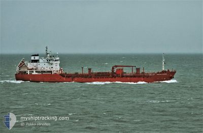
ANNELIESE ESSBERGER
Oil/Chemical Tanker
Current Trip
| Time Travelled | 1 day |
|---|---|
| Remaining Time | 1 day |
| Distance Travelled | 583.06 nm |
| Remaining Distance | 504.57 nm |
| AVG Speed | 12.4 Knots |
| MAX Speed | 14 Knots |
| AVG Wind | 7.7 knots |
| MAX Wind | 17.8 knots |
| MIN Temp | 18.2°C / 64.76°F |
| MAX Temp | 21.4°C / 70.52°F |
| Draught | 6.3 m |
| Position Received | 1 d ago |
Current Position
| Longitude | 10.94628° |
|---|---|
| Latitude | 37.64880° |
| Status | Under way using engine |
| Speed | 12.3 Knots |
| Course | 292.5° |
| Area | Mediterranean Sea - Western Basin |
| Station | T-AIS |
| Position Received | 1 d ago |
Info
Information
The current position of ANNELIESE ESSBERGER is in Mediterranean Sea - Western Basin with coordinates 37.64880° / 10.94628° as reported on 2024-05-18 08:48 by AIS to our vessel tracker app. The vessel's current speed is 12.3 Knots and is heading at the port of CEUTA. The estimated time of arrival as calculated by vessel tracking app is 2024-05-20 23:56 LT
The vessel ANNELIESE ESSBERGER (IMO: 9295426, MMSI: 244363000) is a Oil/Chemical Tanker that was built in 2005 ( 19 years old ). It's sailing under the flag of [NL] Netherlands.
In this page you can find informations about the vessels current position, last detected port calls, and current voyage information. If the vessels is not in coverage by AIS you will find the latest position.
The current position of ANNELIESE ESSBERGER is detected by our AIS receivers and we are not responsible for the reliability of the data. The last position was recorded while the vessel was in Coverage by the Ais receivers of our vessel tracking app.
The current draught of ANNELIESE ESSBERGER as reported by AIS is 6.3 meters
Weather
| Temperature | 18.6°C / 65.48°F |
|---|---|
| Wind Speed | 1 knots |
| Direction | 308° NW |
| Pressure | 1011 hPa |
| Humidity | 76.2 % |
| Cloud Coverage | 100 % |
Featured Company
Last Port Calls
| Port | Arrival | Departure | Time In Port |
|---|---|---|---|
| 2024-05-15 23:36 | 2024-05-17 11:40 | 1 d | |
| 2024-05-13 11:13 | 2024-05-14 05:45 | 18 h | |
| 2024-05-10 20:33 | 2024-05-11 14:41 | 18 h | |
| 2024-05-05 19:46 | 2024-05-06 14:20 | 18 h | |
| 2024-04-25 22:25 | 2024-04-28 18:12 | 2 d | |
| 2024-04-23 18:36 | 2024-04-25 06:27 | 1 d | |
| 2024-04-19 05:12 | 2024-04-23 15:11 | 4 d | |
| 2024-04-11 04:51 | 2024-04-12 11:44 | 1 d | |
| 2024-04-09 09:42 | 2024-04-09 20:27 | 10 h | |
| 2024-04-06 14:43 | 2024-04-07 19:23 | 1 d |
Most Visited Ports (Last year)
| Port | Arrivals | |
|---|---|---|
| 12 | ||
| 9 | ||
| 6 | ||
| 5 | ||
| 5 | ||
| 4 |
Last Trips
| Origin | Departure | Destination | Arrival | Distance | |
|---|---|---|---|---|---|
| 2024-05-14 07:45 | 2024-05-16 01:36 | 506.02 nm | |||
| 2024-05-11 16:41 | 2024-05-13 13:13 | 446.69 nm | |||
| 2024-05-06 16:20 | 2024-05-10 22:33 | 11.55 nm | |||
| 2024-04-28 20:12 | 2024-05-05 21:46 | 1933.37 nm | |||
| 2024-04-25 08:27 | 2024-04-26 00:25 | 142.79 nm | |||
| 2024-04-23 17:11 | 2024-04-23 20:36 | 20.76 nm | |||
| 2024-04-12 13:44 | 2024-04-19 07:12 | 1903.63 nm | |||
| 2024-04-09 22:27 | 2024-04-11 06:51 | 410.70 nm | |||
| 2024-04-07 21:23 | 2024-04-09 11:42 | 336.54 nm | |||
| 2024-03-30 05:18 | 2024-04-06 16:43 | 1409.61 nm |
Events
| Time | Event | Details | Position / Dest | Info |
|---|---|---|---|---|
| 2024-05-18 08:56 | Status Changed | Default Under way using engine |
37.65833 / 10.91333
ESCEU
|
Speed: 12.3 kn Course: 292.5° |
| 2024-05-18 08:48 | OUT of Coverage |
37.64880 / 10.94628
Mediterranean Sea - Western Basin
ESCEU
|
Speed: 12.3 kn Course: 292.5° |
|
| 2024-05-18 08:12 | Status Changed | Under way using engine Default |
37.60545 / 11.09252
ESCEU
|
Speed: 12 kn Course: 288° |
| 2024-05-18 08:05 | Status Changed | Default Under way using engine |
37.59667 / 11.12167
ESCEU
|
Speed: 13 kn Course: 288.4° |
| 2024-05-18 07:54 | Detected in Sea | Tunisian part of the Mediterranean Sea - Western Basin |
37.58529 / 11.16783
Mediterranean Sea - Western Basin
ESCEU
|
Speed: 12.8 kn Course: 289° |
| 2024-05-18 07:54 | Status Changed | Under way using engine Default |
37.58529 / 11.16783
ESCEU
|
Speed: 12 kn Course: 289° |
| 2024-05-18 07:47 | IN Coverage |
37.58529 / 11.16783
Mediterranean Sea - Western Basin
ESCEU
|
Speed: 12.8 kn Course: 289° |
|
| 2024-05-18 05:53 | Status Changed | Default Under way using engine |
37.43333 / 11.66167
ESCEU
|
Speed: 12.7 kn Course: 291.3° |
| 2024-05-18 05:49 | Change Sea Area | Italian part of the Mediterranean Sea - Western Basin Italian part of the Mediterranean Sea - Eastern Basin |
37.42899 / 11.67791
Mediterranean Sea - Western Basin
ESCEU
|
Speed: 12.7 kn Course: 291.3° |
| 2024-05-18 05:49 | OUT of Coverage |
37.42899 / 11.67791
Mediterranean Sea - Western Basin
ESCEU
|
Speed: 12.7 kn Course: 291.3° |