
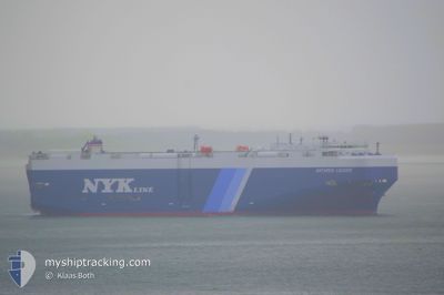
ANTARES LEADER
Vehicles Carrier
Current Trip
| Time Travelled | 23 days |
|---|---|
| Remaining Time | --- |
| Distance Travelled | 9567.01 nm |
| Remaining Distance | --- |
| AVG Speed | 16.9 Knots |
| MAX Speed | 19.6 Knots |
| AVG Wind | 15.3 knots |
| MAX Wind | 33.9 knots |
| MIN Temp | 14.3°C / 57.74°F |
| MAX Temp | 29.7°C / 85.46°F |
| Draught | 8.5 m |
| Position Received | 4 d ago |
Current Position
| Longitude | 32.19380° |
|---|---|
| Latitude | -32.44278° |
| Status | Under way using engine |
| Speed | 12.5 Knots |
| Course | 67.7° |
| Area | Indian Ocean |
| Station | T-AIS |
| Position Received | 4 d ago |
Info
Information
The current position of ANTARES LEADER is in Indian Ocean with coordinates -32.44278° / 32.19380° as reported on 2024-06-22 05:13 by AIS to our vessel tracker app. The vessel's current speed is 12.5 Knots and is heading at the port of FUJAIRAH. The estimated time of arrival as calculated by vessel tracking app is 2024-07-02 23:00 LT
The vessel ANTARES LEADER (IMO: 9539169, MMSI: 431761000) is a Vehicles Carrier that was built in 2011 ( 13 years old ). It's sailing under the flag of [JP] Japan.
In this page you can find informations about the vessels current position, last detected port calls, and current voyage information. If the vessels is not in coverage by AIS you will find the latest position.
The current position of ANTARES LEADER is detected by our AIS receivers and we are not responsible for the reliability of the data. The last position was recorded while the vessel was in Coverage by the Ais receivers of our vessel tracking app.
The current draught of ANTARES LEADER as reported by AIS is 8.5 meters
Weather
| Temperature | 26.3°C / 79.34°F |
|---|---|
| Wind Speed | 26 knots |
| Direction | 141° SE |
| Pressure | 1014.4 hPa |
| Humidity | 79.2 % |
| Cloud Coverage | 63 % |
Featured Company
Last Port Calls
| Port | Arrival | Departure | Time In Port |
|---|---|---|---|
| 2024-06-03 00:07 | 2024-06-03 19:21 | 19 h | |
| 2024-05-31 02:16 | 2024-05-31 21:26 | 19 h | |
| 2024-05-30 01:36 | 2024-05-31 02:10 | 1 d | |
| 2024-05-29 05:42 | 2024-05-30 01:18 | 19 h | |
| 2024-05-22 13:09 | 2024-05-22 23:09 | 10 h | |
| 2024-05-12 03:18 | 2024-05-12 23:30 | 20 h | |
| 2024-04-23 03:15 | 2024-04-23 09:00 | 5 h | |
| 2024-04-21 05:18 | 2024-04-22 03:20 | 22 h | |
| 2024-04-17 21:45 | |||
| 2024-04-16 04:59 | 2024-04-17 14:37 | 1 d |
Last Trips
| Origin | Departure | Destination | Arrival | Distance | |
|---|---|---|---|---|---|
| 2024-05-31 17:26 | 2024-06-02 20:07 | 715.39 nm | |||
| 2024-05-30 22:10 | 2024-05-30 22:16 | 0.59 nm | |||
| 2024-05-29 21:18 | 2024-05-29 21:36 | 1.17 nm | |||
| 2024-05-22 19:09 | 2024-05-29 01:42 | 1868.52 nm | |||
| 2024-05-12 18:30 | 2024-05-22 09:09 | 2732.95 nm | |||
| 2024-04-23 18:00 | 2024-05-11 22:18 | 6287.02 nm | |||
| 2024-04-22 12:20 | 2024-04-23 12:15 | 248.50 nm | |||
| 2024-04-17 23:37 | 2024-04-18 06:45 | 94.69 nm | |||
| 2024-04-14 19:26 | 2024-04-16 13:59 | 462.79 nm | |||
| 2024-03-31 01:41 | 2024-04-14 06:09 | 4712.93 nm |
Events
| Time | Event | Details | Position / Dest | Info |
|---|---|---|---|---|
| 2024-06-22 05:16 | Status Changed | Default Under way using engine |
-32.43797 / 32.20723
AE FJR
|
Speed: 12.5 kn Course: 67.7° |
| 2024-06-22 05:13 | OUT of Coverage |
-32.44278 / 32.19380
Indian Ocean
AE FJR
|
Speed: 12.5 kn Course: 67.7° |
|
| 2024-06-22 04:55 | Status Changed | Under way using engine Default |
-32.46579 / 32.12832
AE FJR
|
Speed: 12.2 kn Course: 70° |
| 2024-06-22 04:29 | Status Changed | Default Under way using engine |
-32.49991 / 32.03212
AE FJR
|
Speed: 13.3 kn Course: 64.3° |
| 2024-06-22 03:23 | Status Changed | Under way using engine Default |
-32.59469 / 31.79248
AE FJR
|
Speed: 11.3 kn Course: 66° |
| 2024-06-22 03:18 | Status Changed | Default Under way using engine |
-32.60218 / 31.77256
AE FJR
|
Speed: 11.6 kn Course: 65.3° |
| 2024-06-21 17:57 | Draught Changed | 8.5 8.3 |
-33.30290 / 29.93599
AE FJR
|
Speed: 11.3 kn Course: 66.6° |
| 2024-06-21 17:57 | Destination Changed | AE FJR US SSI |
-33.30290 / 29.93599
AE FJR
|
Speed: 11.3 kn Course: 66.6° |
| 2024-06-21 17:57 | ETA Changed | 2024/07/02 23:00 2024/06/02 23:00 |
-33.30290 / 29.93599
AE FJR
|
Speed: 11.3 kn Course: 66.6° |
| 2024-06-21 17:53 | Status Changed | Under way using engine Default |
-33.30794 / 29.92249
US SSI
|
Speed: 11.1 kn Course: 66° |