
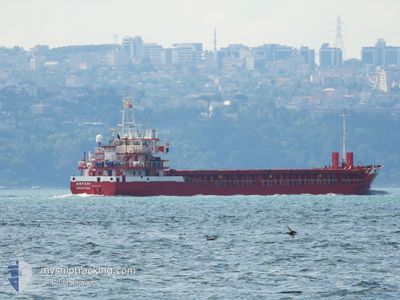
ANTARI
General Cargo
Current Trip
| Time Travelled | 3 days |
|---|---|
| Remaining Time | --- |
| Distance Travelled | 737.35 nm |
| Remaining Distance | --- |
| AVG Speed | 8.6 Knots |
| MAX Speed | 10.3 Knots |
| AVG Wind | 14.9 knots |
| MAX Wind | 27 knots |
| MIN Temp | 19.9°C / 67.82°F |
| MAX Temp | 23.8°C / 74.84°F |
| Draught | 5.6 m |
| Position Received | 4 h, 20 m ago |
Current Position
| Longitude | 20.60641° |
|---|---|
| Latitude | 36.16733° |
| Status | Under way using engine |
| Speed | 8.8 Knots |
| Course | 271.4° |
| Area | Mediterranean Sea - Eastern Basin |
| Station | T-AIS |
| Position Received | 4 h, 20 m ago |
Info
Information
The current position of ANTARI is in Mediterranean Sea - Eastern Basin with coordinates 36.16733° / 20.60641° as reported on 2024-05-26 04:55 by AIS to our vessel tracker app. The vessel's current speed is 8.8 Knots and is heading at the port of TARRAGONA. The estimated time of arrival as calculated by vessel tracking app is 2024-05-30 17:00 LT
The vessel ANTARI (IMO: 9171084, MMSI: 314652000) is a General Cargo that was built in 1998 ( 26 years old ). It's sailing under the flag of [BB] Barbados.
In this page you can find informations about the vessels current position, last detected port calls, and current voyage information. If the vessels is not in coverage by AIS you will find the latest position.
The current position of ANTARI is detected by our AIS receivers and we are not responsible for the reliability of the data. The last position was recorded while the vessel was in Coverage by the Ais receivers of our vessel tracking app.
The current draught of ANTARI as reported by AIS is 5.6 meters
Weather
| Temperature | 20°C / 68°F |
|---|---|
| Wind Speed | 14 knots |
| Direction | 347° NNW |
| Pressure | 1015 hPa |
| Humidity | 72.4 % |
| Cloud Coverage | --- |
Featured Company
Last Port Calls
| Port | Arrival | Departure | Time In Port |
|---|---|---|---|
| 2024-05-22 03:28 | 2024-05-22 19:16 | 15 h | |
| 2024-05-21 20:16 | 2024-05-22 03:19 | 7 h | |
| 2024-05-20 00:41 | |||
| 2024-05-16 23:28 | |||
| 2024-05-07 01:28 | 2024-05-08 13:36 | 1 d | |
| 2024-04-30 19:36 | 2024-05-02 20:52 | 2 d | |
| 2024-04-27 22:08 | 2024-04-29 10:36 | 1 d | |
| 2024-04-15 07:41 | 2024-04-19 09:24 | 4 d | |
| 2024-04-10 21:53 | 2024-04-12 08:52 | 1 d | |
| 2024-04-05 03:09 | 2024-04-06 11:21 | 1 d |
Last Trips
| Origin | Departure | Destination | Arrival | Distance | |
|---|---|---|---|---|---|
| 2024-05-22 06:19 | 2024-05-22 06:28 | 2.28 nm | |||
| 2024-05-22 06:19 | 2024-05-21 23:16 | 2.28 nm | |||
| 2024-05-08 16:36 | 2024-05-17 02:28 | 1160.29 nm | |||
| 2024-05-02 23:52 | 2024-05-07 04:28 | 95.33 nm | |||
| 2024-04-29 13:36 | 2024-04-30 22:36 | 131.49 nm | |||
| 2024-04-19 11:24 | 2024-04-28 01:08 | 1383.35 nm | |||
| 2024-04-12 10:52 | 2024-04-15 09:41 | 137.14 nm | |||
| 2024-04-06 13:21 | 2024-04-10 23:53 | 949.77 nm | |||
| 2024-03-27 01:34 | 2024-04-05 05:09 | 448.89 nm | |||
| 2024-03-12 18:27 | 2024-03-26 10:45 | 1479.17 nm |
Events
| Time | Event | Details | Position / Dest | Info |
|---|---|---|---|---|
| 2024-05-26 05:01 | Status Changed | Default Under way using engine |
36.16793 / 20.58760
ESTAR
|
Speed: 8.8 kn Course: 271.4° |
| 2024-05-26 04:55 | Detected in Sea | Greek part of the Mediterranean Sea - Eastern Basin |
36.16733 / 20.60641
Mediterranean Sea - Eastern Basin
ESTAR
|
Speed: 8.8 kn Course: 271.4° |
| 2024-05-26 04:55 | Status Changed | Under way using engine Default |
36.16733 / 20.60641
ESTAR
|
Speed: 8.8 kn Course: 272° |
| 2024-05-26 04:55 | OUT of Coverage |
36.16733 / 20.60641
Mediterranean Sea - Eastern Basin
ESTAR
|
Speed: 8.8 kn Course: 271.4° |
|
| 2024-05-26 04:40 | IN Coverage |
36.16733 / 20.60641
Mediterranean Sea - Eastern Basin
ESTAR
|
Speed: 8.8 kn Course: 271.4° |
|
| 2024-05-25 14:52 | Status Changed | Default Under way using engine |
36.06108 / 23.21182
ESTAR
|
Speed: 9.3 kn Course: 266.6° |
| 2024-05-25 14:49 | OUT of Coverage |
36.06153 / 23.22368
Aegean Sea
ESTAR
|
Speed: 9.3 kn Course: 266.6° |
|
| 2024-05-25 13:55 | Status Changed | Under way using engine Default |
36.06455 / 23.39701
ESTAR
|
Speed: 9.3 kn Course: 268° |
| 2024-05-25 13:55 | IN Coverage |
36.06455 / 23.39701
Aegean Sea
ESTAR
|
Speed: 9.3 kn Course: 266.6° |
|
| 2024-05-25 10:51 | OUT of Coverage |
36.08278 / 23.97994
Aegean Sea
ESTAR
|
Speed: 9.1 kn Course: 269.1° |