
ANTIGUA
Passengers Ship
Current Trip
LONGYEARBYEN
| Time Travelled | 47 days |
|---|---|
| Remaining Time | --- |
| Distance Travelled | 1678.66 nm |
| Remaining Distance | --- |
| AVG Speed | 6.3 Knots |
| MAX Speed | 9.1 Knots |
| AVG Wind | 8.2 knots |
| MAX Wind | 22 knots |
| MIN Temp | -13.1°C / 8.42°F |
| MAX Temp | 4.7°C / 40.46°F |
| Draught | 3.1 m |
| Position Received | 1 m ago |
Current Position
| Longitude | 11.84243° |
|---|---|
| Latitude | 79.79097° |
| Status | Under way sailing |
| Speed | |
| Course | 253° |
| Area | Greenland Sea |
| Station | T-AIS |
| Position Received | 1 m ago |
Info
Information
The current position of ANTIGUA is in Greenland Sea with coordinates 79.79097° / 11.84243° as reported on 2024-06-03 01:13 by AIS to our vessel tracker app. The vessel's current speed is 0 Knots
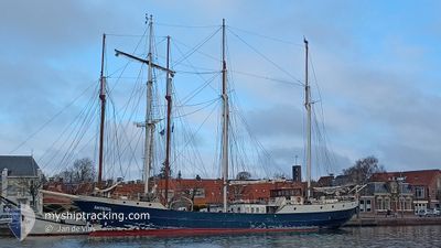
The vessel ANTIGUA (IMO: 5019800, MMSI: 246337000) is a Passengers Ship that was built in 1957 ( 67 years old ). It's sailing under the flag of [NL] Netherlands.
In this page you can find informations about the vessels current position, last detected port calls, and current voyage information. If the vessels is not in coverage by AIS you will find the latest position.
The current position of ANTIGUA is detected by our AIS receivers and we are not responsible for the reliability of the data. The last position was recorded while the vessel was in Coverage by the Ais receivers of our vessel tracking app.
The current draught of ANTIGUA as reported by AIS is 3.1 meters
Weather
| Temperature | 1.2°C / 34.16°F |
|---|---|
| Wind Speed | 4 knots |
| Direction | 71° ENE |
| Pressure | 1005.7 hPa |
| Humidity | 97.1 % |
| Cloud Coverage | 100 % |
Featured Company
Most Visited Ports (Last year)
| Port | Arrivals | |
|---|---|---|
| 5 | ||
| 2 | ||
| 1 | ||
| 1 | ||
| 1 | ||
| 1 |
Events
| Time | Event | Details | Position / Dest | Info |
|---|---|---|---|---|
| 2024-06-02 23:13 | STOP Moving |
79.79051 / 11.84324
LONGYEARBYEN
|
Speed: 0.1 kn Course: 313° |
|
| 2024-06-02 16:45 | Status Changed | Under way sailing Default |
80.33320 / 11.93272
LONGYEARBYEN
|
Speed: 4.6 kn Course: 181° |
| 2024-06-02 16:05 | Status Changed | Default Under way sailing |
80.36696 / 11.94544
LONGYEARBYEN
|
Speed: 2.5 kn Course: 184° |
| 2024-06-02 16:01 | Status Changed | Under way sailing Default |
80.36928 / 11.94618
LONGYEARBYEN
|
Speed: 2.5 kn Course: 186° |
| 2024-06-02 15:53 | Status Changed | Default Under way sailing |
80.37505 / 11.94842
LONGYEARBYEN
|
Speed: 3.1 kn Course: 178° |
| 2024-06-02 15:41 | Change Sea Area | Norwegian part of the Greenland Sea Norwegian part of the Arctic Ocean |
80.38620 / 11.95078
Greenland Sea
LONGYEARBYEN
|
Speed: 4 kn Course: 182.7° |
| 2024-06-02 15:41 | Status Changed | Under way sailing Default |
80.38620 / 11.95078
LONGYEARBYEN
|
Speed: 3.9 kn Course: 181° |
| 2024-06-02 15:34 | Status Changed | Default Under way sailing |
80.39481 / 11.95300
LONGYEARBYEN
|
Speed: 3.8 kn Course: 182° |
| 2024-06-02 15:03 | Status Changed | Under way sailing Default |
80.42132 / 11.95510
LONGYEARBYEN
|
Speed: 3.1 kn Course: 179° |
| 2024-06-02 14:32 | Status Changed | Default Under way sailing |
80.45069 / 11.94943
LONGYEARBYEN
|
Speed: 4.3 kn Course: 180° |