
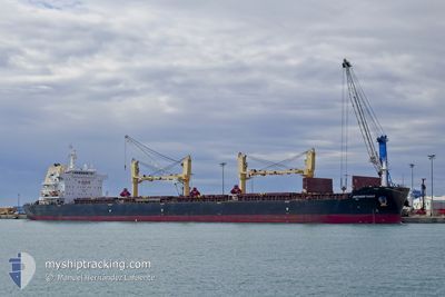
ANTWERP EAGLE
Cargo
Current Trip
| Time Travelled | 6 days |
|---|---|
| Remaining Time | --- |
| Distance Travelled | 1450.95 nm |
| Remaining Distance | --- |
| AVG Speed | 10 Knots |
| MAX Speed | 12.3 Knots |
| AVG Wind | 10.4 knots |
| MAX Wind | 15.8 knots |
| MIN Temp | 15.5°C / 59.9°F |
| MAX Temp | 23.2°C / 73.76°F |
| Draught | 13.5 m |
| Position Received | 5 d ago |
Current Position
| Longitude | -73.87828° |
|---|---|
| Latitude | 36.66814° |
| Status | Under way using engine |
| Speed | 11.6 Knots |
| Course | 109.9° |
| Area | North Atlantic Ocean |
| Station | T-AIS |
| Position Received | 5 d ago |
Info
Information
The current position of ANTWERP EAGLE is in North Atlantic Ocean with coordinates 36.66814° / -73.87828° as reported on 2024-05-03 08:05 by AIS to our vessel tracker app. The vessel's current speed is 11.6 Knots and is heading at the port of SINGAPORE. The estimated time of arrival as calculated by vessel tracking app is 2024-06-19 13:00 LT
The vessel ANTWERP EAGLE (IMO: 9699036, MMSI: 538009603) is a Cargo It's sailing under the flag of [MH] Marshall Is.
In this page you can find informations about the vessels current position, last detected port calls, and current voyage information. If the vessels is not in coverage by AIS you will find the latest position.
The current position of ANTWERP EAGLE is detected by our AIS receivers and we are not responsible for the reliability of the data. The last position was recorded while the vessel was in Coverage by the Ais receivers of our vessel tracking app.
The current draught of ANTWERP EAGLE as reported by AIS is 13.5 meters
Weather
| Temperature | 22.8°C / 73.04°F |
|---|---|
| Wind Speed | 13 knots |
| Direction | 95° E |
| Pressure | 1017.7 hPa |
| Humidity | 68.5 % |
| Cloud Coverage | 100 % |
Featured Company
Last Port Calls
| Port | Arrival | Departure | Time In Port |
|---|---|---|---|
| 2024-05-01 02:12 | 2024-05-02 19:42 | 1 d | |
| 2024-04-25 19:11 | 2024-04-27 06:01 | 1 d | |
| 2024-04-08 15:10 | 2024-04-16 02:10 | 7 d | |
| 2024-03-03 22:17 | 2024-03-07 23:44 | 4 d |
Most Visited Ports (Last year)
| Port | Arrivals | |
|---|---|---|
| 2 | ||
| 2 | ||
| 2 | ||
| 2 | ||
| 1 | ||
| 1 |
Last Trips
| Origin | Departure | Destination | Arrival | Distance | |
|---|---|---|---|---|---|
| 2024-04-27 02:01 | 2024-04-30 22:12 | 300.28 nm | |||
| 2024-04-15 22:10 | 2024-04-25 15:11 | 475.66 nm | |||
| 2024-03-07 23:44 | 2024-04-08 11:10 | 5421.95 nm | |||
| 2024-02-10 18:12 | 2024-03-03 22:17 | 3978.58 nm |
Events
| Time | Event | Details | Position / Dest | Info |
|---|---|---|---|---|
| 2024-05-04 20:44 | START Moving |
34.57675 / -68.49339
SGSIN
|
Speed: 3.8 kn Course: 258° |
|
| 2024-05-04 11:58 | STOP Moving |
34.62520 / -68.29684
SGSIN
|
Speed: 0.2 kn Course: 1° |
|
| 2024-05-03 08:10 | Status Changed | Default Under way using engine |
36.66148 / -73.85677
SGSIN
|
Speed: 11.6 kn Course: 109.9° |
| 2024-05-03 08:05 | OUT of Coverage |
36.66814 / -73.87828
North Atlantic Ocean
|
Speed: 11.6 kn Course: 109.9° |
|
| 2024-05-03 07:57 | Status Changed | Under way using engine Default |
36.67654 / -73.90706
SGSIN
|
Speed: 11.5 kn Course: 110° |
| 2024-05-03 07:50 | Status Changed | Default Under way using engine |
36.68346 / -73.93142
SGSIN
|
Speed: 11.9 kn Course: 101.5° |
| 2024-05-03 06:31 | Status Changed | Under way using engine Default |
36.73992 / -74.22719
SGSIN
|
Speed: 10.7 kn Course: 105° |
| 2024-05-03 06:27 | Status Changed | Default Under way using engine |
36.74329 / -74.24137
SGSIN
|
Speed: 10.5 kn Course: 106.2° |
| 2024-05-03 06:08 | Status Changed | Under way using engine Default |
36.75825 / -74.30482
SGSIN
|
Speed: 10.2 kn Course: 105° |
| 2024-05-03 06:06 | Status Changed | Default Under way using engine |
36.75992 / -74.31094
SGSIN
|
Speed: 10.2 kn Course: 106.6° |