
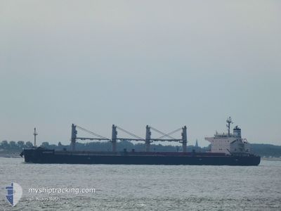
APHROS
Bulk Carrier
Current Trip
| Time Travelled | 11 days |
|---|---|
| Remaining Time | 7 days |
| Distance Travelled | 1845.13 nm |
| Remaining Distance | 1964.66 nm |
| AVG Speed | 11.1 Knots |
| MAX Speed | 13.2 Knots |
| AVG Wind | 11.6 knots |
| MAX Wind | 19 knots |
| MIN Temp | 20.4°C / 68.72°F |
| MAX Temp | 29.3°C / 84.74°F |
| Draught | 12.2 m |
| Position Received | 5 d ago |
Current Position
| Longitude | -40.23085° |
|---|---|
| Latitude | -21.83498° |
| Status | Under way using engine |
| Speed | 11.1 Knots |
| Course | 64° |
| Area | South Atlantic Ocean |
| Station | T-AIS |
| Position Received | 5 d ago |
Info
Information
The current position of APHROS is in South Atlantic Ocean with coordinates -21.83498° / -40.23085° as reported on 2024-05-18 01:10 by AIS to our vessel tracker app. The vessel's current speed is 11.1 Knots and is heading at the port of LAS PALMAS. The estimated time of arrival as calculated by vessel tracking app is 2024-05-30 22:35 LT
The vessel APHROS (IMO: 9460514, MMSI: 538009257) is a Bulk Carrier that was built in 2013 ( 11 years old ). It's sailing under the flag of [MH] Marshall Is.
In this page you can find informations about the vessels current position, last detected port calls, and current voyage information. If the vessels is not in coverage by AIS you will find the latest position.
The current position of APHROS is detected by our AIS receivers and we are not responsible for the reliability of the data. The last position was recorded while the vessel was in Coverage by the Ais receivers of our vessel tracking app.
The current draught of APHROS as reported by AIS is 12.2 meters
Weather
| Temperature | 27.5°C / 81.5°F |
|---|---|
| Wind Speed | 13 knots |
| Direction | 98° E |
| Pressure | 1012.8 hPa |
| Humidity | 80.4 % |
| Cloud Coverage | 14 % |
Featured Company
Events
| Time | Event | Details | Position / Dest | Info |
|---|---|---|---|---|
| 2024-05-18 01:16 | Status Changed | Default Under way using engine |
-21.82742 / -40.21189
LAS PALMAS
|
Speed: 11.1 kn Course: 64° |
| 2024-05-18 01:10 | OUT of Coverage |
-21.83498 / -40.23085
South Atlantic Ocean
LAS PALMAS
|
Speed: 11.1 kn Course: 64° |
|
| 2024-05-17 21:08 | Status Changed | Under way using engine Default |
-22.31852 / -40.82203
LAS PALMAS
|
Speed: 10.7 kn Course: 46° |
| 2024-05-17 21:01 | IN Coverage |
-22.31824 / -40.82173
South Atlantic Ocean
LAS PALMAS
|
Speed: 10.5 kn Course: 45.9° |
|
| 2024-05-17 12:25 | Status Changed | Default Under way using engine |
-23.31213 / -42.28473
LAS PALMAS
|
Speed: 12.2 kn Course: 75.4° |
| 2024-05-17 12:20 | OUT of Coverage |
-23.31633 / -42.30166
South Atlantic Ocean
LAS PALMAS
|
Speed: 12.2 kn Course: 75.4° |
|
| 2024-05-17 10:33 | Status Changed | Under way using engine Default |
-23.41236 / -42.68466
LAS PALMAS
|
Speed: 11.8 kn Course: 79° |
| 2024-05-17 10:17 | Status Changed | Default Under way using engine |
-23.42424 / -42.74199
LAS PALMAS
|
Speed: 11.8 kn Course: 77° |
| 2024-05-17 07:15 | Status Changed | Under way using engine Default |
-23.58248 / -43.36301
LAS PALMAS
|
Speed: 11.5 kn Course: 77° |
| 2024-05-17 07:08 | Status Changed | Default Under way using engine |
-23.58775 / -43.38633
LAS PALMAS
|
Speed: 11.4 kn Course: 76.8° |