
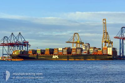
APL GWANGYANG
Container Ship
Aktuelle Reise
| Bisherige Reisezeit | 10 h, 57 Minuten |
|---|---|
| Verbleibende Reisezeit | 4 h, 29 Minuten |
| Zurückgelegte Distanz | 36.88 nm |
| Verbleibende Distanz | 14.42 nm |
| Durchschnittliche Geschwindigkeit | 8.9 Knoten |
| Maximale Geschwindigkeit | 12.1 Knoten |
| Durchschnittliche Windgeschwindigkeit | 4.4 Knoten |
| Maximale Windgeschwindigkeit | 6 Knoten |
| Minimale Temperatur | 28.6°C / 83.48°F |
| Maximale Temperatur | 29.3°C / 84.74°F |
| Tiefgang | 14.4 m |
| Position erhalten | 1 m alt |
Aktuelle Position
| Länge | --- |
|---|---|
| Breite | --- |
| Zustand | Under way using engine |
| Geschwindigkeit | 0.2 Knoten |
| Kurs | 36° |
| Gebiet | Persian Gulf |
| Station | T-AIS |
| Position erhalten | 1 m alt |
Schiffsdetails
Information
Die APL GWANGYANG befindet sich derzeit in Persian Gulf mit den Koordinaten 25.02150° / 54.55669°, Diese Position wurde am 2024-11-07 10:24 von unserer Schiffsverfolgungs-App über AIS erfasst. Das Schiff fährt momentan mit einer Geschwindigkeit von 0.2 Knoten und fahrt in den Hafen von KHALIFA. Die geschatzte Ankunftszeit, berechnet von der -App zur Schiffsverfolgung, ist 2024-11-07 14:55 LT
Das Schiff APL GWANGYANG (IMO: 9461879, MMSI: 566319000) ist Container Ship das wurde im Jahr 2011 ( 13 Jahre alt ) gebaut. und fährt unter der Flagge von [SG] Singapore.
Auf dieser Seite erhalten Sie Informationen zur aktuellen Position des Schiffes, zu den letzten bekannten Hafenanläufen und zu den aktuellen Reiseinformationen. Sollte das Schiff nicht durch AIS abgedeckt sein, wird die zuletzt erfasste Position angezeigt.
Die APL GWANGYANG wird durch unsere AIS-Empfänger ermittelt. Wir übernehmen keine Gewähr für die Richtigkeit der Daten. Die letzte Position wurde von unseren AIS-Empfängern aufgezeichnet, während das Schiff in Reichweite war.
Der aktuelle Entwurf von APL GWANGYANG, wie von AIS gemeldet, betragt 14.4 meter
Wetter
| Temperatur | 29.2°C / 84.56°F |
|---|---|
| Windgeschwindigkeit | 5 Knoten |
| Windrichtung | 309° NW |
| Luftdruck | 1014.6 hPa |
| Luftfeuchtigkeit | 56.4 % |
| Wolken | --- |
Featured Company
Letzte Hafenanläufe
| Hafen | Ankunft | Abfahrt | Time In Port |
|---|---|---|---|
| 2024-11-05 06:27 | 2024-11-06 23:29 | 1 d | |
| 2024-10-11 22:14 | 2024-10-13 02:39 | 1 d | |
| 2024-10-05 14:56 | 2024-10-07 12:31 | 1 d | |
| 2024-10-02 21:09 | 2024-10-03 09:31 | 12 h | |
| 2024-09-30 23:29 | 2024-10-02 10:52 | 1 d | |
| 2024-09-28 08:06 | 2024-09-29 21:19 | 1 d | |
| 2024-09-25 17:03 | 2024-09-27 02:56 | 1 d | |
| 2024-09-23 03:47 | 2024-09-24 20:25 | 1 d | |
| 2024-09-18 07:34 | 2024-09-18 22:17 | 14 h |
Meistbesuchte Häfen (Letztes Jahr)
| Hafen | Ankünfte | |
|---|---|---|
| 5 | ||
| 4 | ||
| 3 | ||
| 3 | ||
| 3 | ||
| 3 |
Letzte Reisen
| Herkunft | Abfahrt | Ziel | Ankunft | Distanz | |
|---|---|---|---|---|---|
| 2024-10-13 04:39 | 2024-11-05 10:27 | 9933.77 nm | |||
| 2024-10-07 14:31 | 2024-10-12 00:14 | 1251.39 nm | |||
| 2024-10-03 11:31 | 2024-10-05 16:56 | 175.20 nm | |||
| 2024-10-02 12:52 | 2024-10-02 23:09 | 138.64 nm | |||
| 2024-09-29 22:19 | 2024-10-01 01:29 | 288.64 nm | |||
| 2024-09-27 04:56 | 2024-09-28 09:06 | 469.61 nm | |||
| 2024-09-24 22:25 | 2024-09-25 19:03 | 244.20 nm | |||
| 2024-09-18 23:17 | 2024-09-23 05:47 | 1391.23 nm | |||
| 2024-08-26 19:21 | 2024-09-18 08:34 | 9743.73 nm |
Events
| Zeit | Ereignis | Details | Position / Ziel | Information |
|---|---|---|---|---|
| 2024-11-07 10:11 | STOP Bewegung | 14.12 nm, North West of KHALIFA |
25.02085 / 54.55610
AEKHL
|
Geschwindigkeit: 0.3 kn Kurs: 46° |
| 2024-11-07 08:48 | START Bewegung | 16.16 nm, North West of KHALIFA |
25.05609 / 54.55083
AEKHL
|
Geschwindigkeit: 3.1 kn Kurs: 186° |
| 2024-11-07 04:38 | geänderter Status | Under way using engine Default |
25.05758 / 54.57742
AEKHL
|
Geschwindigkeit: 0.5 kn Kurs: 314° |
| 2024-11-07 04:33 | geänderter Status | Default Under way using engine |
25.05796 / 54.57823
AEKHL
|
Geschwindigkeit: 0.5 kn Kurs: 313° |
| 2024-11-07 04:27 | geänderter Status | Under way using engine Default |
25.05837 / 54.57898
AEKHL
|
Geschwindigkeit: 0.6 kn Kurs: 307° |
| 2024-11-07 04:24 | geänderter Status | Default Under way using engine |
25.05869 / 54.57954
AEKHL
|
Geschwindigkeit: 0.6 kn Kurs: 303° |
| 2024-11-07 04:13 | geänderter Status | Under way using engine Default |
25.05955 / 54.58099
AEKHL
|
Geschwindigkeit: 0.5 kn Kurs: 293° |
| 2024-11-07 03:57 | geänderter Status | Default Under way using engine |
25.06083 / 54.58278
AEKHL
|
Geschwindigkeit: 0.5 kn Kurs: 282° |
| 2024-11-07 03:13 | STOP Bewegung | 15.99 nm, North of KHALIFA |
25.06398 / 54.58402
AEKHL
|
Geschwindigkeit: 0.3 kn Kurs: 257° |
| 2024-11-06 23:29 | ABFAHRTSHAFEN |
|
25.03293 / 55.03525
AEKHL
|
Geschwindigkeit: 5.7 kn Kurs: 321° |