
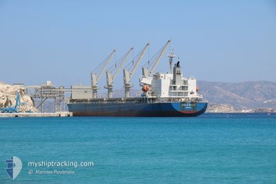
APOLLO BULKER
General Cargo
Current Trip
| Time Travelled | 22 days |
|---|---|
| Remaining Time | 57 mins |
| Distance Travelled | 6255.74 nm |
| Remaining Distance | 24.97 nm |
| AVG Speed | 11.5 Knots |
| MAX Speed | 13.6 Knots |
| AVG Wind | 10.9 knots |
| MAX Wind | 24.9 knots |
| MIN Temp | 16.1°C / 60.98°F |
| MAX Temp | 29.3°C / 84.74°F |
| Draught | 10.2 m |
| Position Received | 1 d ago |
Current Position
| Longitude | -80.48895° |
|---|---|
| Latitude | 24.25745° |
| Status | Under way using engine |
| Speed | 11 Knots |
| Course | 240.3° |
| Area | North Atlantic Ocean |
| Station | T-AIS |
| Position Received | 1 d ago |
Info
Information
The current position of APOLLO BULKER is in North Atlantic Ocean with coordinates 24.25745° / -80.48895° as reported on 2024-05-31 06:48 by AIS to our vessel tracker app. The vessel's current speed is 11 Knots and is heading at the port of PORT MANATEE. The estimated time of arrival as calculated by vessel tracking app is 2024-06-01 19:39 LT
The vessel APOLLO BULKER (IMO: 9459151, MMSI: 371709000) is a General Cargo that was built in 2011 ( 13 years old ). It's sailing under the flag of [PA] Panama.
In this page you can find informations about the vessels current position, last detected port calls, and current voyage information. If the vessels is not in coverage by AIS you will find the latest position.
The current position of APOLLO BULKER is detected by our AIS receivers and we are not responsible for the reliability of the data. The last position was recorded while the vessel was in Coverage by the Ais receivers of our vessel tracking app.
The current draught of APOLLO BULKER as reported by AIS is 10.2 meters
Weather
| Temperature | 29.3°C / 84.74°F |
|---|---|
| Wind Speed | 3 knots |
| Direction | 101° E |
| Pressure | 1018.3 hPa |
| Humidity | 53.1 % |
| Cloud Coverage | 100 % |
Featured Company
Events
| Time | Event | Details | Position / Dest | Info |
|---|---|---|---|---|
| 2024-06-01 17:59 | STOP Moving | 17.02 nm, West of TIERRA VERDE |
27.62539 / -83.02986
PORT MANATEE
|
Speed: 0.3 kn Course: 119° |
| 2024-05-31 06:54 | Status Changed | Default Under way using engine |
24.24667 / -80.50667
PORT MANATEE
|
Speed: 11 kn Course: 240.3° |
| 2024-05-31 06:48 | OUT of Coverage |
24.25745 / -80.48895
North Atlantic Ocean
PORT MANATEE
|
Speed: 11 kn Course: 240.3° |
|
| 2024-05-31 05:55 | Status Changed | Under way using engine Default |
24.33516 / -80.33220
PORT MANATEE
|
Speed: 11 kn Course: 240° |
| 2024-05-31 05:48 | Status Changed | Default Under way using engine |
24.34500 / -80.31167
PORT MANATEE
|
Speed: 11.3 kn Course: 241.1° |
| 2024-05-31 05:23 | Status Changed | Under way using engine Default |
24.38419 / -80.23682
PORT MANATEE
|
Speed: 11.5 kn Course: 239° |
| 2024-05-31 05:03 | Status Changed | Default Under way using engine |
24.41667 / -80.17500
PORT MANATEE
|
Speed: 11.7 kn Course: 240.3° |
| 2024-05-31 04:52 | Status Changed | Under way using engine Default |
24.43560 / -80.14208
PORT MANATEE
|
Speed: 11 kn Course: 241° |
| 2024-05-31 04:15 | Status Changed | Default Under way using engine |
24.49333 / -80.02666
PORT MANATEE
|
Speed: 11.7 kn Course: 241.4° |
| 2024-05-31 04:09 | Status Changed | Under way using engine Default |
24.50446 / -80.00831
PORT MANATEE
|
Speed: 11 kn Course: 241° |