
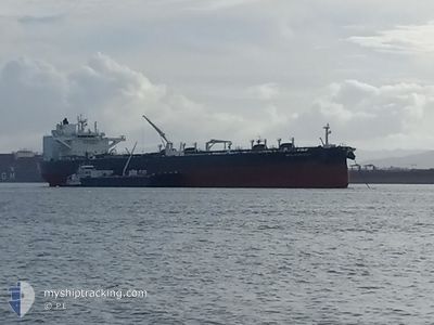
APOLLO VOYAGER
Tanker
Current Trip
EPAL
| Time Travelled | 4 days |
|---|---|
| Remaining Time | --- |
| Distance Travelled | 541.22 nm |
| Remaining Distance | --- |
| AVG Speed | 9.1 Knots |
| MAX Speed | 14.7 Knots |
| AVG Wind | 6.5 knots |
| MAX Wind | 27 knots |
| MIN Temp | 10.8°C / 51.44°F |
| MAX Temp | 18.9°C / 66.02°F |
| Draught | 9.5 m |
| Position Received | Now |
Current Position
| Longitude | -117.87206° |
|---|---|
| Latitude | 33.07022° |
| Status | Restricted manoeuverability |
| Speed | 2.3 Knots |
| Course | 264° |
| Area | North Pacific Ocean |
| Station | T-AIS |
| Position Received | Now |
Info
Information
The current position of APOLLO VOYAGER is in North Pacific Ocean with coordinates 33.07022° / -117.87206° as reported on 2024-06-01 04:31 by AIS to our vessel tracker app. The vessel's current speed is 2.3 Knots
The vessel APOLLO VOYAGER (IMO: 9878890, MMSI: 311000902) is a Tanker It's sailing under the flag of [BS] Bahamas.
In this page you can find informations about the vessels current position, last detected port calls, and current voyage information. If the vessels is not in coverage by AIS you will find the latest position.
The current position of APOLLO VOYAGER is detected by our AIS receivers and we are not responsible for the reliability of the data. The last position was recorded while the vessel was in Coverage by the Ais receivers of our vessel tracking app.
The current draught of APOLLO VOYAGER as reported by AIS is 9.5 meters
Weather
| Temperature | 15°C / 59°F |
|---|---|
| Wind Speed | 3 knots |
| Direction | 269° W |
| Pressure | 1013 hPa |
| Humidity | 79.3 % |
| Cloud Coverage | 81 % |
Featured Company
Last Port Calls
| Port | Arrival | Departure | Time In Port |
|---|---|---|---|
| 2024-05-25 19:52 | 2024-05-27 20:12 | 2 d | |
| 2024-05-19 03:28 | 2024-05-21 03:16 | 1 d | |
| 2024-05-10 20:52 | 2024-05-12 05:47 | 1 d | |
| 2024-05-05 07:30 | 2024-05-07 15:19 | 2 d | |
| 2024-05-02 19:19 | 2024-05-03 13:26 | 18 h | |
| 2024-04-18 08:59 | 2024-04-20 04:50 | 1 d | |
| 2024-04-09 08:15 | 2024-04-11 03:15 | 1 d |
Most Visited Ports (Last year)
| Port | Arrivals | |
|---|---|---|
| 17 | ||
| 11 | ||
| 9 |
Last Trips
| Origin | Departure | Destination | Arrival | Distance | |
|---|---|---|---|---|---|
| 2024-05-20 20:16 | 2024-05-25 12:52 | 973.81 nm | |||
| 2024-05-11 22:47 | 2024-05-18 20:28 | 1062.99 nm | |||
| 2024-05-07 08:19 | 2024-05-10 13:52 | 557.51 nm | |||
| 2024-05-03 06:26 | 2024-05-05 00:30 | 445.88 nm | |||
| 2024-04-19 23:50 | 2024-05-02 12:19 | 3204.19 nm | |||
| 2024-04-10 20:15 | 2024-04-18 03:59 | 2702.08 nm | |||
| 2024-03-27 16:49 | 2024-04-09 01:15 | 2813.20 nm |
Events
| Time | Event | Details | Position / Dest | Info |
|---|---|---|---|---|
| 2024-06-01 00:01 | ETA Changed | 2025/05/31 06:00 2024/05/31 06:00 |
32.96044 / -117.74732
EPAL
|
Speed: 2.4 kn Course: 332° |
| 2024-05-31 11:20 | STOP Moving |
32.95551 / -117.81406
EPAL
|
Speed: 0.3 kn Course: 127° |
|
| 2024-05-31 07:12 | START Moving | 19.25 nm, South East of AVALON |
33.18364 / -117.99222
EPAL
|
Speed: 3.1 kn Course: 149° |
| 2024-05-31 04:02 | Status Changed | Restricted manoeuverability Under way using engine |
33.17179 / -117.99173
EPAL
|
Speed: 0.1 kn Course: 342° |
| 2024-05-31 03:49 | STOP Moving | 19.7 nm, South East of AVALON |
33.17099 / -117.99091
EPAL
|
Speed: 0.3 kn Course: 327° |
| 2024-05-30 23:18 | START Moving | 4.07 nm, South West of SEAL BEACH |
33.68551 / -118.14981
EPAL
|
Speed: 3.1 kn Course: 230° |
| 2024-05-30 23:04 | Status Changed | Under way using engine At anchor |
33.68769 / -118.14288
EPAL
|
Speed: Course: 257° |
| 2024-05-30 21:25 | Destination Changed | EPAL LONG BEACH |
33.68765 / -118.14226
EPAL
|
Speed: Course: 252° |
| 2024-05-30 21:25 | ETA Changed | 2024/05/31 06:00 2024/05/30 02:00 |
33.68765 / -118.14226
EPAL
|
Speed: Course: 252° |
| 2024-05-30 18:45 | Status Changed | At anchor Default |
33.68829 / -118.14278
LONG BEACH
|
Speed: Course: 228° |