
AQUAGRACE
Cargo
Aktuelle Reise
| Bisherige Reisezeit | 10 Tage |
|---|---|
| Verbleibende Reisezeit | --- |
| Zurückgelegte Distanz | 2740.03 nm |
| Verbleibende Distanz | --- |
| Durchschnittliche Geschwindigkeit | 11 Knoten |
| Maximale Geschwindigkeit | 14.1 Knoten |
| Durchschnittliche Windgeschwindigkeit | 12.5 Knoten |
| Maximale Windgeschwindigkeit | 30.2 Knoten |
| Minimale Temperatur | 8.3°C / 46.94°F |
| Maximale Temperatur | 15.6°C / 60.08°F |
| Tiefgang | 12.4 m |
| Position erhalten | 10 d alt |
Aktuelle Position
| Länge | -126.74285° |
|---|---|
| Breite | 48.48955° |
| Zustand | Under way using engine |
| Geschwindigkeit | 11.2 Knoten |
| Kurs | 268.4° |
| Gebiet | North Pacific Ocean |
| Station | T-AIS |
| Position erhalten | 10 d alt |
Schiffsdetails
Information
Die AQUAGRACE befindet sich derzeit in North Pacific Ocean mit den Koordinaten 48.48955° / -126.74285°, Diese Position wurde am 2024-09-14 17:53 von unserer Schiffsverfolgungs-App über AIS erfasst. Das Schiff fährt momentan mit einer Geschwindigkeit von 11.2 Knoten und fahrt in den Hafen von ONAHAMA. Die geschatzte Ankunftszeit, berechnet von der -App zur Schiffsverfolgung, ist 2024-09-28 22:00 LT
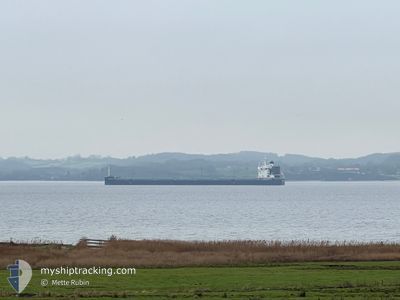
Das Schiff AQUAGRACE (IMO: 9764087, MMSI: 371355000) ist Cargo und fährt unter der Flagge von [PA] Panama.
Auf dieser Seite erhalten Sie Informationen zur aktuellen Position des Schiffes, zu den letzten bekannten Hafenanläufen und zu den aktuellen Reiseinformationen. Sollte das Schiff nicht durch AIS abgedeckt sein, wird die zuletzt erfasste Position angezeigt.
Die AQUAGRACE wird durch unsere AIS-Empfänger ermittelt. Wir übernehmen keine Gewähr für die Richtigkeit der Daten. Die letzte Position wurde von unseren AIS-Empfängern aufgezeichnet, während das Schiff in Reichweite war.
Der aktuelle Entwurf von AQUAGRACE, wie von AIS gemeldet, betragt 12.4 meter
Wetter
| Temperatur | 11.3°C / 52.34°F |
|---|---|
| Windgeschwindigkeit | 9 Knoten |
| Windrichtung | 329° NNW |
| Luftdruck | 1021.4 hPa |
| Luftfeuchtigkeit | 81.1 % |
| Wolken | 100 % |
Featured Company
Letzte Hafenanläufe
| Hafen | Ankunft | Abfahrt | Time In Port |
|---|---|---|---|
| 2024-09-12 13:48 | 2024-09-14 00:21 | 1 d | |
| 2024-08-20 22:23 | 2024-08-23 00:28 | 2 d |
Meistbesuchte Häfen (Letztes Jahr)
| Hafen | Ankünfte | |
|---|---|---|
| 1 | ||
| 1 | ||
| 1 | ||
| 1 | ||
| 1 | ||
| 1 |
Letzte Reisen
| Herkunft | Abfahrt | Ziel | Ankunft | Distanz | |
|---|---|---|---|---|---|
| 2024-08-23 09:28 | 2024-09-12 06:48 | 4679.46 nm | |||
| 2024-05-23 04:57 | 2024-08-21 07:23 | 8249.31 nm |
Events
| Zeit | Ereignis | Details | Position / Ziel | Information |
|---|