
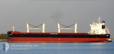
AQUALIBRA
Cargo
Aktuelle Reise
| Bisherige Reisezeit | 7 Tage |
|---|---|
| Verbleibende Reisezeit | 12 Tage |
| Zurückgelegte Distanz | 1945.73 nm |
| Verbleibende Distanz | 3443.76 nm |
| Durchschnittliche Geschwindigkeit | 11.6 Knoten |
| Maximale Geschwindigkeit | 15.5 Knoten |
| Durchschnittliche Windgeschwindigkeit | 11.9 Knoten |
| Maximale Windgeschwindigkeit | 22.8 Knoten |
| Minimale Temperatur | 6.2°C / 43.16°F |
| Maximale Temperatur | 18.9°C / 66.02°F |
| Tiefgang | 7 m |
| Position erhalten | 2 d alt |
Aktuelle Position
| Länge | --- |
|---|---|
| Breite | --- |
| Zustand | Under way using engine |
| Geschwindigkeit | 13.5 Knoten |
| Kurs | 88.4° |
| Gebiet | North Pacific Ocean |
| Station | T-AIS |
| Position erhalten | 2 d alt |
Schiffsdetails
Information
Die AQUALIBRA befindet sich derzeit in North Pacific Ocean mit den Koordinaten 41.63041° / 141.75463°, Diese Position wurde am 2024-11-10 11:16 von unserer Schiffsverfolgungs-App über AIS erfasst. Das Schiff fährt momentan mit einer Geschwindigkeit von 13.5 Knoten und fahrt in den Hafen von VANCOUVER. Die geschatzte Ankunftszeit, berechnet von der -App zur Schiffsverfolgung, ist 2024-11-24 23:09 LT
Das Schiff AQUALIBRA (IMO: 9765603, MMSI: 636018249) ist Cargo und fährt unter der Flagge von [LR] Liberia.
Auf dieser Seite erhalten Sie Informationen zur aktuellen Position des Schiffes, zu den letzten bekannten Hafenanläufen und zu den aktuellen Reiseinformationen. Sollte das Schiff nicht durch AIS abgedeckt sein, wird die zuletzt erfasste Position angezeigt.
Die AQUALIBRA wird durch unsere AIS-Empfänger ermittelt. Wir übernehmen keine Gewähr für die Richtigkeit der Daten. Die letzte Position wurde von unseren AIS-Empfängern aufgezeichnet, während das Schiff in Reichweite war.
Der aktuelle Entwurf von AQUALIBRA, wie von AIS gemeldet, betragt 7 meter
Wetter
| Temperatur | 7.6°C / 45.68°F |
|---|---|
| Windgeschwindigkeit | 17 Knoten |
| Windrichtung | 160° SSE |
| Luftdruck | 1005.7 hPa |
| Luftfeuchtigkeit | 69.8 % |
| Wolken | 100 % |
Featured Company
Letzte Hafenanläufe
| Hafen | Ankunft | Abfahrt | Time In Port |
|---|---|---|---|
| 2024-10-30 07:52 | 2024-11-05 15:12 | 6 d | |
| 2024-09-03 11:06 |
Meistbesuchte Häfen (Letztes Jahr)
| Hafen | Ankünfte | |
|---|---|---|
| 2 | ||
| 2 | ||
| 2 | ||
| 2 | ||
| 1 | ||
| 1 |
Letzte Reisen
| Herkunft | Abfahrt | Ziel | Ankunft | Distanz | |
|---|---|---|---|---|---|
| 2024-09-03 08:06 | 2024-10-30 15:52 | 12594.67 nm |
Events
| Zeit | Ereignis | Details | Position / Ziel | Information |
|---|---|---|---|---|
| 2024-11-10 11:32 | geänderter Status | Default Under way using engine |
41.63254 / 141.83340
CAVAN
|
Geschwindigkeit: 13.5 kn Kurs: 88.4° |
| 2024-11-10 11:16 | außerhalb Abdeckung |
41.63041 / 141.75463
North Pacific Ocean
CAVAN
|
Geschwindigkeit: 13.5 kn Kurs: 88.4° |
|
| 2024-11-10 10:45 | geänderter Status | Under way using engine Default |
41.62826 / 141.60136
CAVAN
|
Geschwindigkeit: 13.6 kn Kurs: 90° |
| 2024-11-10 10:42 | geänderter Status | Default Under way using engine |
41.62812 / 141.58652
CAVAN
|
Geschwindigkeit: 14 kn Kurs: 92.5° |
| 2024-11-10 09:47 | Ändere Seegebiet | Japanese part of the North Pacific Ocean Japanese part of the Japan Sea |
41.63046 / 141.30435
North Pacific Ocean
CAVAN
|
Geschwindigkeit: 13.3 kn Kurs: 88.1° |
| 2024-11-10 09:06 | geänderter Status | Under way using engine Default |
41.62203 / 141.10978
CAVAN
|
Geschwindigkeit: 13.6 kn Kurs: 92° |
| 2024-11-10 08:59 | geänderter Status | Default Under way using engine |
41.62267 / 141.07359
CAVAN
|
Geschwindigkeit: 13.2 kn Kurs: 92.3° |
| 2024-11-10 08:33 | geänderter Status | Under way using engine Default |
41.62410 / 140.94737
CAVAN
|
Geschwindigkeit: 13.4 kn Kurs: 87° |
| 2024-11-10 08:31 | geänderter Status | Default Under way using engine |
41.62372 / 140.93658
CAVAN
|
Geschwindigkeit: 13.2 kn Kurs: 85.9° |
| 2024-11-10 08:26 | geänderter Status | Under way using engine Default |
41.62223 / 140.91064
CAVAN
|
Geschwindigkeit: 13.1 kn Kurs: 85° |