
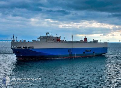
AQUARIUS ACE
Ro-Ro/Passenger Ship
Current Trip
| Time Travelled | 1 day |
|---|---|
| Remaining Time | 2 days |
| Distance Travelled | 478.35 nm |
| Remaining Distance | 839.78 nm |
| AVG Speed | 15.5 Knots |
| MAX Speed | 18.1 Knots |
| AVG Wind | 10.1 knots |
| MAX Wind | 17.1 knots |
| MIN Temp | 12.9°C / 55.22°F |
| MAX Temp | 25.3°C / 77.54°F |
| Draught | 7.2 m |
| Position Received | Now |
Current Position
| Longitude | 23.00407° |
|---|---|
| Latitude | 36.04007° |
| Status | Under way using engine |
| Speed | 16.1 Knots |
| Course | 272.4° |
| Area | Aegean Sea |
| Station | T-AIS |
| Position Received | Now |
Info
Information
The current position of AQUARIUS ACE is in Aegean Sea with coordinates 36.04007° / 23.00407° as reported on 2024-05-20 02:56 by AIS to our vessel tracker app. The vessel's current speed is 16.1 Knots and is heading at the port of LIVORNO. The estimated time of arrival as calculated by vessel tracking app is 2024-05-22 05:53 LT
The vessel AQUARIUS ACE (IMO: 9150339, MMSI: 354123000) is a Ro-Ro/Passenger Ship that was built in 1998 ( 26 years old ). It's sailing under the flag of [PA] Panama.
In this page you can find informations about the vessels current position, last detected port calls, and current voyage information. If the vessels is not in coverage by AIS you will find the latest position.
The current position of AQUARIUS ACE is detected by our AIS receivers and we are not responsible for the reliability of the data. The last position was recorded while the vessel was in Coverage by the Ais receivers of our vessel tracking app.
The current draught of AQUARIUS ACE as reported by AIS is 7.2 meters
Weather
| Temperature | 19.6°C / 67.28°F |
|---|---|
| Wind Speed | 12 knots |
| Direction | 49° NE |
| Pressure | 1010.5 hPa |
| Humidity | 79.7 % |
| Cloud Coverage | 8 % |
Featured Company
Last Port Calls
| Port | Arrival | Departure | Time In Port |
|---|---|---|---|
| 2024-05-18 09:59 | 2024-05-18 20:34 | 10 h | |
| 2024-05-08 04:43 | 2024-05-09 09:37 | 1 d | |
| 2024-05-05 04:45 | 2024-05-05 13:31 | 8 h | |
| 2024-04-26 03:18 | 2024-04-26 23:01 | 19 h | |
| 2024-04-20 03:52 | 2024-04-20 12:34 | 8 h | |
| 2024-04-15 18:37 | 2024-04-17 06:46 | 1 d | |
| 2024-04-13 09:41 | 2024-04-14 14:25 | 1 d | |
| 2024-04-11 17:03 | 2024-04-12 16:18 | 23 h | |
| 2024-04-09 03:09 | 2024-04-10 18:30 | 1 d | |
| 2024-04-05 03:54 | 2024-04-05 11:58 | 8 h |
Last Trips
| Origin | Departure | Destination | Arrival | Distance | |
|---|---|---|---|---|---|
| 2024-05-09 10:37 | 2024-05-18 12:59 | 3538.19 nm | |||
| 2024-05-05 15:31 | 2024-05-08 05:43 | 946.25 nm | |||
| 2024-04-27 01:01 | 2024-05-05 06:45 | 1903.25 nm | |||
| 2024-04-20 14:34 | 2024-04-26 05:18 | 1784.27 nm | |||
| 2024-04-17 07:46 | 2024-04-20 05:52 | 948.01 nm | |||
| 2024-04-14 16:25 | 2024-04-15 19:37 | 300.80 nm | |||
| 2024-04-12 18:18 | 2024-04-13 11:41 | 154.85 nm | |||
| 2024-04-10 19:30 | 2024-04-11 19:03 | 292.72 nm | |||
| 2024-04-05 12:58 | 2024-04-09 04:09 | 491.58 nm | |||
| 2024-03-30 20:24 | 2024-04-05 04:54 | 1863.00 nm |
Events
| Time | Event | Details | Position / Dest | Info |
|---|---|---|---|---|
| 2024-05-20 02:34 | Change Sea Area | Greek part of the Mediterranean Sea - Eastern Basin Greek part of the Aegean Sea |
36.03938 / 23.12717
Mediterranean Sea - Eastern Basin
ITLIV
|
Speed: 16.4 kn Course: 236.2° |
| 2024-05-20 02:33 | Status Changed | Under way using engine Default |
36.04157 / 23.13076
ITLIV
|
Speed: 16 kn Course: 214° |
| 2024-05-20 02:26 | IN Coverage |
36.03938 / 23.12717
Mediterranean Sea - Eastern Basin
ITLIV
|
Speed: 16.4 kn Course: 236.2° |
|
| 2024-05-20 01:11 | Status Changed | Default Under way using engine |
36.34500 / 23.39667
ITLIV
|
Speed: 16.7 kn Course: 215.4° |
| 2024-05-20 01:01 | OUT of Coverage |
36.38200 / 23.42893
Aegean Sea
ITLIV
|
Speed: 16.7 kn Course: 215.4° |
|
| 2024-05-20 00:55 | Status Changed | Under way using engine Default |
36.40554 / 23.44993
ITLIV
|
Speed: 16 kn Course: 216° |
| 2024-05-20 00:50 | Status Changed | Default Under way using engine |
36.42333 / 23.46666
ITLIV
|
Speed: 16.7 kn Course: 215.7° |
| 2024-05-19 10:51 | Change Sea Area | Greek part of the Aegean Sea Turkish part of the Aegean Sea |
39.87172 / 25.80899
Aegean Sea
ITLIV
|
Speed: 16.6 kn Course: 205.2° |
| 2024-05-19 10:50 | Status Changed | Under way using engine Default |
39.87411 / 25.81053
ITLIV
|
Speed: 16 kn Course: 210° |
| 2024-05-19 10:35 | Status Changed | Default Under way using engine |
39.92652 / 25.86846
ITLIV
|
Speed: 18.1 kn Course: 226.5° |