
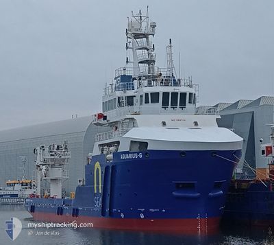
AQUARIUS-G
Noncombatant ship
Current Trip
DIVE OPS CPA 200MTR
| Time Travelled | 3 days |
|---|---|
| Remaining Time | --- |
| Distance Travelled | 10.38 nm |
| Remaining Distance | --- |
| AVG Speed | 8.3 Knots |
| MAX Speed | 13.7 Knots |
| AVG Wind | 16.6 knots |
| MAX Wind | 21 knots |
| MIN Temp | 13.6°C / 56.48°F |
| MAX Temp | 18.2°C / 64.76°F |
| Draught | 4.6 m |
| Position Received | 24 m ago |
Current Position
| Longitude | 8.61280° |
|---|---|
| Latitude | 53.95525° |
| Status | Restricted manoeuverability |
| Speed | 0.1 Knots |
| Course | 317° |
| Area | North Sea |
| Station | T-AIS |
| Position Received | 24 m ago |
Info
Information
The current position of AQUARIUS-G is in North Sea with coordinates 53.95525° / 8.61280° as reported on 2024-05-19 07:45 by AIS to our vessel tracker app. The vessel's current speed is 0.1 Knots
The vessel AQUARIUS-G (IMO: 9697131, MMSI: 352003294) is a Noncombatant ship It's sailing under the flag of [PA] Panama.
In this page you can find informations about the vessels current position, last detected port calls, and current voyage information. If the vessels is not in coverage by AIS you will find the latest position.
The current position of AQUARIUS-G is detected by our AIS receivers and we are not responsible for the reliability of the data. The last position was recorded while the vessel was in Coverage by the Ais receivers of our vessel tracking app.
The current draught of AQUARIUS-G as reported by AIS is 4.6 meters
Weather
| Temperature | 14°C / 57.2°F |
|---|---|
| Wind Speed | 11 knots |
| Direction | 54° NE |
| Pressure | 1010.9 hPa |
| Humidity | 80.7 % |
| Cloud Coverage | 100 % |
Featured Company
Most Visited Ports (Last year)
| Port | Arrivals | |
|---|---|---|
| 3 | ||
| 2 | ||
| 2 |
Last Trips
Events
| Time | Event | Details | Position / Dest | Info |
|---|---|---|---|---|
| 2024-05-17 19:12 | IN Coverage |
53.95793 / 8.61496
North Sea
|
Speed: Course: 326.5° |
|
| 2024-05-17 17:37 | OUT of Coverage |
53.95788 / 8.61484
North Sea
|
Speed: Course: 37.2° |
|
| 2024-05-16 19:23 | IN Coverage |
53.95757 / 8.61340
North Sea
|
Speed: Course: 247.1° |
|
| 2024-05-16 17:51 | OUT of Coverage |
53.95573 / 8.61144
North Sea
|
Speed: Course: 48.6° |
|
| 2024-05-16 06:30 | Destination Changed | DIVE OPS CPA 200MTR DE CUXHAVEN |
53.95685 / 8.61090
DIVE OPS CPA 200MTR
|
Speed: 1.1 kn Course: 68° |
| 2024-05-15 20:27 | Status Changed | Restricted manoeuverability Under way using engine |
53.95741 / 8.60996
DE CUXHAVEN
|
Speed: 0.3 kn Course: 122° |
| 2024-05-15 20:14 | STOP Moving | 6.54 nm, North West of CUXHAVEN |
53.95823 / 8.60796
DE CUXHAVEN
|
Speed: 0.3 kn Course: 117° |
| 2024-05-15 19:19 | PORT DEPARTURE |
|
53.87515 / 8.71066
DE CUXHAVEN
|
Speed: 5.6 kn Course: 69° |
| 2024-05-15 19:19 | START Moving |
53.87501 / 8.70993
[DE] CUXHAVEN
|
Speed: 5.5 kn Course: 87° |
|
| 2024-05-15 19:18 | Status Changed | Under way using engine Moored |
53.87566 / 8.70732
[DE] CUXHAVEN
|
Speed: 0.4 kn Course: 146° |