
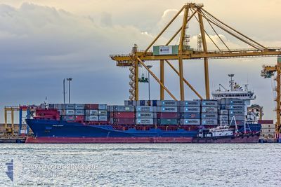
KILIA
Container Ship
Current Trip
| Time Travelled | 3 days |
|---|---|
| Remaining Time | 14 h, 37 mins |
| Distance Travelled | 803.05 nm |
| Remaining Distance | 155.11 nm |
| AVG Speed | 10.2 Knots |
| MAX Speed | 16.4 Knots |
| AVG Wind | 11.5 knots |
| MAX Wind | 21.9 knots |
| MIN Temp | 6.7°C / 44.06°F |
| MAX Temp | 20.5°C / 68.9°F |
| Draught | 8.6 m |
| Position Received | 2 h, 28 m ago |
Current Position
| Longitude | 7.14721° |
|---|---|
| Latitude | 53.94653° |
| Status | Under way using engine |
| Speed | 10.6 Knots |
| Course | 256.1° |
| Area | North Sea |
| Station | T-AIS |
| Position Received | 2 h, 28 m ago |
Info
Information
The current position of KILIA is in North Sea with coordinates 53.94653° / 7.14721° as reported on 2024-05-18 23:59 by AIS to our vessel tracker app. The vessel's current speed is 10.6 Knots and is heading at the port of KIEL. The estimated time of arrival as calculated by vessel tracking app is 2024-05-19 17:04 LT
The vessel KILIA (IMO: 9412517, MMSI: 255806313) is a Container Ship that was built in 2010 ( 14 years old ). It's sailing under the flag of [PT] Portugal.
In this page you can find informations about the vessels current position, last detected port calls, and current voyage information. If the vessels is not in coverage by AIS you will find the latest position.
The current position of KILIA is detected by our AIS receivers and we are not responsible for the reliability of the data. The last position was recorded while the vessel was in Coverage by the Ais receivers of our vessel tracking app.
The current draught of KILIA as reported by AIS is 8.6 meters
Weather
| Temperature | 13.5°C / 56.3°F |
|---|---|
| Wind Speed | 12 knots |
| Direction | 40° NE |
| Pressure | 1010.6 hPa |
| Humidity | 87 % |
| Cloud Coverage | 7 % |
Featured Company
Last Port Calls
| Port | Arrival | Departure | Time In Port |
|---|---|---|---|
| 2024-05-15 11:56 | 2024-05-16 01:45 | 13 h | |
| 2024-05-13 16:35 | 2024-05-14 08:36 | 16 h | |
| 2024-05-13 05:35 | 2024-05-13 13:04 | 7 h | |
| 2024-05-11 11:34 | 2024-05-11 11:37 | 3 m | |
| 2024-05-09 17:13 | 2024-05-10 05:38 | 12 h | |
| 2024-05-08 12:01 | 2024-05-09 15:35 | 1 d | |
| 2024-05-05 09:34 | 2024-05-08 10:44 | 3 d | |
| 2024-05-04 17:15 | 2024-05-05 09:19 | 16 h | |
| 2024-05-02 19:46 | 2024-05-03 16:31 | 20 h | |
| 2024-04-29 09:59 | 2024-04-30 16:21 | 1 d |
Most Visited Ports (Last year)
| Port | Arrivals | |
|---|---|---|
| 17 | ||
| 9 | ||
| 7 | ||
| 7 | ||
| 6 | ||
| 5 |
Last Trips
| Origin | Departure | Destination | Arrival | Distance | |
|---|---|---|---|---|---|
| 2024-05-14 11:36 | 2024-05-15 14:56 | 323.78 nm | |||
| 2024-05-13 16:04 | 2024-05-13 19:35 | 47.00 nm | |||
| 2024-05-11 13:37 | 2024-05-13 08:35 | 626.35 nm | |||
| 2024-05-10 07:38 | 2024-05-11 13:34 | 331.18 nm | |||
| 2024-05-09 17:35 | 2024-05-09 19:13 | 17.05 nm | |||
| 2024-05-08 12:44 | 2024-05-08 14:01 | 14.25 nm | |||
| 2024-05-05 11:19 | 2024-05-05 11:34 | 0.66 nm | |||
| 2024-05-03 18:31 | 2024-05-04 19:15 | 113.34 nm | |||
| 2024-04-30 17:21 | 2024-05-02 21:46 | 778.76 nm | |||
| 2024-04-27 00:00 | 2024-04-29 10:59 | 706.35 nm |
Events
| Time | Event | Details | Position / Dest | Info |
|---|---|---|---|---|
| 2024-05-19 00:04 | Status Changed | Default Under way using engine |
53.94285 / 7.12200
DENOK
|
Speed: 10.6 kn Course: 256.1° |
| 2024-05-18 23:59 | OUT of Coverage |
53.94653 / 7.14721
North Sea
|
Speed: 10.6 kn Course: 256.1° |
|
| 2024-05-18 23:36 | Status Changed | Under way using engine Default |
53.96046 / 7.25985
DENOK
|
Speed: 10.7 kn Course: 257° |
| 2024-05-18 23:28 | Status Changed | Default Under way using engine |
53.96587 / 7.30007
DENOK
|
Speed: 10.6 kn Course: 257° |
| 2024-05-18 23:24 | Status Changed | Under way using engine Default |
53.96864 / 7.32056
DENOK
|
Speed: 10.5 kn Course: 257° |
| 2024-05-18 23:20 | Status Changed | Default Under way using engine |
53.97112 / 7.33903
DENOK
|
Speed: 10.6 kn Course: 257.7° |
| 2024-05-18 22:53 | Status Changed | Under way using engine Default |
53.98761 / 7.46850
DENOK
|
Speed: 10.4 kn Course: 258° |
| 2024-05-18 22:51 | IN Coverage |
53.98761 / 7.46850
North Sea
|
Speed: 10.4 kn Course: 258° |
|
| 2024-05-18 19:12 | Status Changed | Default Under way using engine |
53.96273 / 8.60477
DENOK
|
Speed: 13 kn Course: 313.5° |
| 2024-05-18 19:06 | OUT of Coverage |
53.95232 / 8.63817
North Sea
|
Speed: 13 kn Course: 313.5° |