
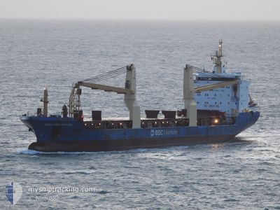
ARALIA
General Cargo
Current Trip
| Time Travelled | 12 h, 19 mins |
|---|---|
| Remaining Time | 23 mins |
| Distance Travelled | 140.50 nm |
| Remaining Distance | 9.18 nm |
| AVG Speed | 11.8 Knots |
| MAX Speed | 12.3 Knots |
| AVG Wind | 4.1 knots |
| MAX Wind | 6.9 knots |
| MIN Temp | 18.7°C / 65.66°F |
| MAX Temp | 20.6°C / 69.08°F |
| Draught | 6.4 m |
| Position Received | 1 m ago |
Current Position
| Longitude | 13.30022° |
|---|---|
| Latitude | 45.63916° |
| Status | Under way using engine |
| Speed | 0.4 Knots |
| Course | 60° |
| Area | Adriatic Sea |
| Station | T-AIS |
| Position Received | 1 m ago |
Info
Information
The current position of ARALIA is in Adriatic Sea with coordinates 45.63916° / 13.30022° as reported on 2024-05-28 06:02 by AIS to our vessel tracker app. The vessel's current speed is 0.4 Knots and is heading at the port of PORTO NOGARO. The estimated time of arrival as calculated by vessel tracking app is 2024-05-28 06:26 LT
The vessel ARALIA (IMO: 9357212, MMSI: 636022337) is a General Cargo that was built in 2007 ( 17 years old ). It's sailing under the flag of [LR] Liberia.
In this page you can find informations about the vessels current position, last detected port calls, and current voyage information. If the vessels is not in coverage by AIS you will find the latest position.
The current position of ARALIA is detected by our AIS receivers and we are not responsible for the reliability of the data. The last position was recorded while the vessel was in Coverage by the Ais receivers of our vessel tracking app.
The current draught of ARALIA as reported by AIS is 6.4 meters
Weather
| Temperature | 17.5°C / 63.5°F |
|---|---|
| Wind Speed | 4 knots |
| Direction | 41° NE |
| Pressure | 1015.1 hPa |
| Humidity | 78.7 % |
| Cloud Coverage | 70 % |
Featured Company
Last Port Calls
| Port | Arrival | Departure | Time In Port |
|---|---|---|---|
| 2024-05-24 06:35 | 2024-05-27 17:44 | 3 d | |
| 2024-05-19 18:30 | 2024-05-20 19:37 | 1 d | |
| 2024-05-12 14:36 | 2024-05-16 15:43 | 4 d | |
| 2024-05-04 13:52 | 2024-05-09 23:35 | 5 d | |
| 2024-04-28 00:21 | 2024-05-01 17:30 | 3 d | |
| 2024-04-07 21:38 | 2024-04-07 22:30 | 52 m | |
| 2024-03-31 11:51 | 2024-03-31 12:44 | 53 m | |
| 2024-03-16 05:15 | 2024-03-27 19:20 | 11 d |
Last Trips
| Origin | Departure | Destination | Arrival | Distance | |
|---|---|---|---|---|---|
| 2024-05-20 21:37 | 2024-05-24 08:35 | 1082.76 nm | |||
| 2024-05-16 17:43 | 2024-05-19 20:30 | 996.32 nm | |||
| 2024-05-10 00:35 | 2024-05-12 16:36 | 846.61 nm | |||
| 2024-05-01 18:30 | 2024-05-04 14:52 | 66.93 nm | |||
| 2024-04-07 19:30 | 2024-04-28 01:21 | 4944.11 nm | |||
| 2024-03-31 09:44 | 2024-04-07 18:38 | 2.33 nm | |||
| 2024-03-27 16:20 | 2024-03-31 08:51 | 1045.97 nm | |||
| 2024-02-23 23:55 | 2024-03-16 02:15 | 372.58 nm |
Events
| Time | Event | Details | Position / Dest | Info |
|---|---|---|---|---|
| 2024-05-28 05:59 | STOP Moving | 9.3 nm, South of PORTO NOGARO |
45.63902 / 13.30036
IT PNG
|
Speed: 0.3 kn Course: 62° |
| 2024-05-28 04:14 | Change Sea Area | Italian part of the Adriatic Sea Croatian part of the Adriatic Sea |
45.39611 / 13.14914
Adriatic Sea
IT PNG
|
Speed: 12 kn Course: 348.9° |
| 2024-05-27 22:40 | ETA Changed | 2024/05/28 06:00 2024/05/28 04:00 |
44.54010 / 14.04349
IT PNG
|
Speed: 11.7 kn Course: 306.5° |
| 2024-05-27 21:53 | Status Changed | Under way using engine Default |
44.44984 / 14.22328
IT PNG
|
Speed: 12.4 kn Course: 284° |
| 2024-05-27 21:53 | IN Coverage |
44.45403 / 14.21249
Adriatic Sea
IT PNG
|
Speed: 12 kn Course: 303.2° |
|
| 2024-05-27 20:58 | Status Changed | Default Under way using engine |
44.40420 / 14.47864
IT PNG
|
Speed: 12 kn Course: 283.6° |
| 2024-05-27 20:52 | OUT of Coverage |
44.39945 / 14.50613
Adriatic Sea
IT PNG
|
Speed: 12 kn Course: 283.6° |
|
| 2024-05-27 20:35 | Status Changed | Under way using engine Default |
44.38694 / 14.57966
IT PNG
|
Speed: 11.9 kn Course: 299° |
| 2024-05-27 20:27 | IN Coverage |
44.38694 / 14.57966
Adriatic Sea
IT PNG
|
Speed: 12 kn Course: 283.4° |
|
| 2024-05-27 19:17 | OUT of Coverage |
44.26102 / 14.89783
Adriatic Sea
IT PNG
|
Speed: 12.1 kn Course: 299.1° |