
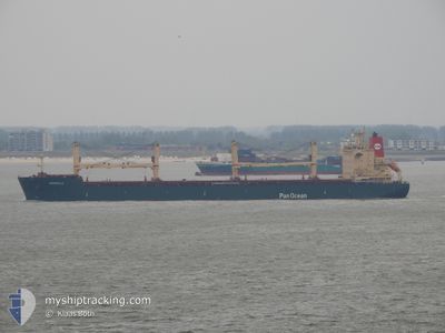
ARBORELLA
Cargo
Current Trip
| Time Travelled | 6 days |
|---|---|
| Remaining Time | --- |
| Distance Travelled | 1914.49 nm |
| Remaining Distance | --- |
| AVG Speed | 12.5 Knots |
| MAX Speed | 15.3 Knots |
| AVG Wind | 11.6 knots |
| MAX Wind | 19 knots |
| MIN Temp | 26.5°C / 79.7°F |
| MAX Temp | 29.4°C / 84.92°F |
| Draught | 6 m |
| Position Received | 21 h, 9 m ago |
Current Position
| Longitude | -60.66637° |
|---|---|
| Latitude | 14.10985° |
| Status | Under way using engine |
| Speed | 11.7 Knots |
| Course | 117.7° |
| Area | Caribbean Sea |
| Station | T-AIS |
| Position Received | 21 h, 9 m ago |
Info
Information
The current position of ARBORELLA is in Caribbean Sea with coordinates 14.10985° / -60.66637° as reported on 2024-05-31 14:24 by AIS to our vessel tracker app. The vessel's current speed is 11.7 Knots and is heading at the port of PORTOCEL.
The vessel ARBORELLA (MMSI: 538004720) is a Cargo It's sailing under the flag of [MH] Marshall Is.
In this page you can find informations about the vessels current position, last detected port calls, and current voyage information. If the vessels is not in coverage by AIS you will find the latest position.
The current position of ARBORELLA is detected by our AIS receivers and we are not responsible for the reliability of the data. The last position was recorded while the vessel was in Coverage by the Ais receivers of our vessel tracking app.
The current draught of ARBORELLA as reported by AIS is 6 meters
Weather
| Temperature | 28.1°C / 82.58°F |
|---|---|
| Wind Speed | 15 knots |
| Direction | 93° E |
| Pressure | 1014 hPa |
| Humidity | 81.1 % |
| Cloud Coverage | 52 % |
Featured Company
Last Port Calls
| Port | Arrival | Departure | Time In Port |
|---|---|---|---|
| 2024-05-24 08:18 | 2024-05-26 03:19 | 1 d | |
| 2024-05-18 23:06 | 2024-05-21 00:26 | 2 d | |
| 2024-05-13 07:58 | 2024-05-17 02:03 | 3 d | |
| 2024-04-22 15:36 | 2024-04-28 19:46 | 6 d | |
| 2024-04-08 06:50 | 2024-04-10 07:28 | 2 d | |
| 2024-04-05 20:14 | 2024-04-06 17:27 | 21 h | |
| 2024-04-03 13:03 |
Most Visited Ports (Last year)
| Port | Arrivals | |
|---|---|---|
| 5 | ||
| 4 | ||
| 3 | ||
| 3 | ||
| 3 | ||
| 2 |
Last Trips
| Origin | Departure | Destination | Arrival | Distance | |
|---|---|---|---|---|---|
| 2024-05-20 19:26 | 2024-05-24 04:18 | 383.77 nm | |||
| 2024-05-16 21:03 | 2024-05-18 18:06 | 509.74 nm | |||
| 2024-04-28 16:46 | 2024-05-13 02:58 | 3639.91 nm | |||
| 2024-04-10 03:28 | 2024-04-22 12:36 | 3161.63 nm | |||
| 2024-04-06 12:27 | 2024-04-08 02:50 | 382.01 nm | |||
| 2024-04-03 08:03 | 2024-04-05 15:14 | 552.45 nm |
Events
| Time | Event | Details | Position / Dest | Info |
|---|---|---|---|---|
| 2024-05-31 14:29 | Status Changed | Default Under way using engine |
14.10371 / -60.65182
PORTOCEL BR
|
Speed: 11.7 kn Course: 117.7° |
| 2024-05-31 14:24 | OUT of Coverage |
14.10985 / -60.66637
Caribbean Sea
|
Speed: 11.7 kn Course: 117.7° |
|
| 2024-05-31 14:17 | Status Changed | Under way using engine Default |
14.11972 / -60.68897
PORTOCEL BR
|
Speed: 11.6 kn Course: 114° |
| 2024-05-31 14:15 | Status Changed | Default Under way using engine |
14.12206 / -60.69411
PORTOCEL BR
|
Speed: 11.5 kn Course: 113.9° |
| 2024-05-31 13:58 | Status Changed | Under way using engine Default |
14.14628 / -60.74705
PORTOCEL BR
|
Speed: 11.6 kn Course: 116° |
| 2024-05-31 13:56 | Status Changed | Default Under way using engine |
14.14905 / -60.75312
PORTOCEL BR
|
Speed: 11.5 kn Course: 112.7° |
| 2024-05-31 12:29 | Change Sea Area | Saint Lucia part of the Caribbean Sea Guadeloupe and Martinique part of the Caribbean Sea |
14.26310 / -61.02287
Caribbean Sea
|
Speed: 12.2 kn Course: 110.6° |
| 2024-05-31 11:32 | Status Changed | Under way using engine Default |
14.34130 / -61.20413
PORTOCEL BR
|
Speed: 11.8 kn Course: 115° |
| 2024-05-31 11:06 | Status Changed | Default Under way using engine |
14.37609 / -61.28395
PORTOCEL BR
|
Speed: 11.6 kn Course: 117.6° |
| 2024-05-31 10:46 | Change Sea Area | Guadeloupe and Martinique part of the Caribbean Sea Cuban part of the North Atlantic Ocean |
14.40424 / -61.34541
Caribbean Sea
|
Speed: 12.3 kn Course: 112.9° |