
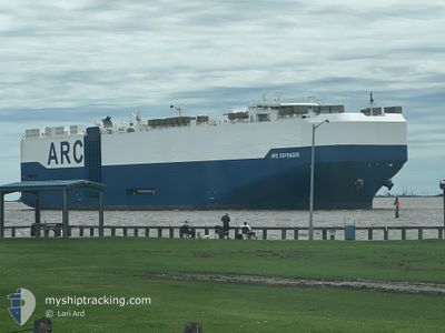
ARC DEFENDER
Ro-Ro/Passenger Ship
Current Trip
| Time Travelled | 2 days |
|---|---|
| Remaining Time | 1 day |
| Distance Travelled | 908.84 nm |
| Remaining Distance | 454.55 nm |
| AVG Speed | 11.7 Knots |
| MAX Speed | 18.5 Knots |
| AVG Wind | 6.7 knots |
| MAX Wind | 17.4 knots |
| MIN Temp | 20.6°C / 69.08°F |
| MAX Temp | 29.6°C / 85.28°F |
| Draught | 9.7 m |
| Position Received | 5 m ago |
Current Position
| Longitude | -80.39279° |
|---|---|
| Latitude | 24.36220° |
| Status | Under way using engine |
| Speed | 17.1 Knots |
| Course | 57.2° |
| Area | North Atlantic Ocean |
| Station | T-AIS |
| Position Received | 5 m ago |
Info
Information
The current position of ARC DEFENDER is in North Atlantic Ocean with coordinates 24.36220° / -80.39279° as reported on 2024-05-18 01:30 by AIS to our vessel tracker app. The vessel's current speed is 17.1 Knots and is heading at the port of BRUNSWICK. The estimated time of arrival as calculated by vessel tracking app is 2024-05-19 04:12 LT
The vessel ARC DEFENDER (IMO: 9375264, MMSI: 338145000) is a Ro-Ro/Passenger Ship that was built in 2008 ( 16 years old ). It's sailing under the flag of [US] USA.
In this page you can find informations about the vessels current position, last detected port calls, and current voyage information. If the vessels is not in coverage by AIS you will find the latest position.
The current position of ARC DEFENDER is detected by our AIS receivers and we are not responsible for the reliability of the data. The last position was recorded while the vessel was in Coverage by the Ais receivers of our vessel tracking app.
The current draught of ARC DEFENDER as reported by AIS is 9.7 meters
Weather
| Temperature | 28.4°C / 83.12°F |
|---|---|
| Wind Speed | 10 knots |
| Direction | 91° E |
| Pressure | 1013.4 hPa |
| Humidity | 84.2 % |
| Cloud Coverage | --- |
Featured Company
Last Port Calls
| Port | Arrival | Departure | Time In Port |
|---|---|---|---|
| 2024-05-11 21:57 | 2024-05-15 12:00 | 3 d | |
| 2024-05-07 12:20 | 2024-05-08 20:46 | 1 d | |
| 2024-05-05 10:22 | 2024-05-06 01:41 | 15 h | |
| 2024-04-29 04:29 | 2024-04-30 02:00 | 21 h | |
| 2024-04-16 07:06 | 2024-04-17 00:27 | 17 h | |
| 2024-04-13 15:48 | 2024-04-14 15:29 | 23 h | |
| 2024-04-05 20:49 | 2024-04-12 16:59 | 6 d | |
| 2024-03-23 11:53 | 2024-03-25 14:25 | 2 d | |
| 2024-03-20 09:14 | 2024-03-20 20:46 | 11 h | |
| 2024-03-12 16:08 | 2024-03-16 12:00 | 3 d |
Most Visited Ports (Last year)
| Port | Arrivals | |
|---|---|---|
| 9 | ||
| 8 | ||
| 7 | ||
| 5 | ||
| 5 | ||
| 5 |
Last Trips
| Origin | Departure | Destination | Arrival | Distance | |
|---|---|---|---|---|---|
| 2024-05-08 15:46 | 2024-05-11 16:57 | 658.67 nm | |||
| 2024-05-05 20:41 | 2024-05-07 07:20 | 484.14 nm | |||
| 2024-04-29 22:00 | 2024-05-05 05:22 | 1444.59 nm | |||
| 2024-04-17 01:27 | 2024-04-29 00:29 | 3923.76 nm | |||
| 2024-04-14 17:29 | 2024-04-16 08:06 | 273.59 nm | |||
| 2024-04-12 18:59 | 2024-04-13 17:48 | 350.00 nm | |||
| 2024-03-25 10:25 | 2024-04-05 22:49 | 3943.49 nm | |||
| 2024-03-20 16:46 | 2024-03-23 07:53 | 702.87 nm | |||
| 2024-03-16 07:00 | 2024-03-20 05:14 | 1366.14 nm | |||
| 2024-03-11 18:27 | 2024-03-12 11:08 | 113.86 nm |
Events
| Time | Event | Details | Position / Dest | Info |
|---|---|---|---|---|
| 2024-05-18 01:27 | Status Changed | Under way using engine Default |
24.35568 / -80.40383
US SSI
|
Speed: 17.3 kn Course: 57° |
| 2024-05-18 01:20 | Status Changed | Default Under way using engine |
24.33766 / -80.43447
US SSI
|
Speed: 17.3 kn Course: 57.1° |
| 2024-05-18 01:14 | Status Changed | Under way using engine Default |
24.32052 / -80.46377
US SSI
|
Speed: 17.4 kn Course: 57° |
| 2024-05-18 01:03 | Status Changed | Default Under way using engine |
24.29275 / -80.51142
US SSI
|
Speed: 17.4 kn Course: 57.6° |
| 2024-05-18 00:56 | Status Changed | Under way using engine Default |
24.27576 / -80.54077
US SSI
|
Speed: 17.3 kn Course: 58° |
| 2024-05-18 00:45 | Status Changed | Default Under way using engine |
24.24745 / -80.58990
US SSI
|
Speed: 17.2 kn Course: 57.5° |
| 2024-05-17 23:46 | ETA Changed | 2024/05/19 08:00 2024/05/19 09:00 |
24.09474 / -80.85069
US SSI
|
Speed: 17 kn Course: 57.4° |
| 2024-05-17 23:26 | Status Changed | Under way using engine Default |
24.04322 / -80.93813
US SSI
|
Speed: 16.9 kn Course: 57° |
| 2024-05-17 23:16 | Status Changed | Default Under way using engine |
24.01760 / -80.98147
US SSI
|
Speed: 16.9 kn Course: 57.1° |
| 2024-05-17 22:52 | Change Sea Area | Bahamas part of the North Atlantic Ocean United States part of the Gulf of Mexico |
23.95768 / -81.08343
North Atlantic Ocean
US SSI
|
Speed: 16.9 kn Course: 57.4° |