
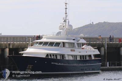
ARCADIA
Yacht
Current Trip
| Time Travelled | 2 days |
|---|---|
| Remaining Time | --- |
| Distance Travelled | 468.58 nm |
| Remaining Distance | --- |
| AVG Speed | 10.1 Knots |
| MAX Speed | 11.1 Knots |
| AVG Wind | 5.6 knots |
| MAX Wind | 20.8 knots |
| MIN Temp | 13.4°C / 56.12°F |
| MAX Temp | 25.2°C / 77.36°F |
| Draught | 3 m |
| Position Received | 1 m ago |
Current Position
| Longitude | 13.75136° |
|---|---|
| Latitude | 45.60898° |
| Status | Moored |
| Speed | |
| Course | 26° |
| Area | Adriatic Sea |
| Station | T-AIS |
| Position Received | 1 m ago |
Info
Information
The current position of ARCADIA is in Adriatic Sea with coordinates 45.60898° / 13.75136° as reported on 2024-06-15 09:10 by AIS to our vessel tracker app. The vessel's current speed is 0 Knots
The vessel ARCADIA (IMO: 1008451, MMSI: 319030600) is a Yacht that was built in 2006 ( 18 years old ). It's sailing under the flag of [KY] Cayman Is.
In this page you can find informations about the vessels current position, last detected port calls, and current voyage information. If the vessels is not in coverage by AIS you will find the latest position.
The current position of ARCADIA is detected by our AIS receivers and we are not responsible for the reliability of the data. The last position was recorded while the vessel was in Coverage by the Ais receivers of our vessel tracking app.
The current draught of ARCADIA as reported by AIS is 3 meters
Weather
| Temperature | 23°C / 73.4°F |
|---|---|
| Wind Speed | 8 knots |
| Direction | 220° SW |
| Pressure | 1012.1 hPa |
| Humidity | 58 % |
| Cloud Coverage | 15 % |
Featured Company
Last Port Calls
| Port | Arrival | Departure | Time In Port |
|---|---|---|---|
| 2024-06-12 19:07 | 2024-06-12 21:41 | 2 h | |
| 2024-05-24 12:08 | 2024-06-03 12:42 | 10 d | |
| 2024-05-17 11:49 | 2024-05-20 14:13 | 3 d | |
| 2024-05-07 14:50 | 2024-05-13 06:19 | 5 d | |
| 2024-05-07 06:29 |
Last Trips
| Origin | Departure | Destination | Arrival | Distance | |
|---|---|---|---|---|---|
| 2024-06-03 14:42 | 2024-06-12 21:07 | 745.02 nm | |||
| 2024-05-20 16:13 | 2024-05-24 14:08 | 119.48 nm | |||
| 2024-05-13 08:19 | 2024-05-17 13:49 | 376.10 nm | |||
| 2024-05-07 08:29 | 2024-05-07 16:50 | 17.36 nm |
Events
| Time | Event | Details | Position / Dest | Info |
|---|---|---|---|---|
| 2024-06-14 21:24 | Status Changed | Moored Under way using engine |
45.60898 / 13.75136
MUGGIA
|
Speed: Course: 24° |
| 2024-06-14 20:57 | STOP Moving | 0.67 nm, West of MUGGIA |
45.60957 / 13.75128
MUGGIA
|
Speed: 0.3 kn Course: 105° |
| 2024-06-14 20:35 | Change Sea Area | Italian part of the Adriatic Sea Slovenian part of the Adriatic Sea |
45.60650 / 13.70165
Adriatic Sea
MUGGIA
|
Speed: 10.2 kn Course: 56.4° |
| 2024-06-14 19:47 | Change Sea Area | Slovenian part of the Adriatic Sea Croatian part of the Adriatic Sea |
45.53004 / 13.53635
Adriatic Sea
MUGGIA
|
Speed: 10.4 kn Course: 59.1° |
| 2024-06-14 12:53 | IN Coverage |
44.50318 / 14.17121
Adriatic Sea
MUGGIA
|
Speed: 10.5 kn Course: 312.9° |
|
| 2024-06-14 01:04 | OUT of Coverage |
43.10387 / 16.25077
Adriatic Sea
MUGGIA
|
Speed: 10.3 kn Course: 311.8° |
|
| 2024-06-13 21:55 | Change Sea Area | Croatian part of the Adriatic Sea Italian part of the Adriatic Sea |
42.70993 / 16.72619
Adriatic Sea
MUGGIA
|
Speed: 10 kn Course: 314.8° |
| 2024-06-13 21:54 | IN Coverage |
42.70993 / 16.72619
Adriatic Sea
MUGGIA
|
Speed: 10 kn Course: 314.8° |
|
| 2024-06-13 14:53 | OUT of Coverage |
41.86406 / 17.16210
Adriatic Sea
MUGGIA
|
Speed: 10.6 kn Course: 314.1° |
|
| 2024-06-13 11:35 | IN Coverage |
41.48444 / 17.66863
Adriatic Sea
MUGGIA
|
Speed: 9.3 kn Course: 316.6° |