
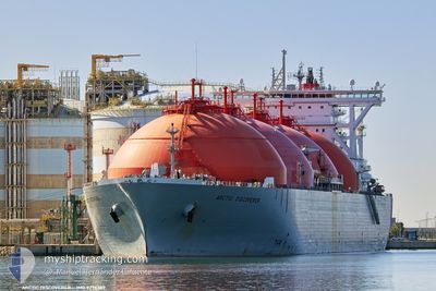
ARCTIC DISCOVERER
Lng Tanker
Current Trip
| Time Travelled | 5 days |
|---|---|
| Remaining Time | --- |
| Distance Travelled | 2027.71 nm |
| Remaining Distance | --- |
| AVG Speed | 14.2 Knots |
| MAX Speed | 16.9 Knots |
| AVG Wind | 11.9 knots |
| MAX Wind | 35.4 knots |
| MIN Temp | 3.6°C / 38.48°F |
| MAX Temp | 16.7°C / 62.06°F |
| Draught | 11.4 m |
| Position Received | 47 m ago |
Current Position
| Longitude | 23.91859° |
|---|---|
| Latitude | 60.01417° |
| Status | Moored |
| Speed | |
| Course | 112° |
| Area | Gulf of Finland |
| Station | T-AIS |
| Position Received | 47 m ago |
Info
Information
The current position of ARCTIC DISCOVERER is in Gulf of Finland with coordinates 60.01417° / 23.91859° as reported on 2024-05-30 10:32 by AIS to our vessel tracker app. The vessel's current speed is 0 Knots
The vessel ARCTIC DISCOVERER (IMO: 9276389, MMSI: 309481000) is a Lng Tanker that was built in 2006 ( 18 years old ). It's sailing under the flag of [BS] Bahamas.
In this page you can find informations about the vessels current position, last detected port calls, and current voyage information. If the vessels is not in coverage by AIS you will find the latest position.
The current position of ARCTIC DISCOVERER is detected by our AIS receivers and we are not responsible for the reliability of the data. The last position was recorded while the vessel was in Coverage by the Ais receivers of our vessel tracking app.
The current draught of ARCTIC DISCOVERER as reported by AIS is 11.4 meters
Weather
| Temperature | 17.3°C / 63.14°F |
|---|---|
| Wind Speed | 4 knots |
| Direction | 136° SE |
| Pressure | 1013.8 hPa |
| Humidity | 67.9 % |
| Cloud Coverage | 41 % |
Featured Company
Last Port Calls
| Port | Arrival | Departure | Time In Port |
|---|---|---|---|
| 2024-05-23 07:21 | 2024-05-24 13:20 | 1 d | |
| 2024-05-13 02:22 | 2024-05-14 06:37 | 1 d | |
| 2024-05-03 19:23 | 2024-05-04 23:57 | 1 d | |
| 2024-04-22 06:23 | 2024-04-23 03:16 | 20 h | |
| 2024-04-12 15:59 | 2024-04-16 04:44 | 3 d | |
| 2024-03-28 16:22 | |||
| 2024-03-05 14:31 | 2024-03-06 13:23 | 22 h |
Most Visited Ports (Last year)
| Port | Arrivals | |
|---|---|---|
| 12 | ||
| 2 | ||
| 2 | ||
| 2 | ||
| 1 | ||
| 1 |
Last Trips
| Origin | Departure | Destination | Arrival | Distance | |
|---|---|---|---|---|---|
| 2024-05-14 08:37 | 2024-05-23 09:21 | 1444.41 nm | |||
| 2024-05-05 01:57 | 2024-05-13 04:22 | 1441.03 nm | |||
| 2024-04-23 05:16 | 2024-05-03 21:23 | 2222.55 nm | |||
| 2024-04-16 06:44 | 2024-04-22 08:23 | 2161.43 nm | |||
| 2024-03-28 17:22 | 2024-04-12 17:59 | 2102.22 nm | |||
| 2024-02-21 09:03 | 2024-03-05 15:31 | 3117.32 nm |
Events
| Time | Event | Details | Position / Dest | Info |
|---|---|---|---|---|
| 2024-05-30 10:37 | Status Changed | Default Moored |
60.01424 / 23.91861
FIINK
|
Speed: Course: 112° |
| 2024-05-30 10:31 | Status Changed | Moored Under way using engine |
60.01418 / 23.91858
FIINK
|
Speed: Course: 112° |
| 2024-05-30 09:17 | STOP Moving | 0.17 nm, West of INKOO |
60.01392 / 23.91916
FIINK
|
Speed: 0.3 kn Course: 111° |
| 2024-05-30 03:35 | Detected in Sea | Finnish part of the Gulf of Finland |
59.54014 / 23.15797
Gulf of Finland
FIINK
|
Speed: 14.6 kn Course: 73.2° |
| 2024-05-30 02:10 | Detected in Sea | Finnish part of the Baltic Sea |
59.40556 / 22.54643
Baltic Sea
FIINK
|
Speed: 14.5 kn Course: 52.9° |
| 2024-05-29 22:19 | Status Changed | Under way using engine Default |
58.71665 / 21.30843
FIINK
|
Speed: 14.8 kn Course: 35° |
| 2024-05-29 21:35 | Status Changed | Default Under way using engine |
58.56624 / 21.11637
FIINK
|
Speed: 14.9 kn Course: 37° |
| 2024-05-29 21:33 | Change Sea Area | Estonian part of the Baltic Sea Latvian part of the Baltic Sea |
58.55877 / 21.10638
Baltic Sea
FIINK
|
Speed: 14.9 kn Course: 37° |
| 2024-05-29 21:32 | Status Changed | Under way using engine Default |
58.55576 / 21.10236
FIINK
|
Speed: 14.8 kn Course: 37° |
| 2024-05-29 21:24 | IN Coverage |
58.55877 / 21.10638
Baltic Sea
FIINK
|
Speed: 14.9 kn Course: 37° |