
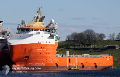
ARCTIC TIDE
Multi Purpose Offshore Vessel
Current Trip
| Time Travelled | 1 day |
|---|---|
| Remaining Time | --- |
| Distance Travelled | 182.62 nm |
| Remaining Distance | --- |
| AVG Speed | 10.2 Knots |
| MAX Speed | 12.8 Knots |
| AVG Wind | 7 knots |
| MAX Wind | 14 knots |
| MIN Temp | 11.1°C / 51.98°F |
| MAX Temp | 13.8°C / 56.84°F |
| Draught | 5.6 m |
| Position Received | 4 h, 23 m ago |
Current Position
| Longitude | 3.47148° |
|---|---|
| Latitude | 56.17792° |
| Status | Under way using engine |
| Speed | 6.9 Knots |
| Course | 49.1° |
| Area | North Sea |
| Station | T-AIS |
| Position Received | 4 h, 23 m ago |
Info
Information
The current position of ARCTIC TIDE is in North Sea with coordinates 56.17792° / 3.47148° as reported on 2024-05-26 20:59 by AIS to our vessel tracker app. The vessel's current speed is 6.9 Knots
The vessel ARCTIC TIDE (IMO: 9592812, MMSI: 259989000) is a Multi Purpose Offshore Vessel that was built in 2012 ( 12 years old ). It's sailing under the flag of [NO] Norway.
In this page you can find informations about the vessels current position, last detected port calls, and current voyage information. If the vessels is not in coverage by AIS you will find the latest position.
The current position of ARCTIC TIDE is detected by our AIS receivers and we are not responsible for the reliability of the data. The last position was recorded while the vessel was in Coverage by the Ais receivers of our vessel tracking app.
The current draught of ARCTIC TIDE as reported by AIS is 5.6 meters
Weather
| Temperature | 13.7°C / 56.66°F |
|---|---|
| Wind Speed | 12 knots |
| Direction | 122° ESE |
| Pressure | 1012.2 hPa |
| Humidity | 88.7 % |
| Cloud Coverage | 99 % |
Featured Company
Last Port Calls
| Port | Arrival | Departure | Time In Port |
|---|---|---|---|
| 2024-05-25 06:30 | 2024-05-25 13:05 | 6 h | |
| 2024-05-20 19:26 | 2024-05-21 15:39 | 20 h | |
| 2024-05-20 10:34 | 2024-05-20 10:46 | 11 m | |
| 2024-05-16 05:04 | 2024-05-16 16:04 | 11 h | |
| 2024-05-11 06:40 | 2024-05-11 17:00 | 10 h | |
| 2024-05-06 15:03 | 2024-05-06 22:38 | 7 h | |
| 2024-05-02 08:00 | 2024-05-02 15:19 | 7 h | |
| 2024-04-27 03:25 | 2024-04-27 22:33 | 19 h | |
| 2024-04-23 05:12 | 2024-04-23 15:26 | 10 h | |
| 2024-04-18 06:53 | 2024-04-18 14:35 | 7 h |
Last Trips
| Origin | Departure | Destination | Arrival | Distance | |
|---|---|---|---|---|---|
| 2024-05-21 17:39 | 2024-05-25 08:30 | 344.89 nm | |||
| 2024-05-20 12:46 | 2024-05-20 21:26 | 84.24 nm | |||
| 2024-05-16 18:04 | 2024-05-20 12:34 | 387.49 nm | |||
| 2024-05-11 19:00 | 2024-05-16 07:04 | 404.36 nm | |||
| 2024-05-07 00:38 | 2024-05-11 08:40 | 410.30 nm | |||
| 2024-05-02 17:19 | 2024-05-06 17:03 | 389.63 nm | |||
| 2024-04-28 00:33 | 2024-05-02 10:00 | 409.00 nm | |||
| 2024-04-23 17:26 | 2024-04-27 05:25 | 392.17 nm | |||
| 2024-04-18 16:35 | 2024-04-23 07:12 | 357.94 nm | |||
| 2024-04-13 17:21 | 2024-04-18 08:53 | 400.63 nm |
Events
| Time | Event | Details | Position / Dest | Info |
|---|---|---|---|---|
| 2024-05-26 20:59 | OUT of Coverage |
56.17792 / 3.47148
North Sea
RISAVIKA
|
Speed: 6.9 kn Course: 49.1° |
|
| 2024-05-26 20:59 | IN Coverage |
56.17792 / 3.47148
North Sea
RISAVIKA
|
Speed: 6.9 kn Course: 49.1° |
|
| 2024-05-26 18:58 | OUT of Coverage |
56.17569 / 3.46071
North Sea
RISAVIKA
|
Speed: 0.1 kn Course: 230.8° |
|
| 2024-05-26 18:54 | Destination Changed | RISAVIKA VALHALL |
56.17569 / 3.46071
RISAVIKA
|
Speed: 0.1 kn Course: 140° |
| 2024-05-26 18:54 | ETA Changed | 2024/05/28 06:00 2024/05/26 07:00 |
56.17569 / 3.46071
RISAVIKA
|
Speed: 0.1 kn Course: 140° |
| 2024-05-26 18:12 | STOP Moving |
56.17571 / 3.46103
VALHALL
|
Speed: 0.1 kn Course: 140° |
|
| 2024-05-26 17:49 | IN Coverage |
56.17833 / 3.45908
North Sea
|
Speed: 2.9 kn Course: 142.7° |
|
| 2024-05-26 16:46 | OUT of Coverage |
56.18314 / 3.45010
North Sea
|
Speed: 0.1 kn Course: 87.5° |
|
| 2024-05-26 16:46 | IN Coverage |
56.18314 / 3.45010
North Sea
|
Speed: 0.1 kn Course: 87.5° |
|
| 2024-05-26 00:59 | OUT of Coverage |
57.19758 / 4.09775
North Sea
VALHALL
|
Speed: 10.3 kn Course: 204.3° |