
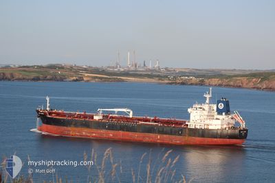
ARDMORE ENDEAVOUR
Oil/Chemical Tanker
Current Trip
| Time Travelled | 2 days |
|---|---|
| Remaining Time | --- |
| Distance Travelled | 255.64 nm |
| Remaining Distance | --- |
| AVG Speed | 6.1 Knots |
| MAX Speed | 13 Knots |
| AVG Wind | 10.1 knots |
| MAX Wind | 17.8 knots |
| MIN Temp | 24.6°C / 76.28°F |
| MAX Temp | 30.6°C / 87.08°F |
| Draught | 8 m |
| Position Received | 1 d ago |
Current Position
| Longitude | 103.46279° |
|---|---|
| Latitude | 1.21803° |
| Status | Under way using engine |
| Speed | 6.6 Knots |
| Course | 285.8° |
| Area | Singapore Strait |
| Station | T-AIS |
| Position Received | 1 d ago |
Info
Information
The current position of ARDMORE ENDEAVOUR is in Singapore Strait with coordinates 1.21803° / 103.46279° as reported on 2024-05-30 16:37 by AIS to our vessel tracker app. The vessel's current speed is 6.6 Knots
The vessel ARDMORE ENDEAVOUR (IMO: 9667942, MMSI: 538005761) is a Oil/Chemical Tanker that was built in 2013 ( 11 years old ). It's sailing under the flag of [MH] Marshall Is.
In this page you can find informations about the vessels current position, last detected port calls, and current voyage information. If the vessels is not in coverage by AIS you will find the latest position.
The current position of ARDMORE ENDEAVOUR is detected by our AIS receivers and we are not responsible for the reliability of the data. The last position was recorded while the vessel was in Coverage by the Ais receivers of our vessel tracking app.
The current draught of ARDMORE ENDEAVOUR as reported by AIS is 8 meters
Weather
| Temperature | 29.4°C / 84.92°F |
|---|---|
| Wind Speed | 14 knots |
| Direction | 133° SE |
| Pressure | 1008.7 hPa |
| Humidity | 76.3 % |
| Cloud Coverage | 100 % |
Featured Company
Last Port Calls
| Port | Arrival | Departure | Time In Port |
|---|---|---|---|
| 2024-05-29 07:56 | 2024-05-30 05:40 | 21 h | |
| 2024-05-27 16:33 | 2024-05-29 02:57 | 1 d | |
| 2024-05-25 12:47 | 2024-05-26 09:13 | 20 h | |
| 2024-05-15 07:25 | 2024-05-16 21:28 | 1 d | |
| 2024-04-28 03:42 | 2024-04-29 15:18 | 1 d | |
| 2024-04-06 22:51 | 2024-04-08 13:10 | 1 d |
Most Visited Ports (Last year)
| Port | Arrivals | |
|---|---|---|
| 4 | ||
| 3 | ||
| 3 | ||
| 3 | ||
| 2 | ||
| 2 |
Last Trips
| Origin | Departure | Destination | Arrival | Distance | |
|---|---|---|---|---|---|
| 2024-05-29 10:57 | 2024-05-29 15:56 | 37.52 nm | |||
| 2024-05-26 17:13 | 2024-05-28 00:33 | 42.66 nm | |||
| 2024-05-17 06:28 | 2024-05-25 20:47 | 2587.41 nm | |||
| 2024-04-29 07:18 | 2024-05-15 16:25 | 4307.35 nm | |||
| 2024-04-08 22:10 | 2024-04-27 19:42 | 4209.37 nm | |||
| 2024-03-19 10:30 | 2024-04-07 07:51 | 4091.54 nm |
Events
| Time | Event | Details | Position / Dest | Info |
|---|---|---|---|---|
| 2024-05-30 16:42 | Status Changed | Default Under way using engine |
1.22069 / 103.45343
MELAKA
|
Speed: 6.6 kn Course: 285.8° |
| 2024-05-30 16:37 | OUT of Coverage |
1.21803 / 103.46279
Singapore Strait
MELAKA
|
Speed: 6.6 kn Course: 285.8° |
|
| 2024-05-30 16:28 | Status Changed | Under way using engine Default |
1.21356 / 103.47938
MELAKA
|
Speed: 6.9 kn Course: 282° |
| 2024-05-30 16:18 | Status Changed | Default Under way using engine |
1.20960 / 103.49749
MELAKA
|
Speed: 7 kn Course: 283.1° |
| 2024-05-30 15:53 | Status Changed | Under way using engine Default |
1.19811 / 103.54595
MELAKA
|
Speed: 7 kn Course: 283° |
| 2024-05-30 15:50 | Status Changed | Default Under way using engine |
1.19698 / 103.55079
MELAKA
|
Speed: 7 kn Course: 282.8° |
| 2024-05-30 15:34 | Detected in Sea | Malaysian part of the Singapore Strait |
1.19056 / 103.58083
Singapore Strait
MELAKA
|
Speed: 7.2 kn Course: 281.2° |
| 2024-05-30 14:14 | Change Sea Area | Indonesian part of the Singapore Strait Singaporean part of the Singapore Strait |
1.14045 / 103.72504
Singapore Strait
MELAKA
|
Speed: 6.7 kn Course: 281.5° |
| 2024-05-30 12:58 | START Moving | 3.32 nm, East of BUKOM ISLAND |
1.22339 / 103.80703
MELAKA
|
Speed: 3.1 kn Course: 175° |
| 2024-05-30 12:51 | Destination Changed | MELAKA AWPB |
1.22556 / 103.80732
MELAKA
|
Speed: 0.4 kn Course: 175° |