
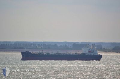
ARDMORE ENDURANCE
Oil Products Tanker
Current Trip
PANAMA FOR ORDERS
| Time Travelled | 14 days |
|---|---|
| Remaining Time | --- |
| Distance Travelled | 4247.51 nm |
| Remaining Distance | --- |
| AVG Speed | 12.2 Knots |
| MAX Speed | 14.6 Knots |
| AVG Wind | 10.3 knots |
| MAX Wind | 25.7 knots |
| MIN Temp | 16.7°C / 62.06°F |
| MAX Temp | 27.3°C / 81.14°F |
| Draught | 11.3 m |
| Position Received | 20 h, 19 m ago |
Current Position
| Longitude | -62.89850° |
|---|---|
| Latitude | 23.21252° |
| Status | Under way using engine |
| Speed | 13 Knots |
| Course | 227.9° |
| Area | North Atlantic Ocean |
| Station | T-AIS |
| Position Received | 20 h, 19 m ago |
Info
Information
The current position of ARDMORE ENDURANCE is in North Atlantic Ocean with coordinates 23.21252° / -62.89850° as reported on 2024-05-17 17:41 by AIS to our vessel tracker app. The vessel's current speed is 13 Knots
The vessel ARDMORE ENDURANCE (IMO: 9654567, MMSI: 538005095) is a Oil Products Tanker that was built in 2013 ( 11 years old ). It's sailing under the flag of [MH] Marshall Is.
In this page you can find informations about the vessels current position, last detected port calls, and current voyage information. If the vessels is not in coverage by AIS you will find the latest position.
The current position of ARDMORE ENDURANCE is detected by our AIS receivers and we are not responsible for the reliability of the data. The last position was recorded while the vessel was in Coverage by the Ais receivers of our vessel tracking app.
The current draught of ARDMORE ENDURANCE as reported by AIS is 11.3 meters
Weather
| Temperature | 27.2°C / 80.96°F |
|---|---|
| Wind Speed | 10 knots |
| Direction | 114° ESE |
| Pressure | 1017.4 hPa |
| Humidity | 81.5 % |
| Cloud Coverage | 8 % |
Featured Company
Last Port Calls
| Port | Arrival | Departure | Time In Port |
|---|---|---|---|
| 2024-05-01 11:17 | 2024-05-04 07:48 | 2 d | |
| 2024-04-22 05:51 | 2024-04-22 17:55 | 12 h | |
| 2024-04-19 07:30 | 2024-04-21 08:21 | 2 d | |
| 2024-04-16 16:36 | 2024-04-17 23:29 | 1 d | |
| 2024-03-29 22:41 | 2024-04-02 21:13 | 3 d | |
| 2024-03-26 22:22 | 2024-03-28 13:12 | 1 d | |
| 2024-03-24 07:41 | 2024-03-25 17:53 | 1 d | |
| 2024-03-18 22:06 | 2024-03-20 18:04 | 1 d | |
| 2024-03-16 12:17 | 2024-03-17 21:33 | 1 d | |
| 2024-03-10 18:36 | 2024-03-15 03:40 | 4 d |
Most Visited Ports (Last year)
| Port | Arrivals | |
|---|---|---|
| 2 | ||
| 2 | ||
| 1 | ||
| 1 | ||
| 1 | ||
| 1 |
Last Trips
| Origin | Departure | Destination | Arrival | Distance | |
|---|---|---|---|---|---|
| 2024-04-22 18:55 | 2024-05-01 13:17 | 776.15 nm | |||
| 2024-04-21 09:21 | 2024-04-22 06:51 | 255.53 nm | |||
| 2024-04-18 00:29 | 2024-04-19 08:30 | 123.52 nm | |||
| 2024-04-03 00:13 | 2024-04-16 17:36 | 2685.02 nm | |||
| 2024-03-28 15:12 | 2024-03-30 00:41 | 141.90 nm | |||
| 2024-03-25 18:53 | 2024-03-27 00:22 | 196.46 nm | |||
| 2024-03-20 19:04 | 2024-03-24 08:41 | 1041.57 nm | |||
| 2024-03-17 22:33 | 2024-03-18 23:06 | 301.94 nm | |||
| 2024-03-15 04:40 | 2024-03-16 13:17 | 309.12 nm | |||
| 2024-01-09 17:43 | 2024-03-10 19:36 | 9754.76 nm |
Events
| Time | Event | Details | Position / Dest | Info |
|---|---|---|---|---|
| 2024-05-17 17:51 | Status Changed | Default Under way using engine |
23.18877 / -62.92717
PANAMA FOR ORDERS
|
Speed: 13 kn Course: 227.9° |
| 2024-05-17 17:41 | OUT of Coverage |
23.21252 / -62.89850
North Atlantic Ocean
|
Speed: 13 kn Course: 227.9° |
|
| 2024-05-17 16:20 | Draught Changed | 11.3 11.2 |
23.41539 / -62.65550
PANAMA FOR ORDERS
|
Speed: 13.1 kn Course: 228.7° |
| 2024-05-17 16:20 | Destination Changed | PANAMA FOR ORDERS CANAVERAL FOR ORDERS |
23.41539 / -62.65550
PANAMA FOR ORDERS
|
Speed: 13.1 kn Course: 228.7° |
| 2024-05-17 16:03 | Status Changed | Under way using engine Default |
23.45501 / -62.60752
CANAVERAL FOR ORDERS
|
Speed: 13.1 kn Course: 228° |
| 2024-05-17 15:50 | IN Coverage |
23.45210 / -62.61098
North Atlantic Ocean
CANAVERAL FOR ORDERS
|
Speed: 13.1 kn Course: 228.1° |
|
| 2024-05-17 15:00 | Status Changed | Default Under way using engine |
23.60973 / -62.42209
CANAVERAL FOR ORDERS
|
Speed: 13.3 kn Course: 227.1° |
| 2024-05-17 14:43 | Status Changed | Under way using engine Default |
23.65088 / -62.37357
CANAVERAL FOR ORDERS
|
Speed: 13.4 kn Course: 223° |
| 2024-05-17 14:43 | OUT of Coverage |
23.65088 / -62.37357
North Atlantic Ocean
CANAVERAL FOR ORDERS
|
Speed: 13.3 kn Course: 227.1° |
|
| 2024-05-17 14:31 | Status Changed | Default Under way using engine |
23.68171 / -62.33866
CANAVERAL FOR ORDERS
|
Speed: 13.4 kn Course: 223.1° |