
ARGUS
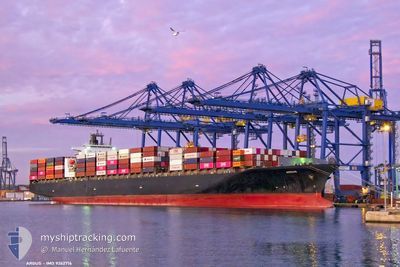
Container Ship
Current Trip
| Time Travelled | 9 days |
|---|---|
| Remaining Time | 2 days |
| Distance Travelled | 3458.41 nm |
| Remaining Distance | 842.63 nm |
| AVG Speed | 15.7 Knots |
| MAX Speed | 19.9 Knots |
| AVG Wind | 16.5 knots |
| MAX Wind | 29.8 knots |
| MIN Temp | 4.4°C / 39.92°F |
| MAX Temp | 21.7°C / 71.06°F |
| Draught | 13.3 m |
| Position Received | 8 d ago |
Current Position
| Longitude | 141.30167° |
|---|---|
| Latitude | 35.69983° |
| Status | Under way using engine |
| Speed | 19.2 Knots |
| Course | 48° |
| Area | North Pacific Ocean |
| Station | T-AIS |
| Position Received | 8 d ago |
Info
Information
The current position of ARGUS is in North Pacific Ocean with coordinates 35.69983° / 141.30167° as reported on 2024-05-23 11:05 by AIS to our vessel tracker app. The vessel's current speed is 19.2 Knots and is heading at the port of TACOMA. The estimated time of arrival as calculated by vessel tracking app is 2024-06-04 05:00 LT
The vessel ARGUS (IMO: 9262716, MMSI: 636020476) is a Container Ship that was built in 2004 ( 20 years old ). It's sailing under the flag of [LR] Liberia.
In this page you can find informations about the vessels current position, last detected port calls, and current voyage information. If the vessels is not in coverage by AIS you will find the latest position.
The current position of ARGUS is detected by our AIS receivers and we are not responsible for the reliability of the data. The last position was recorded while the vessel was in Coverage by the Ais receivers of our vessel tracking app.
The current draught of ARGUS as reported by AIS is 13.3 meters
Weather
| Temperature | 7.5°C / 45.5°F |
|---|---|
| Wind Speed | 20 knots |
| Direction | 200° SSW |
| Pressure | 1004.9 hPa |
| Humidity | 93.8 % |
| Cloud Coverage | 100 % |
Featured Company
Last Port Calls
| Port | Arrival | Departure | Time In Port |
|---|---|---|---|
| 2024-05-22 08:57 | 2024-05-23 02:37 | 17 h | |
| 2024-05-21 09:12 | 2024-05-21 19:34 | 10 h | |
| 2024-05-18 00:04 | 2024-05-19 03:28 | 1 d | |
| 2024-05-15 07:05 | 2024-05-15 22:45 | 15 h | |
| 2024-05-09 23:52 | 2024-05-10 08:40 | 8 h | |
| 2024-05-08 22:28 | 2024-05-09 08:31 | 10 h | |
| 2024-05-06 06:22 | 2024-05-07 19:38 | 1 d | |
| 2024-04-19 16:09 | 2024-04-22 00:04 | 2 d | |
| 2024-04-15 20:53 | 2024-04-19 05:56 | 3 d | |
| 2024-04-03 21:56 | 2024-04-04 12:15 | 14 h |
Most Visited Ports (Last year)
| Port | Arrivals | |
|---|---|---|
| 10 | ||
| 7 | ||
| 5 | ||
| 5 | ||
| 4 | ||
| 4 |
Last Trips
| Origin | Departure | Destination | Arrival | Distance | |
|---|---|---|---|---|---|
| 2024-05-22 04:34 | 2024-05-22 17:57 | 221.46 nm | |||
| 2024-05-19 11:28 | 2024-05-21 18:12 | 916.03 nm | |||
| 2024-05-16 06:45 | 2024-05-18 08:04 | 551.79 nm | |||
| 2024-05-10 17:40 | 2024-05-15 15:05 | 1430.82 nm | |||
| 2024-05-09 17:31 | 2024-05-10 08:52 | 237.51 nm | |||
| 2024-05-08 04:38 | 2024-05-09 07:28 | 368.03 nm | |||
| 2024-04-21 17:04 | 2024-05-06 15:22 | 4325.55 nm | |||
| 2024-04-18 22:56 | 2024-04-19 09:09 | 154.15 nm | |||
| 2024-04-04 21:15 | 2024-04-15 13:53 | 4295.54 nm | |||
| 2024-04-03 02:13 | 2024-04-04 06:56 | 251.52 nm |
Events
| Time | Event | Details | Position / Dest | Info |
|---|---|---|---|---|
| 2024-05-23 11:12 | Status Changed | Default Under way using engine |
35.72516 / 141.33627
USTIW
|
Speed: 19.2 kn Course: 48° |
| 2024-05-23 11:05 | OUT of Coverage |
35.69983 / 141.30167
North Pacific Ocean
USTIW
|
Speed: 19.2 kn Course: 48° |
|
| 2024-05-23 10:48 | Status Changed | Under way using engine Default |
35.63953 / 141.21726
USTIW
|
Speed: 19 kn Course: 48° |
| 2024-05-23 10:43 | Status Changed | Default Under way using engine |
35.62329 / 141.19476
USTIW
|
Speed: 18.9 kn Course: 49.4° |
| 2024-05-23 07:11 | Status Changed | Under way using engine Default |
34.89095 / 140.14481
USTIW
|
Speed: 18.4 kn Course: 56° |
| 2024-05-23 07:04 | Status Changed | Default Under way using engine |
34.90285 / 140.16547
USTIW
|
Speed: 18.2 kn Course: 53.7° |
| 2024-05-23 06:56 | Status Changed | Under way using engine Default |
34.87888 / 140.12249
USTIW
|
Speed: 18.4 kn Course: 56° |
| 2024-05-23 06:49 | Status Changed | Default Under way using engine |
34.85879 / 140.08569
USTIW
|
Speed: 18.5 kn Course: 56.6° |
| 2024-05-23 05:55 | Status Changed | Under way using engine Default |
34.85309 / 139.77529
USTIW
|
Speed: 19.1 kn Course: 151° |
| 2024-05-23 05:37 | IN Coverage |
34.85309 / 139.77529
North Pacific Ocean
USTIW
|
Speed: 19.1 kn Course: 147.1° |