
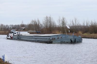
ARIELA
Cargo
Current Trip
ENGTER
| Time Travelled | 11 days |
|---|---|
| Remaining Time | --- |
| Distance Travelled | 45.45 nm |
| Remaining Distance | --- |
| AVG Speed | 5 Knots |
| MAX Speed | 6.6 Knots |
| AVG Wind | 6.3 knots |
| MAX Wind | 9 knots |
| MIN Temp | 14.8°C / 58.64°F |
| MAX Temp | 20.5°C / 68.9°F |
| Draught | 0.3 m |
| Position Received | 2 d ago |
Current Position
| Longitude | 7.65399° |
|---|---|
| Latitude | 52.34354° |
| Status | Under way using engine |
| Speed | |
| Course | --- |
| Area | North Sea |
| Station | T-AIS |
| Position Received | 2 d ago |
Info
Information
The current position of ARIELA is in North Sea with coordinates 52.34354° / 7.65399° as reported on 2024-06-02 22:15 by AIS to our vessel tracker app. The vessel's current speed is 0 Knots
The vessel ARIELA (MMSI: 244670772) is a Cargo It's sailing under the flag of [NL] Netherlands.
In this page you can find informations about the vessels current position, last detected port calls, and current voyage information. If the vessels is not in coverage by AIS you will find the latest position.
The current position of ARIELA is detected by our AIS receivers and we are not responsible for the reliability of the data. The last position was recorded while the vessel was in Coverage by the Ais receivers of our vessel tracking app.
The current draught of ARIELA as reported by AIS is 0.3 meters
Weather
| Temperature | 9.7°C / 49.46°F |
|---|---|
| Wind Speed | 5 knots |
| Direction | 314° NW |
| Pressure | 1021.1 hPa |
| Humidity | 95.3 % |
| Cloud Coverage | --- |
Featured Company
Last Port Calls
| Port | Arrival | Departure | Time In Port |
|---|---|---|---|
| 2024-05-24 10:43 | 2024-05-24 11:11 | 28 m | |
| 2024-05-21 14:05 | 2024-05-22 09:21 | 19 h | |
| 2024-05-21 13:04 | 2024-05-21 13:38 | 34 m | |
| 2024-05-08 11:31 | 2024-05-08 12:14 | 42 m | |
| 2024-05-08 06:59 | 2024-05-08 09:46 | 2 h | |
| 2024-05-04 06:27 | 2024-05-08 04:24 | 3 d | |
| 2024-05-03 17:04 | 2024-05-04 03:29 | 10 h | |
| 2024-05-03 13:04 | 2024-05-03 14:59 | 1 h | |
| 2024-05-01 18:19 | 2024-05-02 04:08 | 9 h | |
| 2024-04-29 12:18 | 2024-05-01 11:26 | 1 d |
Last Trips
| Origin | Departure | Destination | Arrival | Distance | |
|---|---|---|---|---|---|
| 2024-05-22 11:21 | 2024-05-24 12:43 | 129.62 nm | |||
| 2024-05-21 15:38 | 2024-05-21 16:05 | 2.98 nm | |||
| 2024-05-08 14:14 | 2024-05-21 15:04 | 133.59 nm | |||
| 2024-05-08 11:46 | 2024-05-08 13:31 | 12.06 nm | |||
| 2024-05-08 06:24 | 2024-05-08 08:59 | 23.32 nm | |||
| 2024-05-04 05:29 | 2024-05-04 08:27 | 21.35 nm | |||
| 2024-05-03 16:59 | 2024-05-03 19:04 | 11.02 nm | |||
| 2024-05-02 06:08 | 2024-05-03 15:04 | 133.38 nm | |||
| 2024-05-01 13:26 | 2024-05-01 20:19 | 60.00 nm | |||
| 2024-04-29 08:47 | 2024-04-29 14:18 | 18.58 nm |
Events
| Time | Event | Details | Position / Dest | Info |
|---|---|---|---|---|
| 2024-06-02 22:15 | OUT of Coverage |
52.34354 / 7.65399
North Sea
|
Speed: Course: 0° |
|
| 2024-06-02 22:15 | IN Coverage |
52.34354 / 7.65399
North Sea
|
Speed: Course: 0° |
|
| 2024-05-31 12:08 | OUT of Coverage |
52.37374 / 7.86617
North Sea
|
Speed: 6.6 kn Course: 234.6° |
|
| 2024-05-31 11:29 | START Moving | 1.17 nm, West of BRAMSCHE |
52.39341 / 7.96574
ENGTER
|
Speed: 3.8 kn Course: 257.6° |
| 2024-05-27 17:19 | STOP Moving | 1.06 nm, West of BRAMSCHE |
52.39403 / 7.96858
ENGTER
|
Speed: 0.1 kn Course: 511° |
| 2024-05-27 16:28 | START Moving | 2.4 nm, East of BRAMSCHE |
52.40859 / 8.05968
ENGTER
|
Speed: 3.4 kn Course: 84° |
| 2024-05-27 08:48 | STOP Moving | 2.2 nm, East of BRAMSCHE |
52.40810 / 8.05436
ENGTER
|
Speed: 0.3 kn Course: 511° |
| 2024-05-27 06:51 | IN Coverage |
52.36486 / 7.83164
North Sea
|
Speed: 5.3 kn Course: 85.5° |
|
| 2024-05-26 17:31 | OUT of Coverage |
52.34385 / 7.65477
North Sea
|
Speed: Course: 0° |
|
| 2024-05-26 16:20 | IN Coverage |
52.34387 / 7.65478
North Sea
|
Speed: Course: 0° |