
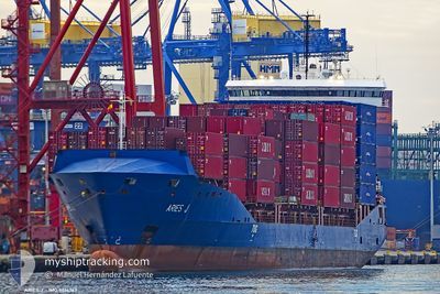
ARIES J
Container Ship
Current Trip
| Time Travelled | 1 day |
|---|---|
| Remaining Time | 16 h, 36 mins |
| Distance Travelled | 305.89 nm |
| Remaining Distance | 207.05 nm |
| AVG Speed | 12.3 Knots |
| MAX Speed | 14.9 Knots |
| AVG Wind | 8.1 knots |
| MAX Wind | 13 knots |
| MIN Temp | 18.5°C / 65.3°F |
| MAX Temp | 20.9°C / 69.62°F |
| Draught | 7.2 m |
| Position Received | 1 m ago |
Current Position
| Longitude | 20.05308° |
|---|---|
| Latitude | 38.27406° |
| Status | Under way using engine |
| Speed | 12.3 Knots |
| Course | 333.2° |
| Area | Ionian Sea |
| Station | T-AIS |
| Position Received | 1 m ago |
Info
Information
The current position of ARIES J is in Ionian Sea with coordinates 38.27406° / 20.05308° as reported on 2024-05-28 20:51 by AIS to our vessel tracker app. The vessel's current speed is 12.3 Knots and is heading at the port of DURRES. The estimated time of arrival as calculated by vessel tracking app is 2024-05-29 13:29 LT
The vessel ARIES J (IMO: 9514767, MMSI: 255803640) is a Container Ship that was built in 2011 ( 13 years old ). It's sailing under the flag of [PT] Portugal.
In this page you can find informations about the vessels current position, last detected port calls, and current voyage information. If the vessels is not in coverage by AIS you will find the latest position.
The current position of ARIES J is detected by our AIS receivers and we are not responsible for the reliability of the data. The last position was recorded while the vessel was in Coverage by the Ais receivers of our vessel tracking app.
The current draught of ARIES J as reported by AIS is 7.2 meters
Weather
| Temperature | 20.4°C / 68.72°F |
|---|---|
| Wind Speed | 5 knots |
| Direction | 252° WSW |
| Pressure | 1015.2 hPa |
| Humidity | 77.7 % |
| Cloud Coverage | 17 % |
Featured Company
Last Port Calls
| Port | Arrival | Departure | Time In Port |
|---|---|---|---|
| 2024-05-26 16:02 | 2024-05-27 19:51 | 1 d | |
| 2024-05-23 01:15 | 2024-05-24 00:04 | 22 h | |
| 2024-05-21 15:36 | 2024-05-22 18:00 | 1 d | |
| 2024-05-18 10:18 | 2024-05-19 13:26 | 1 d | |
| 2024-05-11 08:58 | 2024-05-12 14:26 | 1 d | |
| 2024-05-08 22:27 | 2024-05-10 21:28 | 1 d | |
| 2024-05-02 16:25 | 2024-05-06 18:52 | 4 d | |
| 2024-04-26 16:01 | 2024-04-27 23:38 | 1 d | |
| 2024-04-24 22:40 | 2024-04-25 17:52 | 19 h | |
| 2024-04-16 06:15 | 2024-04-18 08:27 | 2 d |
Last Trips
| Origin | Departure | Destination | Arrival | Distance | |
|---|---|---|---|---|---|
| 2024-05-24 02:04 | 2024-05-26 19:02 | 588.24 nm | |||
| 2024-05-22 20:00 | 2024-05-23 03:15 | 64.92 nm | |||
| 2024-05-19 16:26 | 2024-05-21 17:36 | 606.21 nm | |||
| 2024-05-12 16:26 | 2024-05-18 13:18 | 590.94 nm | |||
| 2024-05-10 23:28 | 2024-05-11 10:58 | 131.81 nm | |||
| 2024-05-06 21:52 | 2024-05-09 00:27 | 651.73 nm | |||
| 2024-04-28 01:38 | 2024-05-02 19:25 | 599.34 nm | |||
| 2024-04-25 19:52 | 2024-04-26 18:01 | 256.55 nm | |||
| 2024-04-18 11:27 | 2024-04-25 00:40 | 436.89 nm | |||
| 2024-04-07 01:57 | 2024-04-16 09:15 | 678.75 nm |
Events
| Time | Event | Details | Position / Dest | Info |
|---|---|---|---|---|
| 2024-05-28 15:03 | Detected in Sea | Greek part of the Ionian Sea |
37.22725 / 20.77240
Ionian Sea
ALDRZ
|
Speed: 12.3 kn Course: 329° |
| 2024-05-28 15:03 | Status Changed | Under way using engine Default |
37.22725 / 20.77240
ALDRZ
|
Speed: 12.2 kn Course: 328° |
| 2024-05-28 15:03 | IN Coverage |
37.22725 / 20.77240
Ionian Sea
ALDRZ
|
Speed: 12.3 kn Course: 329° |
|
| 2024-05-28 05:40 | Status Changed | Default Under way using engine |
36.36863 / 22.78242
ALDRZ
|
Speed: 12 kn Course: 242.1° |
| 2024-05-28 05:38 | OUT of Coverage |
36.37212 / 22.79115
Mediterranean Sea - Eastern Basin
ALDRZ
|
Speed: 12 kn Course: 242.1° |
|
| 2024-05-28 05:33 | Change Sea Area | Greek part of the Mediterranean Sea - Eastern Basin Greek part of the Aegean Sea |
36.37892 / 22.80638
Mediterranean Sea - Eastern Basin
ALDRZ
|
Speed: 12 kn Course: 238.6° |
| 2024-05-28 05:33 | Status Changed | Under way using engine Default |
36.37892 / 22.80638
ALDRZ
|
Speed: 12 kn Course: 241° |
| 2024-05-28 05:17 | IN Coverage |
36.37892 / 22.80638
Mediterranean Sea - Eastern Basin
ALDRZ
|
Speed: 12 kn Course: 238.6° |
|
| 2024-05-28 04:30 | Status Changed | Default Under way using engine |
36.40325 / 23.05686
ALDRZ
|
Speed: 12.1 kn Course: 278.4° |
| 2024-05-28 04:23 | OUT of Coverage |
36.39946 / 23.08782
Aegean Sea
ALDRZ
|
Speed: 12.1 kn Course: 278.4° |