
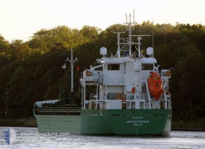
ARKLOW RESOLVE
Cargo
Current Trip
| Time Travelled | 4 days |
|---|---|
| Remaining Time | --- |
| Distance Travelled | 441.59 nm |
| Remaining Distance | --- |
| AVG Speed | 12 Knots |
| MAX Speed | 15.7 Knots |
| AVG Wind | 12.4 knots |
| MAX Wind | 20 knots |
| MIN Temp | 11.1°C / 51.98°F |
| MAX Temp | 15.3°C / 59.54°F |
| Draught | 6.7 m |
| Position Received | 2 d ago |
Current Position
| Longitude | -10.42366° |
|---|---|
| Latitude | 51.58716° |
| Status | Under way using engine |
| Speed | 10.2 Knots |
| Course | 321.4° |
| Area | North Atlantic Ocean |
| Station | T-AIS |
| Position Received | 2 d ago |
Info
Information
The current position of ARKLOW RESOLVE is in North Atlantic Ocean with coordinates 51.58716° / -10.42366° as reported on 2024-06-05 06:50 by AIS to our vessel tracker app. The vessel's current speed is 10.2 Knots
The vessel ARKLOW RESOLVE (IMO: 9923255, MMSI: 250014166) is a Cargo It's sailing under the flag of [IE] Ireland.
In this page you can find informations about the vessels current position, last detected port calls, and current voyage information. If the vessels is not in coverage by AIS you will find the latest position.
The current position of ARKLOW RESOLVE is detected by our AIS receivers and we are not responsible for the reliability of the data. The last position was recorded while the vessel was in Coverage by the Ais receivers of our vessel tracking app.
The current draught of ARKLOW RESOLVE as reported by AIS is 6.7 meters
Weather
| Temperature | 11.2°C / 52.16°F |
|---|---|
| Wind Speed | 13 knots |
| Direction | 308° NW |
| Pressure | 1018.2 hPa |
| Humidity | 62.9 % |
| Cloud Coverage | 25 % |
Featured Company
Last Port Calls
| Port | Arrival | Departure | Time In Port |
|---|---|---|---|
| 2024-06-03 17:23 | 2024-06-03 17:50 | 27 m | |
| 2024-06-02 16:59 | 2024-06-03 16:47 | 23 h | |
| 2024-06-02 15:54 | 2024-06-02 16:21 | 27 m | |
| 2024-06-01 09:10 | 2024-06-01 09:30 | 20 m | |
| 2024-05-25 05:34 | 2024-05-26 14:06 | 1 d | |
| 2024-05-19 14:02 | 2024-05-21 09:04 | 1 d | |
| 2024-05-15 18:26 | 2024-05-17 21:01 | 2 d | |
| 2024-05-07 08:27 | 2024-05-08 18:14 | 1 d | |
| 2024-05-03 05:28 | 2024-05-03 20:10 | 14 h | |
| 2024-04-29 12:04 | 2024-05-01 02:43 | 1 d |
Most Visited Ports (Last year)
| Port | Arrivals | |
|---|---|---|
| 2 | ||
| 2 | ||
| 2 | ||
| 1 | ||
| 1 | ||
| 1 |
Last Trips
| Origin | Departure | Destination | Arrival | Distance | |
|---|---|---|---|---|---|
| 2024-06-03 18:47 | 2024-06-03 19:23 | 2.98 nm | |||
| 2024-06-02 18:21 | 2024-06-02 18:59 | 4.15 nm | |||
| 2024-06-01 10:30 | 2024-06-02 17:54 | 217.95 nm | |||
| 2024-05-26 15:06 | 2024-06-01 10:10 | 684.47 nm | |||
| 2024-05-21 11:04 | 2024-05-25 06:34 | 895.61 nm | |||
| 2024-05-17 22:01 | 2024-05-19 16:02 | 548.63 nm | |||
| 2024-05-08 21:14 | 2024-05-15 19:26 | 1424.46 nm | |||
| 2024-05-03 22:10 | 2024-05-07 11:27 | 963.86 nm | |||
| 2024-05-01 04:43 | 2024-05-03 07:28 | 624.25 nm | |||
| 2024-04-23 00:44 | 2024-04-29 14:04 | 1424.04 nm |
Events
| Time | Event | Details | Position / Dest | Info |
|---|---|---|---|---|
| 2024-06-05 06:50 | OUT of Coverage |
51.58716 / -10.42366
North Atlantic Ocean
FOYNES
|
Speed: 10.2 kn Course: 321.4° |
|
| 2024-06-05 05:02 | Detected in Sea | Irish part of the North Atlantic Ocean |
51.39656 / -10.03753
North Atlantic Ocean
FOYNES
|
Speed: 10.7 kn Course: 297.4° |
| 2024-06-04 22:33 | Detected in Sea | Irish part of the Celtic Sea |
50.91685 / -8.26510
Celtic Sea
FOYNES
|
Speed: 11.7 kn Course: 294.5° |
| 2024-06-04 22:33 | IN Coverage |
50.91685 / -8.26510
Celtic Sea
FOYNES
|
Speed: 11.7 kn Course: 294.5° |
|
| 2024-06-04 15:35 | OUT of Coverage |
50.43014 / -6.29698
Celtic Sea
FOYNES
|
Speed: 10.9 kn Course: 292.2° |
|
| 2024-06-04 11:52 | Change Sea Area | United Kingdom part of the Celtic Sea United Kingdom part of the English Channel |
49.96080 / -5.64062
Celtic Sea
FOYNES
|
Speed: 12 kn Course: 283.4° |
| 2024-06-04 03:06 | Detected in Sea | United Kingdom part of the English Channel |
50.00861 / -2.97723
English Channel
FOYNES
|
Speed: 11.1 kn Course: 269.1° |
| 2024-06-04 00:15 | Change Sea Area | Guernsey part of the English Channel French part of the English Channel |
49.97445 / -2.04992
English Channel
FOYNES
|
Speed: 14.9 kn Course: 285.3° |
| 2024-06-03 17:50 | PORT DEPARTURE |
|
49.29451 / -.24556
FOYNES
|
Speed: 9 kn Course: 5° |
| 2024-06-03 17:42 | START Moving |
49.28069 / -.24902
[FR] OUISTREHAM
|
Speed: 3.1 kn Course: 9° |