
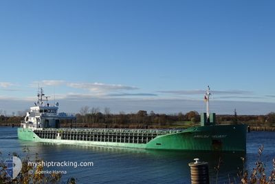
ARKLOW VALIANT
Cargo
Current Trip
| Time Travelled | 4 days |
|---|---|
| Remaining Time | --- |
| Distance Travelled | 726.07 nm |
| Remaining Distance | 7.41 nm |
| AVG Speed | 9.8 Knots |
| MAX Speed | 14.4 Knots |
| AVG Wind | 17.9 knots |
| MAX Wind | 25.1 knots |
| MIN Temp | 10.8°C / 51.44°F |
| MAX Temp | 19.1°C / 66.38°F |
| Draught | 5.7 m |
| Position Received | 1 m ago |
Current Position
| Longitude | 3.81635° |
|---|---|
| Latitude | 51.32933° |
| Status | Under way using engine |
| Speed | 0.1 Knots |
| Course | 148° |
| Area | North Sea |
| Station | T-AIS |
| Position Received | 1 m ago |
Info
Information
The current position of ARKLOW VALIANT is in North Sea with coordinates 51.32933° / 3.81635° as reported on 2024-06-01 20:17 by AIS to our vessel tracker app. The vessel's current speed is 0.1 Knots and is heading at the port of SAS VAN GENT. The estimated time of arrival as calculated by vessel tracking app is 2024-06-01 14:00 LT
The vessel ARKLOW VALIANT (IMO: 9772541, MMSI: 244710091) is a Cargo It's sailing under the flag of [NL] Netherlands.
In this page you can find informations about the vessels current position, last detected port calls, and current voyage information. If the vessels is not in coverage by AIS you will find the latest position.
The current position of ARKLOW VALIANT is detected by our AIS receivers and we are not responsible for the reliability of the data. The last position was recorded while the vessel was in Coverage by the Ais receivers of our vessel tracking app.
The current draught of ARKLOW VALIANT as reported by AIS is 5.7 meters
Weather
| Temperature | 13.7°C / 56.66°F |
|---|---|
| Wind Speed | 14 knots |
| Direction | 358° N |
| Pressure | 1022.2 hPa |
| Humidity | 79.8 % |
| Cloud Coverage | 100 % |
Featured Company
Last Port Calls
| Port | Arrival | Departure | Time In Port |
|---|---|---|---|
| 2024-05-27 20:06 | 2024-05-28 17:17 | 21 h | |
| 2024-05-23 20:40 | 2024-05-24 15:13 | 18 h | |
| 2024-05-22 23:16 | 2024-05-23 00:41 | 1 h | |
| 2024-05-19 18:16 | 2024-05-22 22:17 | 3 d | |
| 2024-05-19 15:59 | 2024-05-19 17:38 | 1 h | |
| 2024-05-14 19:37 | 2024-05-17 13:34 | 2 d | |
| 2024-05-08 12:31 | 2024-05-08 13:32 | 1 h | |
| 2024-05-07 21:36 | 2024-05-08 11:56 | 14 h | |
| 2024-05-02 21:42 | 2024-05-07 21:21 | 4 d | |
| 2024-05-02 16:59 | 2024-05-02 17:34 | 35 m |
Last Trips
| Origin | Departure | Destination | Arrival | Distance | |
|---|---|---|---|---|---|
| 2024-05-24 17:13 | 2024-05-27 22:06 | 898.82 nm | |||
| 2024-05-23 02:41 | 2024-05-23 22:40 | 245.36 nm | |||
| 2024-05-23 00:17 | 2024-05-23 01:16 | 4.55 nm | |||
| 2024-05-19 19:38 | 2024-05-19 20:16 | 2.07 nm | |||
| 2024-05-17 14:34 | 2024-05-19 17:59 | 530.20 nm | |||
| 2024-05-08 15:32 | 2024-05-14 20:37 | 548.81 nm | |||
| 2024-05-08 13:56 | 2024-05-08 14:31 | 0.29 nm | |||
| 2024-05-07 23:21 | 2024-05-07 23:36 | 1.15 nm | |||
| 2024-05-02 19:34 | 2024-05-02 23:42 | 12.02 nm | |||
| 2024-05-02 12:33 | 2024-05-02 18:59 | 37.08 nm |
Events
| Time | Event | Details | Position / Dest | Info |
|---|---|---|---|---|
| 2024-06-01 19:39 | STOP Moving | 1.25 nm, North West of TERNEUZEN |
51.33825 / 3.80992
NLSVG
|
Speed: 0.2 kn Course: 167° |
| 2024-06-01 17:44 | Change Sea Area | Dutch part of the North Sea Belgian part of the North Sea |
51.40157 / 3.34737
North Sea
NLSVG
|
Speed: 10 kn Course: 93.8° |
| 2024-06-01 13:14 | Change Sea Area | Belgian part of the North Sea French part of the North Sea |
51.32145 / 2.36440
North Sea
NLSVG
|
Speed: 6.8 kn Course: 57.1° |
| 2024-06-01 09:26 | Detected in Sea | French part of the North Sea |
50.99580 / 1.63943
North Sea
NLSVG
|
Speed: 11.2 kn Course: 42.1° |
| 2024-06-01 07:34 | Status Changed | Under way using engine Default |
50.70397 / 1.33523
NLSVG
|
Speed: 11.7 kn Course: 46° |
| 2024-06-01 07:30 | Status Changed | Default Under way using engine |
50.69425 / 1.32103
NLSVG
|
Speed: 12.5 kn Course: 45.2° |
| 2024-06-01 07:21 | Status Changed | Under way using engine Default |
50.67362 / 1.28813
NLSVG
|
Speed: 12.5 kn Course: 45° |
| 2024-06-01 07:06 | Status Changed | Default Under way using engine |
50.63533 / 1.23058
NLSVG
|
Speed: 12.5 kn Course: 50.7° |
| 2024-06-01 06:44 | Change Sea Area | French part of the English Channel United Kingdom part of the English Channel |
50.58522 / 1.13840
English Channel
NLSVG
|
Speed: 12.3 kn Course: 50.5° |
| 2024-06-01 06:44 | Status Changed | Under way using engine Default |
50.58522 / 1.13840
NLSVG
|
Speed: 12.5 kn Course: 51° |