
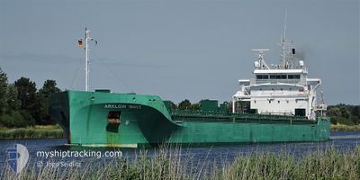
ARKLOW WAVE
Cargo
Current Trip
| Time Travelled | 4 days |
|---|---|
| Remaining Time | 20 h, 49 mins |
| Distance Travelled | 1108.89 nm |
| Remaining Distance | 221.29 nm |
| AVG Speed | 10.8 Knots |
| MAX Speed | 16.8 Knots |
| AVG Wind | 8.4 knots |
| MAX Wind | 21 knots |
| MIN Temp | 10.9°C / 51.62°F |
| MAX Temp | 18.5°C / 65.3°F |
| Draught | 8.7 m |
| Position Received | 7 h, 35 m ago |
Current Position
| Longitude | -4.28557° |
|---|---|
| Latitude | 58.69713° |
| Status | Under way using engine |
| Speed | 10.5 Knots |
| Course | 265.4° |
| Area | North Atlantic Ocean |
| Station | T-AIS |
| Position Received | 7 h, 35 m ago |
Info
Information
The current position of ARKLOW WAVE is in North Atlantic Ocean with coordinates 58.69713° / -4.28557° as reported on 2024-05-28 21:09 by AIS to our vessel tracker app. The vessel's current speed is 10.5 Knots and is heading at the port of BELFAST. The estimated time of arrival as calculated by vessel tracking app is 2024-05-30 01:34 LT
The vessel ARKLOW WAVE (IMO: 9818931, MMSI: 250005382) is a Cargo It's sailing under the flag of [IE] Ireland.
In this page you can find informations about the vessels current position, last detected port calls, and current voyage information. If the vessels is not in coverage by AIS you will find the latest position.
The current position of ARKLOW WAVE is detected by our AIS receivers and we are not responsible for the reliability of the data. The last position was recorded while the vessel was in Coverage by the Ais receivers of our vessel tracking app.
The current draught of ARKLOW WAVE as reported by AIS is 8.7 meters
Weather
| Temperature | 11.2°C / 52.16°F |
|---|---|
| Wind Speed | 3 knots |
| Direction | 258° WSW |
| Pressure | 1003.2 hPa |
| Humidity | 89.2 % |
| Cloud Coverage | 100 % |
Featured Company
Last Port Calls
| Port | Arrival | Departure | Time In Port |
|---|---|---|---|
| 2024-05-19 20:23 | 2024-05-24 22:18 | 5 d | |
| 2024-05-13 20:34 | 2024-05-16 22:25 | 3 d | |
| 2024-05-05 08:54 | 2024-05-08 17:46 | 3 d | |
| 2024-04-27 13:35 | 2024-05-03 19:09 | 6 d | |
| 2024-04-27 13:05 | 2024-04-27 13:21 | 15 m | |
| 2024-04-14 20:19 | 2024-04-21 04:16 | 6 d | |
| 2024-04-12 04:52 | 2024-04-14 19:33 | 2 d | |
| 2024-04-08 00:26 | 2024-04-09 13:03 | 1 d | |
| 2024-03-26 16:15 | 2024-03-28 01:26 | 1 d | |
| 2024-03-20 20:22 | 2024-03-22 17:25 | 1 d |
Last Trips
| Origin | Departure | Destination | Arrival | Distance | |
|---|---|---|---|---|---|
| 2024-05-17 00:25 | 2024-05-19 22:23 | 525.94 nm | |||
| 2024-05-08 19:46 | 2024-05-13 22:34 | 1245.49 nm | |||
| 2024-05-03 21:09 | 2024-05-05 10:54 | 371.34 nm | |||
| 2024-04-27 15:21 | 2024-04-27 15:35 | 0.27 nm | |||
| 2024-04-21 06:16 | 2024-04-27 15:05 | 575.52 nm | |||
| 2024-04-14 21:33 | 2024-04-14 22:19 | 8.30 nm | |||
| 2024-04-09 14:03 | 2024-04-12 06:52 | 631.45 nm | |||
| 2024-03-28 01:26 | 2024-04-08 01:26 | 814.03 nm | |||
| 2024-03-22 18:25 | 2024-03-26 16:15 | 962.79 nm | |||
| 2024-03-20 00:55 | 2024-03-20 21:22 | 270.76 nm |
Events
| Time | Event | Details | Position / Dest | Info |
|---|---|---|---|---|
| 2024-05-28 21:15 | Status Changed | Default Under way using engine |
58.69552 / -4.32190
GBBEL
|
Speed: 10.5 kn Course: 265.4° |
| 2024-05-28 21:09 | OUT of Coverage |
58.69713 / -4.28557
North Atlantic Ocean
GBBEL
|
Speed: 10.5 kn Course: 265.4° |
|
| 2024-05-28 21:06 | Status Changed | Under way using engine Default |
58.69787 / -4.26987
GBBEL
|
Speed: 10.5 kn Course: 265° |
| 2024-05-28 21:04 | Status Changed | Default Under way using engine |
58.69848 / -4.25600
GBBEL
|
Speed: 10.5 kn Course: 265.2° |
| 2024-05-28 18:43 | Change Sea Area | United Kingdom part of the North Atlantic Ocean United Kingdom part of the North Sea |
58.71895 / -3.41085
North Atlantic Ocean
GBBEL
|
Speed: 13.1 kn Course: 267° |
| 2024-05-28 17:03 | ETA Changed | 2024/05/30 04:00 2024/05/30 06:00 |
58.69498 / -2.66345
GBBEL
|
Speed: 11.6 kn Course: 275.9° |
| 2024-05-28 16:55 | Detected in Sea | United Kingdom part of the North Sea |
58.69292 / -2.61943
North Sea
GBBEL
|
Speed: 11.5 kn Course: 274.4° |
| 2024-05-28 16:54 | Status Changed | Under way using engine Default |
58.69272 / -2.61443
GBBEL
|
Speed: 11.4 kn Course: 275° |
| 2024-05-28 16:52 | IN Coverage |
58.69292 / -2.61943
North Sea
GBBEL
|
Speed: 11.5 kn Course: 274.4° |
|
| 2024-05-28 00:33 | OUT of Coverage |
58.18500 / 2.86592
North Sea
GBBEL
|
Speed: 10.8 kn Course: 287.1° |