
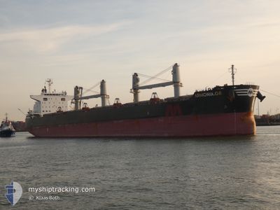
ARMONIA.GR
Cargo
Current Trip
| Time Travelled | 5 days |
|---|---|
| Remaining Time | 7 days |
| Distance Travelled | 1283.28 nm |
| Remaining Distance | 2375.83 nm |
| AVG Speed | 11.6 Knots |
| MAX Speed | 12.7 Knots |
| AVG Wind | 12.1 knots |
| MAX Wind | 23.5 knots |
| MIN Temp | 16.1°C / 60.98°F |
| MAX Temp | 24.4°C / 75.92°F |
| Draught | 8.7 m |
| Position Received | 3 d ago |
Current Position
| Longitude | -15.65452° |
|---|---|
| Latitude | 27.13033° |
| Status | Under way using engine |
| Speed | 12.1 Knots |
| Course | 207° |
| Area | North Atlantic Ocean |
| Station | T-AIS |
| Position Received | 3 d ago |
Info
Information
The current position of ARMONIA.GR is in North Atlantic Ocean with coordinates 27.13033° / -15.65452° as reported on 2024-06-06 20:15 by AIS to our vessel tracker app. The vessel's current speed is 12.1 Knots and is heading at the port of DOUALA. The estimated time of arrival as calculated by vessel tracking app is 2024-06-17 16:55 LT
The vessel ARMONIA.GR (IMO: 9758868, MMSI: 538009119) is a Cargo It's sailing under the flag of [MH] Marshall Is.
In this page you can find informations about the vessels current position, last detected port calls, and current voyage information. If the vessels is not in coverage by AIS you will find the latest position.
The current position of ARMONIA.GR is detected by our AIS receivers and we are not responsible for the reliability of the data. The last position was recorded while the vessel was in Coverage by the Ais receivers of our vessel tracking app.
The current draught of ARMONIA.GR as reported by AIS is 8.7 meters
Weather
| Temperature | 24.4°C / 75.92°F |
|---|---|
| Wind Speed | 5 knots |
| Direction | 307° NW |
| Pressure | 1014 hPa |
| Humidity | 78.7 % |
| Cloud Coverage | 14 % |
Featured Company
Last Port Calls
| Port | Arrival | Departure | Time In Port |
|---|---|---|---|
| 2024-06-02 10:30 | 2024-06-04 14:20 | 2 d | |
| 2024-05-19 22:19 | 2024-05-29 16:45 | 9 d | |
| 2024-05-13 10:12 | 2024-05-16 20:35 | 3 d | |
| 2024-04-11 19:02 | 2024-04-17 19:02 | 6 d |
Most Visited Ports (Last year)
| Port | Arrivals | |
|---|---|---|
| 2 | ||
| 2 | ||
| 1 | ||
| 1 | ||
| 1 | ||
| 1 |
Last Trips
| Origin | Departure | Destination | Arrival | Distance | |
|---|---|---|---|---|---|
| 2024-05-29 18:45 | 2024-06-02 11:30 | 1112.75 nm | |||
| 2024-05-16 22:35 | 2024-05-20 00:19 | 269.69 nm | |||
| 2024-04-17 16:02 | 2024-05-13 12:12 | 5896.45 nm | |||
| 2024-03-30 00:37 | 2024-04-11 16:02 | 986.35 nm |
Events
| Time | Event | Details | Position / Dest | Info |
|---|---|---|---|---|
| 2024-06-06 20:15 | OUT of Coverage |
27.13033 / -15.65452
North Atlantic Ocean
CM DLA
|
Speed: 12.1 kn Course: 207° |
|
| 2024-06-06 20:14 | IN Coverage |
27.13033 / -15.65452
North Atlantic Ocean
CM DLA
|
Speed: 12.1 kn Course: 207° |
|
| 2024-06-06 17:02 | OUT of Coverage |
27.71065 / -15.33209
North Atlantic Ocean
CM DLA
|
Speed: 11.6 kn Course: 204.1° |
|
| 2024-06-06 15:05 | ETA Changed | 2024/06/16 19:00 2024/06/16 20:00 |
28.07212 / -15.36076
CM DLA
|
Speed: 9.5 kn Course: 126.1° |
| 2024-06-06 14:57 | START Moving | 3.44 nm, South East of LAS PALMAS |
28.08161 / -15.37580
CM DLA
|
Speed: 5 kn Course: 113.7° |
| 2024-06-06 14:45 | Status Changed | Under way using engine At anchor |
28.08052 / -15.38162
CM DLA
|
Speed: 0.1 kn Course: 41° |
| 2024-06-06 14:19 | Draught Changed | 8.7 8.4 |
28.08097 / -15.38181
CM DLA
|
Speed: Course: 95° |
| 2024-06-06 13:23 | Draught Changed | 8.4 8.3 |
28.07899 / -15.38173
CM DLA
|
Speed: Course: 58° |
| 2024-06-06 13:23 | ETA Changed | 2024/06/16 20:00 2024/06/05 19:30 |
28.07899 / -15.38173
CM DLA
|
Speed: Course: 58° |
| 2024-06-06 12:57 | Destination Changed | CM DLA ES LPA |
28.07896 / -15.38169
CM DLA
|
Speed: Course: 57° |